Download
1 / 43
430 likes | 673 Views
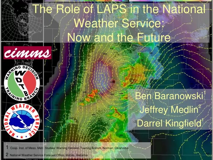
The Role of LAPS in the National Weather Service: Now and the Future. Ben Baranowski 1 Jeffrey Medlin 2 Darrel Kingfield 1. 1 Coop. Inst. of Meso. Metr. Studies/ Warning Decision Training Branch, Norman, Oklahoma 2 National Weather Service Forecast Office, Mobile, Alabama. Overview of Topics.

E N D
The Role of LAPS in the National Weather Service:Now and the Future Ben Baranowski1 Jeffrey Medlin2 Darrel Kingfield1 1Coop. Inst. of Meso. Metr. Studies/ Warning Decision Training Branch, Norman, Oklahoma 2National Weather Service Forecast Office, Mobile, Alabama
Overview of Topics • LAPS configuration in the NWS (Ben) • LAPS visualization in forecast operations (Jeffrey) • LAPS usage across the NWS (Darrel) • Future applications with LAPS (Ben)
The Advanced Weather Interactive Processing System (AWIPS) • Fielded in mid-90s • Self contained processing and display system: • Decoders • Visualization • Dissemination of products (warnings) • Archiver AWIPS is an integrated suite of automated data-processing equipment that supports complex analysis, interactive processing, display of hydrometeorological data, and the rapid dissemination of warnings and forecasts in a highly reliable manner. AWIPS D2D 3-monitor Display
LAPS-0-25-9 No national NWS training Background Models: RUC 40 ETA 48 No capability for higher-res models Input data: Metar Maritime Raob Acars/Pireps level-3 radar Profiler Satellite LAPS in AWIPS CRON Entries: 20 * * * * perl /awips/laps/etc/sched.pl /awips/laps/ /awips/laps/data 03,19,34,49 * * * * perl /awips/laps/etc/laps_driver.pl vrc_driver.x /awips/laps /awips/laps/data 08,14,23,29,38,45,53,59 * * * * perl /awips/laps/etc/laps_driver.pl lvd_sat_ingest.exe /awips/laps /awips/laps/data
LAPS Processing in AWIPS • LAPS Default Domain: • 10 km grid spacing • ~ 600 km by 600 km • Centered over the area of responsibility. OUN
WFO MOB’s DOMAIN WFO MOB LAPS Domain
“LAPS Hot StartExample” ***Initialization with LAPS Radar***
“LAPS Hot StartExample” ***One hour later and after ~600 time steps!*** WRF 1h Precipitation Accumulation Usually lose that ‘bump’ by fourth hour!
WFO MOB’s Domain ASOS, AWOS , C-MAN and Buoys
WFO MOB’s Domain ?????? ASOS, AWOS , C-MAN, Buoys, USA Mesonet, Eglin Mesonet, RAWS, Other
WFO MOB’s Domain Improved Coastal Analysis Mobile Bay
WFO MOB’s Domain Problematic Inland Analyses LAPS Utilization in the WFOs ??????
WFO MOB’s Domain Problematic Inland Analyses LAPS Utilization in the WFOs
Most Popular NWS Mobile, AL Applications - Big Picture with Local Detail! 300 hPa 250 hPa 500 hPa 850 hPa 0-1km MLCAPE - 1524 UTC
Most Popular NWS Mobile, AL Applications - Big Picture with Local Detail! 300 hPa 250 hPa A A’ 500 hPa 850 hPa 0-1km MLCAPE - 1524 UTC
Most Popular NWS Mobile, AL Applications - Big Picture with Local Detail! A A’ LAPS ω, isotachs and ϴ LAPS RH, ϴ and condensation PDEF LAPS frontogenesis and ageovertcrcln 0-1km MLCAPE - 1524 UTC LAPS DIV, CAPE and q
Most Popular NWS Mobile, AL Applications -POP-UP Skew -T log P • Can quickly compare • LAPS to other NWP • sources. • Very useful for quickly • scanning lapse rates and • moisture distribution over • entire area at once • without loading point • soundings which can take • extra time. • Would like to see • parameters display as • one roams around • though. • Also feel Skew-T display could be made to be larger.
Other Tools that Use LAPS -Standard Environmental Data Packages • Maps environmental data to radar tilts • isotherms, wind vectors, etc • Allows cursor sampling of environment data at height of radar bin and display height on Popup SkewT
Most Popular NWS Mobile, AL Applications - Integrated Quantities- Updraft intensifies in this area Multicell forms in this area 0-1km MLCAPE - 1524 UTC
Most Popular NWS Mobile, AL Applications - Integrated Quantities- Multicell in question 0-1 km MLCAPE - 1624 UTC
Most Popular NWS Mobile, AL Applications - Integrated Quantities- Updraft develops into a mesocyclone 0-1 km MLCAPE -1737 UTC
Most Popular NWS Mobile, AL Applications - Integrated Quantities- Local Tornado Warning Example - 15 May 2008 -
Most Popular NWS Mobile, AL Applications - Integrated Quantities- Anticipation based on T-R-E-N-D-S of observed ingredients! 150 m2 s -2 0-1.5 km SrHelicity 1600 UTC
Most Popular NWS Mobile, AL Applications - Integrated Quantities- ~250 m2 s -2 0-1.5 km SrHelicity 1700 UTC
Most Popular NWS Mobile, AL Applications - Integrated Quantities- ~330 m2 s -2 0-1.5 km SrHelicity 1800 UTC
Most Popular NWS Mobile, AL Applications - Integrated Quantities- Local Tornado Warning Example - 15 May 2008 - SPC watching NCEP RUC may not always observe the same thing as a WFO’s local LAPS. Many times, I have collaborated positively to bring about an improved forecast simply based on a more accurate spatial distribution, magnitude and tendency of both CAPE and Sr Helicity (e.g., shaving off a row of counties from a watch).
Verification Local Red Flag Warning Criteria met on a relative small scale! *Improve PODs *Reduce FARs
Verification • LAPS used exclusively • in GFE to represent the • “observed” condition • beginning t0- ∆t. • Diurnal T and Td curves • generated from these • grids. • Also, during first six hours • of forecast these grids • can be used when the • forecast is one of • persistence.
LAPS Usage Across the NWS Purpose Office input of LAPS strengths & weaknesses Site Selection 31 forecast offices across United States Site selection based on geographic characteristics
Knowledge of the LAPS Software LAPS Knowledge Response Frequency By Region 1 2 3 4 5 Weak Understanding Strong Understanding
Estimate of Office LAPS Use Mean Percentage of Forecasters Using LAPS Per Office “LAPS is more of an event-driven tool than a situational awareness tool”
Events where LAPS is an asset Responses fit climatology • Central/South U.S. • Severe Weather Analysis, Convective Potential and Instability • North U.S. • Winter Weather, melting layer, wind analysis • Western U.S. • Moisture trends, synoptic-forced systems
Trust in LAPS Output • Trust dependent on 2 factors: • Topography • Surface network input density • Vocal sites do not QC observations Data Hole • “The analysis can go bad and usually this is easy to spot if you have an awareness of your geographic domain.” • “Ignore remote or elevated stations.” • “Lack of trust when we see bull's-eyes”
Customization of LAPS • Minimal customization activity Reasons Why Not… • Unsure of customization possibilities • Fear of interrupting live operations Blacklist Example
LAPS Output & Local Modeling • 28 Offices – Why Not Yet? • No compatible model, do not know how, LAPS output/model domain conflict. • 3 Offices – How Did You Do It? • Some use a newer version of LAPS external to AWIPS for model initialization.
Transition from AWIPS 1 to AWIPS 2 AWIPS 1 (now) AWIPS 2 (soon)
LAPS and AWIPS-2 • New LAPS allows for RUC 13 ingest • Bug fixes • Common AWIPS Vis. Environment (CAVE) replaces D-2D • Display of LAPS is the same in CAVE as was in D-2D
NWS Suggestions on How to Increase LAPS Usage • General Comments • Effective documentation • Training • Customization • Value • High Expertise Comments • Increase grid spacing, domain size, time frequency • Predictive component
Potential solutions to the NWS suggestions • High Expertise Users • Predictive: Incorporate LAPS into WRF • Config: Upgrade of AWIPS hardware • General Comments • Docs: AWIPS2 Documentation • Training: • Training for AWIPS 2 LAPS Experts (~May 2011) • Training for forecasters?
LAPS Training Need:Application & Example-Driven Learning Solution: Configuration and Best practices training • Configuration: • How to mitigate data and analysis issues • How to incorporate LAPS into local model • Best Practices: • Illustrate the value of LAPS through specific relevant examples
Final Thoughts • LAPS in AWIPS since ’90s • Preference for LAPS is not consistent across NWS • “LAPS is an event driven tool” • AWIPS 2 provides an opportunity for an update to LAPS Expert Training • Re-emphasize the value of LAPS AWIPS 2 LAPS training contact: ben.baranowski@noaa.gov