Download
1 / 77
820 likes | 1.01k Views
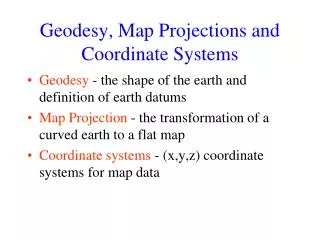
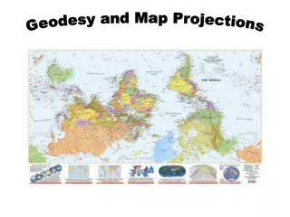
Geodesy, Map Projections and Coordinate Systems. Geodesy - the shape of the earth and definition of earth datums Map Projection - the transformation of a curved earth to a flat map Coordinate systems - (x,y,z) coordinate systems for map data.

E N D
Geodesy, Map Projections and Coordinate Systems • Geodesy - the shape of the earth and definition of earth datums • Map Projection - the transformation of a curved earth to a flat map • Coordinate systems - (x,y,z) coordinate systems for map data
Learning Objectives:By the end of this class you should be able to: • describe the role of geodesy as a basis for earth datums • list the basic types of map projection • identify the properties of common map projections • properly use the terminology of common coordinate systems • use spatial references in ArcMap so that geographic data is properly displayed • determine the spatial reference system associated with a feature class or data frame • use ArcGIS to convert between coordinate systems • calculate distances on a spherical earth and in a projected coordinate system
Readings: Introduction http://resources.arcgis.com/en/help/getting-started/articles/026n0000000s000000.htm
Readings: Further Detail http://resources.arcgis.com/en/help/main/10.1/index.html#//003r00000001000000
Revolution in Earth Measurement Some images and slides from Michael Dennis, National Geodetic Survey and Lewis Lapine, South Carolina Geodetic Survey Traditional Surveying uses benchmarks as reference points Global Positioning uses fixed GPS receivers as reference points (Continuously Operating Reference System, CORS)
Global Position Systems (Press and hold) Garmin GPSMAP 276C GPS Receiver Trimble GeoXHTM
GPS Satellites • 24 satellites • 6 orbital planes • 12 hour return interval for each satellite Satellites are distributed among six offset orbital planes
How GPS works in five logical steps: • The basis of GPS is triangulation from satellites • GPS receiver measures distance from satellite using the travel time of radio signals • To measure travel time, GPS needs very accurate timing • Along with distance, you need to know exactly where the satellites are in space. Satellite location. High orbits and careful monitoring are the secret • You must correct for any delays the signal experiences as it travels through the atmosphere
Distance from satellite • Radio waves = speed of light • Receivers have nanosecond accuracy (0.000000001 second) • All satellites transmit same signal “string” at same time • Difference in time from satellite to time received gives distance from satellite
GPS location of Mabel Lee Hall, University of Nebraska, Lincoln
Differential GPS • Differential GPS uses the time sequence of observed errors at fixed locations to adjust simultaneous measurements at mobile receivers • A location measurement accurate to 1 cm horizontally and 2cm vertically is now possible in 3 minutes with a mobile receiver • More accurate measurements if the instrument is left in place longer
This has to take Tectonic Motions into account Tectonic Motions From Sella et al., 2002
HORIZONTAL TECTONIC MOTIONS Motion in cm/year North American Plate Pacific Plate When is California not in North America … …. when its on the Pacific Plate!
Types of Coordinate Systems • (1) Global Cartesian coordinates (x,y,z) for the whole earth • (2) Geographic coordinates (f, l, z) • (3) Projected coordinates (x, y, z) on a local area of the earth’s surface • The z-coordinate in (1) and (3) is defined geometrically; in (2) the z-coordinate is defined gravitationally
Z Greenwich Meridian O • Y X Equator Global Cartesian Coordinates (x,y,z) Next 7 slides are from Dr Irmak
This leads to adjustments in locations of the national network of survey benchmarks Survey Benchmark {Latitude (f), Longitude (l), Elevation (z)}
Spatial Reference = Datum + Projection + Coordinate system • For consistent analysis the spatial reference of data sets should be the same. • ArcGIS does projection on the fly so can display data with different spatial references properly if they are properly specified. • ArcGIS terminology • Define projection. Specify the projection for some data without changing the data. • Project. Change the data from one projection to another.
Geographic Coordinates (f, l, z) • Latitude (f) and Longitude (l) defined using an ellipsoid, an ellipse rotated about an axis • Elevation (z) defined using geoid, a surface of constant gravitational potential • Earth datums define standard values of the ellipsoid and geoid
Shape of the Earth It is actually a spheroid, slightly larger in radius at the equator than at the poles We think of the earth as a sphere
Ellipse An ellipse is defined by: Focal length = Distance (F1, P, F2) is constant for all points on ellipse When = 0, ellipse = circle Z b O a X F1 F2 For the earth: Major axis, a = 6378 km Minor axis, b = 6357 km Flattening ratio, f = (a-b)/a ~ 1/300 P
Ellipsoid or SpheroidRotate an ellipse around an axis Z b a O Y a X Rotational axis
Standard Ellipsoids Ref: Snyder, Map Projections, A working manual, USGS Professional Paper 1395, p.12
Geodetic Datums • World Geodetic System (WGS) – is a global system for defining latitude and longitude on earth independently of tectonic movement (military) • North American Datum (NAD) – is a system defined for locating fixed objects on the earth’s surface and includes tectonic movement (civilian)
Horizontal Earth Datums • An earth datum is defined by an ellipse and an axis of rotation • NAD27 (North American Datum of 1927) uses the Clarke (1866) ellipsoid on a non geocentric axis of rotation • NAD83 (NAD,1983) uses the GRS80 ellipsoid on a geocentric axis of rotation • WGS84 (World Geodetic System of 1984) uses GRS80, almost the same as NAD83
Adjustments of the NAD83 Datum Slightly different (f, l) for benchmarks Continuously Operating Reference System Canadian Spatial Reference System National Spatial Reference System High Accuracy Reference Network
Sea surface Ellipsoid Earth surface Geoid Representations of the Earth Mean Sea Level is a surface of constant gravitational potential called the Geoid
THE GEOID AND TWO ELLIPSOIDS CLARKE 1866 (NAD27) GRS80-WGS84 (NAD83) Earth Mass Center Approximately 236 meters GEOID
WGS 84 and NAD 83 North American Datum of 1983 (NAD 83) (Civilian Datum of US) International Terrestrial Reference Frame (ITRF) includes updates to WGS-84 (~ 2 cm) Earth Mass Center 2.2 m (3-D) dX,dY,dZ World Geodetic System of 1984 (WGS 84) is reference frame for Global Positioning Systems GEOID
Definition of Latitude, f m p S n O f q r (1) Take a point S on the surface of the ellipsoid and define there the tangent plane, mn (2) Define the line pq through S and normal to the tangent plane (3) Angle pqr which this line makes with the equatorial plane is the latitude f, of point S
P Prime Meridian Equator Meridian plane Cutting Plane of a Meridian
Definition of Longitude, l l = the angle between a cutting plane on the prime meridian and the cutting plane on the meridian through the point, P 180°E, W -150° 150° -120° 120° 90°W (-90 °) 90°E (+90 °) P -60° l -60° -30° 30° 0°E, W
=0-180°W =0-90°S Latitude and Longitude on a Sphere Meridian of longitude Z Greenwich meridian N Parallel of latitude =0° P • =0-90°N - Geographic longitude - Geographic latitude E W O • Y R R - Mean earth radius • =0° Equator • O - Geocenter =0-180°E X
Length on Meridians and Parallels (Lat, Long) = (f, l) Length on a Meridian: AB = ReDf (same for all latitudes) R Dl D R 30 N C B Re Df 0 N Re Length on a Parallel: CD = R Dl = ReDl Cos f (varies with latitude) A
Example: What is the length of a 1º increment along • on a meridian and on a parallel at 30N, 90W? • Radius of the earth = 6370 km. • Solution: • A 1º angle has first to be converted to radians • p radians = 180 º, so 1º = p/180 = 3.1416/180 = 0.0175 radians • For the meridian, DL = ReDf = 6370 * 0.0175 = 111 km • For the parallel, DL = ReDl Cos f • = 6370 * 0.0175 * Cos 30 • = 96.5 km • Parallels converge as poles are approached
Z B A • Y X Curved Earth Distance(from A to B) Shortest distance is along a “Great Circle” A “Great Circle” is the intersection of a sphere with a plane going through its center. 1. Spherical coordinates converted to Cartesian coordinates. 2. Vector dot product used to calculate angle from latitude and longitude 3. Great circle distance is R, where R=6378.137 km2 Ref: Meyer, T.H. (2010), Introduction to Geometrical and Physical Geodesy, ESRI Press, Redlands, p. 108
Three systems for measuring elevation Orthometric heights (land surveys, geoid) Ellipsoidal heights (lidar, GPS) Tidal heights (Sea water level) Conversion among these height systems has some uncertainty
Trends in Tide Levels(coastal flood risk is changing) Charleston, SC + 1.08 ft/century 1900 2000 Galveston, TX + 2.13 ft/century - 4.16 ft/century 1900 2000 Juneau, AK 1900 2000
Geoid and Ellipsoid Earth surface Ellipsoid Ocean Geoid Gravity Anomaly Gravity anomaly is the elevation difference between a standard shape of the earth (ellipsoid) and a surface of constant gravitational potential (geoid)
Definition of Elevation Elevation Z P z = zp • Land Surface z = 0 Mean Sea level = Geoid Elevation is measured from the Geoid
Gravity Recovery and Climate Experiment (GRACE)Force of gravity responds to changes in water volumeWater is really heavy! Gravity is varying in time and space. Gravity Anomaly of Texas, 2002 – 2012 Normal In 2011, we lost 100 Km3 of water or 3 Lake Mead’s
GRACE and Texas Reservoir Water Storage Surface water reservoir storage is closely correlated with the GRACE data Grace Satellites Normal In 2011 we lost 100 Km3of water overall Surface Water Reservoirs Normal In 2011 we lost 9 Km3of water from reservoirs
Vertical Earth Datums • A vertical datum defines elevation, z • NGVD29 (National Geodetic Vertical Datum of 1929) • NAVD88 (North American Vertical Datum of 1988) • takes into account a map of gravity anomalies between the ellipsoid and the geoid
Converting Vertical Datums • Corps program Corpscon (not in ArcInfo) • http://crunch.tec.army.mil/software/corpscon/corpscon.html Point file attributed with the elevation difference between NGVD 29 and NAVD 88 NGVD 29 terrain + adjustment = NAVD 88 terrain elevation
Importance of geodetic datumsNAVD88 – NGVD29 (cm) NGVD29 higher in East More than 1 meter difference NAVD88 higher in West Orthometric datum height shifts are significant relative to BFE accuracy, so standardization on NAVD88 is justified
Geodesy and Map Projections • Geodesy - the shape of the earth and definition of earth datums • Map Projection - the transformation of a curved earth to a flat map • Coordinate systems - (x,y) coordinate systems for map data
Representative Fraction Globe distanceEarth distance = Earth to Globe to Map Map Projection: Map Scale: Scale Factor Map distanceGlobe distance = (e.g. 0.9996) (e.g. 1:24,000)