Download
1 / 19
190 likes | 261 Views
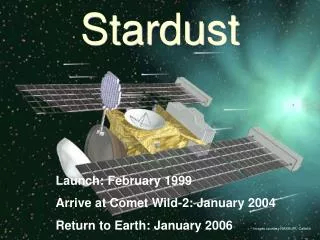
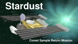
Stardust-NExT Mission Data Review. Matthew Knight December 13, 2011. Raw NavCam Images. Purpose of the dataset: archive the raw images from NavCam during Stardust NExT (12/2010-2/2011) as well as calibration image from 2007-2011

E N D
Stardust-NExT Mission Data Review Matthew Knight December 13, 2011
Raw NavCam Images • Purpose of the dataset: archive the raw images from NavCam during Stardust NExT (12/2010-2/2011) as well as calibration image from 2007-2011 • Additional data: catalog files, documentation on the calibration process/shutter behavior/flat field response/etc.
Overview of review • Documentation is very thorough and well written • Explanations are sufficient • Supplemental information supplied is relevant • Data are clearly laid out and easy to understand what is there • Only needs minor fixes: • A small number of typos • A handful of science suggestions
Acronyms • A number of acronyms were used at various times in many different files either without a definition or so long after the definition was given that I had forgotten what it meant. It would be useful to have a central repository with acronym definitions, perhaps in aareadme.txt or another file at that level. • This goes for all three data sets I reviewed • Example: I didn't figure out that EDR stands for "Edited, raw data record" until I saw it in stardust-cal-nc-2-preflight-v2.0/document/onlabels.txt This also allows me to infer that RDR must stand for "raw data record"
Catalog/navcam.cat • What does “blocking” mean? • Are the blocking values in Ang rather than nm? • NH2: should I interpret this as “less than 10^-2 for wavelengths less than 6500 and longer than 6800; less than 10^-3 for wavelengths shorter than 6450 and longer than 6850?”
Catalog/navcam.cat • Same interpretation for Oxygen? • For C2 • Does this mean “less than 10^-1 from 3000 to 5051 and 5230 to 11000”? • Same notation should be used throughout (“,” here but “-” later) • At what wavelengths are these transmissions valid?
Catalog/navcam.cat • Similar questions for YELLOW, RED, NIR • Should HIRES be 3000-4800 (not 3000-480?) • Note the “nanometers” statement at the bottom • Are these transmission curves given somewhere else (if so, please mention where)? • Plots: sdu-c_cal-navcam-2-next-tempel1-v1.0/document/olddoc/calibrpt.pdf • Ascii: stardust-cal-nc-2-preflight-v2.0/document/stardust/calrpt
Catalog/navcam.cat • Is the new look-up table archived here? Where?
Catalog/next.cat • What happened to 2011-2-14, 2011-2-16? • Should all of the mission phases be consecutive or is it okay to have gaps?
Catalog/dataset.cat • “Data collection periods” section has write ups of “Checkout, Cruise 5, and Cruise 6” and “Encounter”, but not “Approach” or “Departure”. Is this intentional?
Document/nc_cal_overview.* • Why is the calibration procedure called “decalibration” instead of “calibration”? • Klaasen et al. (2011) call it “calibration”
How might I use the data? • Make a flyby movie (raw data) • Very easy to do with all images in ds9
How might I use the data? • Measure a lightcurve of the comet • Problem: I’m not sure where the comet is except very close to flyby. • Suggestion: Make a table with the position of the comet in each image • X,Y position or RA,dec is okay with me • Lightcurve will be shown in Calibrated section
Calibrated NavCam Images • The same as raw NavCam images, except these have been calibrated • Documentation is virtually identical • All comments were given in Raw NavCam presentation
Calibrated NavCam Images • Why doesn’t the calibration get rid of the striping?
How might I use the data? • Make a lightcurve of the comet on approach • Method: find comet, measure photometry from images, extract distance to spacecraft and date from header • Result: rotation visible, change in spatial scale evident
NavCam Ground-based Calibration Data • Contains the raw, preflight, thermal-vacuum calibration images • Testing at various temperatures, exposure times, radiances • Review summary: • Documentation is very thorough and well written • Minimal typos; no problems using the images for science • Easy to understand what was there
How might I use the data? • Measure the flux as a function of T • Read in fits files • Took the median of the whole image to get the flux • Got temperature, radiance, exposure time from the headers
How might I use the data? • Measure the flux as a function of T • Result: corrected for radiance to get a better correlation