Download
1 / 24
250 likes | 382 Views
The Future Okavango (TFO). Scientific support for sustainable land and resource management in the Okavango basin. Funded by the Federal Ministry of Education and Research. Within the research strategy FONA (Research for Sustainability). Under the call Sustainable Land Management.

E N D
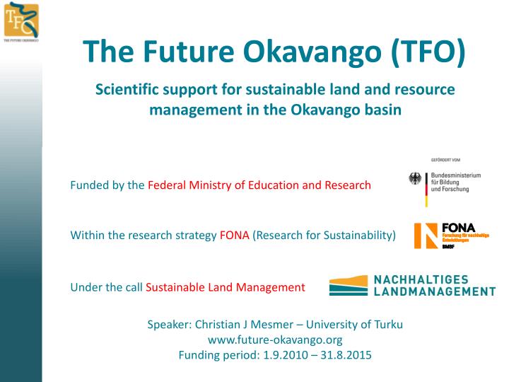
The Future Okavango (TFO) Scientific support for sustainable land and resource management in the Okavango basin Funded by the Federal Ministry of Education and Research Within the research strategy FONA (Research for Sustainability) Under the call Sustainable Land Management Speaker: Christian J Mesmer – University of Turku www.future-okavango.org Funding period: 1.9.2010 – 31.8.2015
General aims of TFO • The project aims at • an improvement of knowledge based land use managementwithin the Okavango catchment – involving the countries Angola, Botswana and Namibia • the application of a trans-disciplinary approach by involving relevant stakeholders on different scales • the analysis of ecosystem functions (ESF) and services (ESS) • under scenarios of global change.
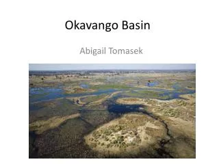
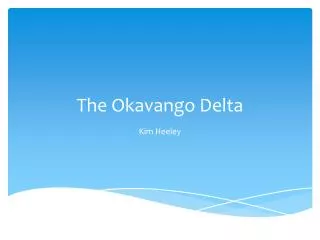
The Region - characteristics • The Okavango is the only perennial river in Africa that flows eastward without reaching the ocean, • … is one of the last near pristine aquatic ecosystems on the African continent, and indeed on earth and • … is the only exploitable perennial river that flows through the territories of both Namibia and Botswana. • The Delta is the largest freshwater swamp south of the equator • … which inhabits an enormous biodiversity (e.g. 71 species of fish, 33 amphibs, 64 reptiles, 444 birds & 122 mammals) • … and thus is of extraordinary importance for nature conservation – and tourism.
The Region - characteristics • The catchment covers an area of about 413.550 km2 and is home for 1.1 Mio. People. • The length of the Okavango from its source in the Angola highlands to the mouth at the outer margin of the Delta in Botswana is 1100 km. • In direction of the water flow the climate changes markedly (e.g. 1300 mm annual rainfall in Huambo, 450 mm in Maun) • Thus, the Angola portion provides 95 % of the total water runoff.
The Region – change perspectives • A strong growth of human population with changing consumption patterns causes an expansion of land use. • Climate change scenarios forecast an increase of water stress and extreme events for the catchment. • The global demand for resources is most likely to severely affect formerly peripheral regions. • The decline of the dry woodland (Miombo) belt due to degradation is regarded as one of the global tipping point regions regarding loss of biodiversity, impacts on climate and on biogeochemical cycles of other regions.
Partners involved Ministry of Agriculture, Water and Forestry, Namibia TUCSIN Namibia Nature Foundation ISCED Lubango
Cooperation between subprojects Stakeholder involvement, implementation, policy implications SP10 9 8 Spatial analyses: Multi-scale remote sensing & GIS-based landscape analyses SP 9 4 7 7 5 Analysis & design of social and economic mechanisms Ecological and economic valuation of ESS SP8 3 SP7 Regional and transboundary Governance 6 Capacity development SP6 User knowledge, valuation and regulation 1 2 Assessment of ESF/ESS related to... SP4 SP3 SP5 Climate SP1 Water Soils & crops Micro- organisms Plants SP2 Coordination & Data integration SPC
Key question How to measure and valuate all/the most important ecosystem services in the Okavango basin, to compare land-use strategies and to improve them in a way that raises value and well-being for people ?
Scientific challenges • To measure and valuate competing ESS on a regional level. • • To understand and describe interdependenciesbetween the services and land management. • To develop monetary and non-monetary valuation and quantification tools to integrate ESS in market based mechanisms . • • To understand and model trade-offs and cumulative effects on larger spatial scales, to suggest solutions for larger landscapes. • To find conditions and mechanisms to integrate the knowledge about ESS into land-use decisions.
Ecosystem services • Ecosystem services are defined as • „the benefits of nature to households, communities and economics“ • → Ecosystems are socially valuable • A more rigorous definition from the viewpoint of welfare measurement is • „Ecosystem services are components of nature, directly enjoyed, consumed, or used to yield human well-being“ • (Boyd & Banzhaf 2006)
Ecosystem services - Examples • Examples of ESS: • Provisioning of crops, meat & fish • Provisioning of cotton, timber & fuel wood • Provisioning of fresh water • Provisioning of medicinal plants • Provisioning of fresh air • Protection from flood-damage • Enabling of recreation • Providing spiritual value • …..
Ecosystem functions … are defined as „the capacity of natural processes and components to provide goods and services that satisfy human needs, directly or indirectly“ (De Groot 1992) → ecosystems functions are a subset of ecological processes and ecosystem structures
ESF & ESS – an Example Solar radiation Rain Crop yield Transpiration Seeds, ploughing, protection, (fertilizer) Evaporation Nutrient cycling Decomposition Groundwater recharche nutrient losses
ESF & ESS – an Example • Specific tasks with TFO: • analyse the curent land-use distribution • measure realized crop yields • evaluate market prizes • evalute management costs • investigate potential crop yields • under given natural conditions • regarding the sustainability of the system • balance the Ecosystem service [ investigate Ecosystem services of alternative land-use types for same area]
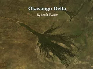
Study site selection Photo : M.Pröpper
Study site selection Key regions indicated in the proposal (March 2010)
SP 08 Ecological and Economic Valuation of ESSPerception of project dynamics Integration Scenarios, Synthesis valuation => informed management SP1,SP9, SP10, SP8 (T1,6) Vertical flow of ESS Catchment dynamics analysis SP2, SP7 SP8 (T5), … ? ESS ESS ESS Boteti?? Key SES Horizontal/ cylcing flow of ESS ES site 1 LU Key SES ES site 2 LU Key SES ESS ES site 3 LU ESS Key SES ESS SP2,SP3, SP4, SP5,SP6, SP7 SP8 (T2,3,4), … ? ES site 4 LU ESS Water flow ES: Ecosystem LU: Land use SES: socio-ecological system ESS: Ecosystem Services (and functions) affects
Methods (1) Task 1:Translating ESF and disciplinary approaches into ESS for economic valuation • Aim: Project-specific conceptual framework for organizing ecosystem functions and ecosystem services • Classification depends on aims. Here: • Valuation • Integration of results at the catchment scale to inform the design of a management plan or river regime plan. • Possible criteria: • Public-private good (Distributional issues) • Spatial and temporal scale (management) • Joint production (valuation) • Complexity • Benefit dependence • Combination • Methods: literature research, internal bilateral discussion or small workshops
Methods (2) • Task 2- Farming system analysis and field research • Aim: Analysis of farming systems • Analysis based on concept of SES • Data: actual LU, labor and energy flows, prices • Task 4: Bio-economic modeling and programming for shadow price detection • Aim: bio-econ comparison of land use options, production oriented valuation of ESS • Data generation: User values of ESS in local currency • Data needed:Impacts of LU on ESS, alternative land uses • Task 3- Willingness to pay analysis for ESS • Aim: assessment of values of tourists for Wildlife • Method: interviews • Data generated: in Botswana; levels of money potentially available for PES in local currency
Methods (3) • Task 5 - Benefit sharing simulations of upstream services to downstream communities • Aim: suggest possibilities for just redistribution of wealth derived from ESS in the catchment • Data needed: • Who (households/governments) affects or provide [which] ESS flow from upper to lower catchment to Whom • What is the institutional context [local and regional] • Data generation: whatever is not be delivered by other SPs/projects • Task 6 -Evaluation of land use options through synthesizing non-monetary and monetary valuation approaches (meta-analysis) • Conceptual and participatory tools • Data needed: inputs from ecological valuation, cultural valuation. Use of own data. Work with SP7.
Thank you! Tangi unene!


![[PDF] Free Download The Fortunate Ones By Catherine Hokin](https://cdn5.slideserve.com/9940559/slide1-dt.jpg)