Download
1 / 35
360 likes | 449 Views
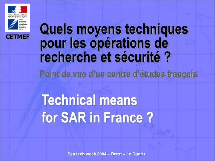
Quels moyens techniques pour les opérations de recherche et sécurité ?. Point de vue d’un centre d’études français. Technical means for SAR in France ?. ORGANISATION FRANCAISE DU SAR FRENCH ORGANISATION OF THE SAR. 1 ACTEURS INSTITUTIONNELS (INSTITUTIONAL ACTORS)

E N D
Quels moyens techniques pour les opérations de recherche et sécurité ? Point de vue d’un centre d’études français Technical means for SAR in France ?
ORGANISATION FRANCAISE DU SARFRENCH ORGANISATION OF THE SAR 1 ACTEURS INSTITUTIONNELS (INSTITUTIONAL ACTORS) • Direction des Affaires Maritimes et des Gens de Mer (DAMGM) : Administration centrale chargée de la politique nationale French department of maritims affairs and seafarers • Préfecture Maritime: Action de l’État en mer Naval headquarters: action of the State in sea • 2 ACTEURS OPÉRATIONNELS (OPERATIONAL ACTORS ) • CROSS: Centres Régionaux Opérationnels de Surveillance et de Sauvetage ( 5 en métropole et 2 en Outre-mer) Regional Operational Monitoring and rescue Centres (MRCC) (5 in mother country and 2 overseas) • Sémaphores Military Watch Station
2 ACTEURS OPÉRATIONNELS (OPERATIONAL ACTORS ) (suite) • SNSM: Société Nationale de Sauvetage en Mer Life Saving Station • Unités de la Marine Nationale (Navires, aéronefs) Units of the Navy (Ships, aircrafts) • Douanes (Surveillance, pollution) Customs (Surveillance, pollution) • Gendarmerie Nationale National state police force • Centre de Consultation Médical Maritime (CCMM Toulouse) Centre of Consultation Medical Maritime • 3 ACTEUR TECHNIQUE (TECHNICAL ACTOR ) • Le CETMEF (Centre d’Étude Technique Maritime et Fluviale) en charge des systèmes terrestres, de surveillance et de sauvetage The Center of Maritime and River Technical Study in charge of the ground systems, of the surveillance and of the rescue
LE CETMEF (1/2) Le pôle surveillance de la navigation maritime et sauvetage assure les missions du service pour tout ce qui concerne : The pole surveillance of the sea navigation and the rescue supplies the missions of the service for all which concerns: • La définition des plans directeurs en matière d’équipement des dispositifs de surveillance de la navigation maritime et de sauvetage; The definition of main plans in equipment of the devices of surveillance of the sea navigation and the rescue; • L’étude, la conception, la fourniture, l’évaluation et la maintenance des matériels et systèmes destinés aux établissements chargés de la surveillance et de la sécurité de la navigation maritime, ainsi qu’aux services de trafic maritime portuaires, The study, the engineering, the supply, the evaluation and the maintenance of the equipments and the systems intended for establishments loaded with the surveillance and the safety of the sea navigation, as well as for harbour services of sea traffic,
LE CETMEF (2/2) • La formation des personnels aux techniques et matériels spécifiques; The training of the staffs to techniques and specific equipments; • La participation aux travaux de l’AISM et de l’OMI dans les domaines ci-dessus. The participation in the works of the AISM and the OMI in domains above.
LES SYSTÈMES TERRESTRES DE LOCALISATION, DE SURVEILLANCE ET DE SAUVETAGE • Radars • Goniomètres ( digital VHF finder) • Station de radiotéléphonie VHF (Station of radiotelephony VHF) • MHF • NAVTEX • SGVR/AIE (Radio Automated Management ) • Station d’émission GPS différentiels (station GPS) • AIS
RADARS Exemple de la station radar Portée (range) 24 à 36 milles Discrimination de 0,2° Traitement et exploitation des images radar multi-sites sur plusieurs postes opérateur Treatment and exploitation of the radar images multi-sites on several posts operator
Mise en réseau des radars Networking of radars • Remplacement des émetteurs récepteurs radar existant et rénovation ou remplacement des antennes existantes Renovation of the existing radar tracking or replacement of the existing antennae • Extension des couvertures radars des CROSS de la Manche Extension of the coverings radars of the MRCC of La Manche PROGRAMME RECORAM • Réalisation d’une station radar sur l’île de Guernesey Realization of a radar tracking station on the island of Guernesey • Réalisation d’une station radar sur la Pointe du Raz Realization of a radar tracking station on the Pointe du Raz
STATIONS DE RADIOGONIOMÉTRIEDIGITAL VHF FINDER STATION Exemple de la station radar et radiogoniométrie Example of the radar tracking and digital VHF finder station • identification des navires par leur émission : • Identification of ships by their broadcast • Précision 0,5° • Portée (Range) 40 à 50 milles • Fonctionnement simultané sur plusieurs fréquences (Simultaneous functioning on several frequencies)
STATIONS DE RADIOTÉLÉPHONIERADIO STATION • Portée (Range) 30 à 40 milles • Fonctions simultanées d’émission et de réception sur plusieurs fréquences (Simultaneous functions of emission and reception on several frequencies): • Veille (Watch) voie 16 • Veille (Watch) ASN • Trafic SAR • Diffusion MSI • report de position des navires (Transfer of position of ships) • secours équipements antennes
MHF Fonctions assurées • Veille (Watch) 2182 KHz • Veille ASN et accusé réception Watch over ASN and acknowledged receipt) • Diffusion des messages de sécurité à la navigation maritime Distribution of the safety messages in the sea navigation • Coordination des secours en zone A2 Coordination of the help in zone A2
NAVTEX • Diffusion télex automatique • Automatic distribution of telex • d’avertissements concernant la navigation ( Of warnings concerning the navigation • de la météo Of the weather • des informations urgentes Of the urgent information • 6 créneaux horaires de 10 min • 6 time slots of 10min • Fréquences • International : 518 kHz • National : 490 kHz
SGVR/AIE (RADIO MANAGEMENT AUTOMATED) • Concept du SGVR AIE • Centraliser dans un poste unique la totalité des interfaces nécessaires Centralize in an unique post the totality of the necessary interfaces • Permettre un fonctionnement opérationnel Allow an operational functioning • Fonctions de communication • Gestion automatisées des voies radio Radio management automated • Numérotation téléphonique automatisée automated Dialing • Diffusion de messages Distribution of message • Réécoute immédiate des messages émis et reçus Immediate listen of emitted and received messages • Télégestion des sites distants Remote control of the distant sites Poste de travail SGVR- AIE Workstation
AIDE INFORMATISÉE À L’EXPLOITATION ASSISTANT COMPUTERIZED IN THE OPERATION
PRINCIPE GPS • The receiver GPS calculates permanently the point GPS in a reference point: it determines the errors of measure made on every satellite • The calculated and checked corrections are real time passed on by radio • A mobile receiver receives on one hand the signals GPS and on the other hand the corrections
COUVERTURE GPS Integration of the network in the RGP The DGPS station of the CETMEF is integrated in Networks Permanent GPS of the National Geographic Institute The data and the information of stations are available for consultation on the internet site: Lareg.ensg.ign.fr
AIS AUTOMATIC IDENTIFICATION SYSTEMPRINCIPE DE FONCTIONNEMENT Données GPS Informations statiques Static information MMSI Nom Type de navire… Informations dynamiques Dynamic information Position Vitesse Route… Informations associées au voyage Tirant d’eau Cargaison Nombre de passagers… VHF Station de base AIS CROSS, Ports, …
BÉNÉFICES ATTENDUS (EXPECTED PROFITS) (1/2) Application navire-navire (Benefits for ships) • Amélioration de la connaissance de la situation des navires Improvement of the knowledge of the situation of the ships • Amélioration de l’évitement des abordages Improvement in collision avoidance Outil pour les STM (Tool for the VTS 1/2) • Amélioration de la gestion du trafic par les STM Improvement of the traffic management by the VTS • Diffusion aux navires, des corrections DGPS Broadcasting of DGNSS corrections to the ships • Automatisation partielle des compte-rendus dans les zones concernées Partial automation of the reports in the concerned zones
BÉNÉFICES ATTENDUS (EXPECTED PROFITS) (2/2) Outil pour les STM (Tool for the VTS 2/2) • Diffusion de messages relatifs à la sécurité Broadcasting of safety related messages • Amélioration des opérations SAR Improvement SAR management Autres (Others) • Aide à la navigation Aid to navigation • Réduction des messages vocaux sur le réseau VHF Reduction of the vocal messages on the VHF channels • Connaissance par l’État de la situation des navires et leur cargaison Knowledge by the State of the situation of ships and their cargo • Amélioration de la lutte anti-pollution Improvement of the anti-pollution fight • Aide aux pilotes Aid to the marine pilots
PROJET DE COUVERTURE AIS Stations AIS DAMGM : 7 sites équipés Les CROSS de la Manche et certaines stations déportées MRCC and VHF stations Marine Nationale : 30 sites équipés Une partie des sémaphores Watch stations
SPATIONAVProgramme commun DAMGM/Marine Nationale • Surveillance des approches maritimes et des zones sous juridiction nationale • National seawater survey • Mise en réseau et exploitation des données provenant des radars, de l’AIS, des radiogoniométres et de TRAFIC 2000, pour l’ensemble des administrations. Networking and exploitation of the data resulting from radars, from AIS, from directional finder and from TRAFFIC 2000, for all the administrations. • Mise en place d’outils d’aide à la décision. Implementation of decision-making tools. • Zones couvertes : Manche/Atlantique, Méditerranée et Antilles/Guyane Covered zones: Channel / Atlantic, the Mediterranean and the Antilles / Guyana
The Galileo constellation • 30 Satellites (27 operational + 3 active spares) • 3 Orbital planes 56 degrees inclination • 23616 km altitude
The Galileo services • OS : OPEN SERVICE • For applications targeted broadly at mass consumer and professional markets. • OS : SERVICE OUVERT • Fourniture d’un service pour le marché de masse (accès gratuit). • CS : COMMERCIAL SERVICE • With additional encrypted data information for value added commercial services. • CS : SERVICE COMMERCIAL • Fourniture d’un service amélioré par rapport au service d’intérêt général (intégrité, services à définir …) destiné aux marchés professionnels.
Les Services de Galileo • SOL : SAFETY OF LIFE • For safety critical applications in aeronautical, maritime and land based (trains) applications. • SOL : SERVICE APPLIQUE A LA SURETE DE LA VIE • Service à intégrité élevée pour les applications qui nécessitent la sécurité des personnes et des biens (notamment le transport aérien). • PRS : PUBLIC REGULATED SERVICE • Providing continuity of service to authorised public user groups in case of crisis. • PRS : SERVICE PUBLIC REGULE • Service sécurisé à robustesse élevée , destiné uniquement aux autorités gouvernementales et certains utilisateurs en cas de crises. • SAR : SEARCH AND RESCUE • Reception of emergency messages for air / sea rescue in the context of COSPAS - SARSAT. • SAR : SERVICE DE RECHERCHE ET DE SAUVETAGE • Service qui diffuse dans le monde les messages d'alerte émis par les balises de détresse (améliore les performances du système international de recherche et sauvetage COSPAS-SARSAT).
Search and Rescue application The SAR/GALILEO will make it possible to improve COSPAS-SARSAT system by a real time reception of messages, alarms localisation and data acknowledgement. Le SAR/GALILEO permettra d'améliorer de façon significative le système COSPAS-SARSAT actuel grâce à une réception en temps quasi réel des messages, une localisation précise des alertes et un accusé de réception.
Long Range Identification and Tracking • Long range : outside of the VHF coverage. • Identification and tracking : by polling • minimum transmitted message (identity, location , time and date of the position) • ability of interrogation for further information. • AIS could be used to supply this message
Identification et Suivi à Longue Distance • Longue distance : au delà de la portée VHF. • Identification et suivi : en mode interrogation • message minimum (identité, position, jour et heure de la position) • possibilité d’interrogation pour obtenir des informations supplémentaires. • L’AIS pourrait être utilisé pour fournir ces informations
Les prochaines générations de capteurs passifs • Radars HF • Principe : émission d’un signal dans la bande HF qui se propage à la surface de la mer et suit la courbure terrestre au-delà de l’horizon. • Deux familles de radars : • Radars à fréquences élevées (30 MHz) pour la détection des polluants, la mesure de houle et les études de courantologie • Radars à basse fréquence (4 à 6 MHz) pour la surveillance du trafic (portée de 200 nautiques pour un cargo se déplaçant à 10 nœuds, 70 nautiques pour un chalutier) • Premières expérimentations réalisées au Canada et en Australie, un démonstrateur de radar HF pourrait être testé en France en utilisant les compétences de l’ONERA • Capteurs aéroportés • Nouveaux moyens de contrôle intégrés : fusion sur un seul écran des donnés de capteurs passifs (radars) et actifs (AIS)
Next generations of passive sensors • Radars HF • General principle : a signal HF spreads over the surface of the sea and follows the ground line beyond the sky line • Two families of radars : • High frequency radars (30MHz) used to detect contamination or mesure heave and sea currents • Low frequency radars (4 to 6 Mhz) used to watch the traffic • First experiments proceeded in Australia and Canada, a french prototype could be developped with the knowhow of the French Office of Aeronautics Research • Airborne sensors • New means for sea-traffic control : merge on a single screen datas issued from passive sensors (radars) and active sensors (AIS)
Les prochaines générations de capteurs/next generation of sensors • réseau d’antennes HF sur le littoral/ HF antennas network on the coast