Download
1 / 9
90 likes | 577 Views
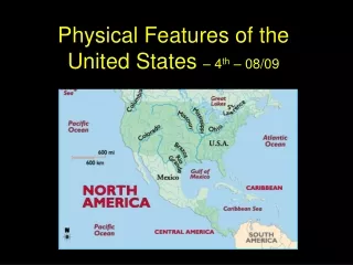
Important Physical and Man-made Features of the United States. Great Basin. This plateau covers most of Nevada and half of Utah. Locate the Great Basin on your map. Color it orange. Death Valley.

E N D
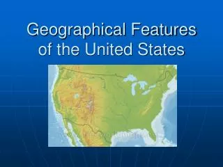
Important Physical and Man-made Features of the United States
Great Basin This plateau covers most of Nevada and half of Utah. Locate the Great Basin on your map. Color it orange.
Death Valley A desert valley in east, central California. The hottest, lowest and driest valley in the United States. Locate Death Valley on your map and color it red.
Great Plains This area covers parts of Colorado, Kansas, Montana, Nebraska, New Mexico, North Dakota, Oklahoma, South Dakota, Texas. Locate the Great Plains on your map and color them green.
Gulf of Mexico A body of water surrounded by the North American Continent and the country of Cuba. It is the 9th largest body of water in the world. Locate the Gulf of Mexico on your map and color it blue. Then label it.
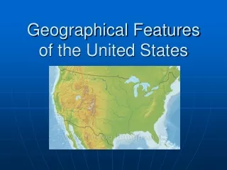
The Great Lakes A chain of freshwater lakes located in North America. Locate the Great Lakes and color them purple. Label them on your map.
St. Lawrence River It is a large riverflowing approximately from southwest to northeast in the middle latitudes of North America, connecting the Great Lakes with the Atlantic Ocean. Locate the St. Lawrence River on your map and color it orange. Don’t forget to label it.
Continental Divide A line that forms a border between to water ways. Locate the Continental Divide on your map and draw and arrow showing where it is. Label it.
Atlantic Coastal Plains Color the states of the Atlantic Coastal Plains Pink.