Download
1 / 21
210 likes | 538 Views
Update on Geographic Area Programs for the 2020 Census Michael Ratcliffe Geography Division US Census Bureau Texas Demographic Conference Austin, Texas June 5, 2019. Update on Geographic Area Programs. In this presentation: Geographic Area Programs for the 2020 Census

E N D
Update on Geographic Area Programs for the 2020 Census Michael Ratcliffe Geography Division US Census Bureau Texas Demographic Conference Austin, Texas June 5, 2019
Update on Geographic Area Programs In this presentation: • Geographic Area Programs for the 2020 Census • Update on the Participant Statistical Areas Program • Census Designated Places in Texas • Colonias and Census Designated Places • Changes to Metropolitan and Micropolitan Statistical Areas • Thoughts on Urban and Rural
Geographic Area Programs for the 2020 Census • Boundary and Annexation Survey • Annual review and update of boundaries for states, counties, and incorporated places; new incorporations, disincorporations, and changes in status. • Participant Statistical Areas Program • Review and update of block groups, census tracts, census designated places, and census county divisions as well as tribal statistical areas. • Boundary Validation Project • Opportunity for highest elected officials to review and approve boundaries for use in tabulating 2020 Census data. • ZIP Code Tabulation Area (ZCTA) Update • Public Use Microdata Areas (PUMA) Delineation • Urban Area Delineation
Participant Statistical Areas Program Overview • Standard statistical geographies: • Census tracts (CTs) • Block groups (BGs) • Census designated places (CDPs) • Census county divisions (CCDs) in selected states • Tribal statistical geographies: • Tribal census tracts (TCTs) • Tribal block groups (TBGs) • Census designated places (CDPs) • Tribal Designated Statistical Areas (TDSAs) • State Designated Tribal Statistical Areas (SDTSAs) • Alaska Native village statistical areas (ANVSAs) • State reservations (legal entities) • Oklahoma tribal statistical areas (OTSAs) and associated tribal subdivisions. Allows invited participants to review and update selected statistical area boundaries for 2020 Census data tabulation using Census Bureau criteria and guidelines. The Census Bureau uses the defined statistical areas for the 2020 Census, American Community Survey, and the Economic Census data.
Participant Statistical Areas Program (PSAP) Overviewhttps://www.census.gov/programs-surveys/decennial-census/about/psap.html
Census Bureau Internal Review The Census Bureau reviewed census tracts and block groups in nearly all counties, identifying suggested changes and adjustments to help streamline the review and update on the part of primary participants. New for 2020 PSAP, based on feedback and lessons learned from the 2010 PSAP. Reduces the need for boundary corrections. Participants choose either the “2020 Proposed Plan” or “2010 Geographies” when using the Modify Area Feature button in the Geographic Update Partnership Software.
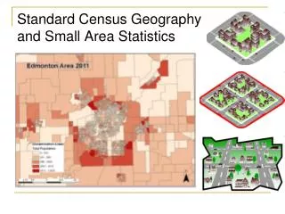
Census Designated Places (CDPs) – Overview Statistical geographic entities representing closely settled, unincorporated communities that are locally recognizable and identifiable by name. Statistical equivalents of incorporated places. 538 CDPs defined in Texas for the 2010 Census. 524 CDPs, as of 2018. 49 new CDPs defined for the 2020 Census.
Census Designated Places and Colonias For the 2010 Census, 245 CDPs contained approximately 750 colonias. We have received a boundary file with information for 2,070 coloniasand are currently reviewing it in relation to current incorporated places and CDPs.
Texas Places and Colonias El Paso County Places and Colonias Webb County Places and Colonias
Texas Places and Colonias Hidalgo County Places and Colonias Cameron County Places and Colonias
Relationships between colonias and places • Sullivan City contains 12 colonias. • Cuevitas CDP contains Cuevitascolonia. • Los Ebanos CDP contains Los Ebanos colonia. • Quesada CDP contains Quesada colonia. • Nina CDP contains Nina colonia. • Valle Vista Subdivision and Rancho Subdivision colonias are not within any CDPs.
Metropolitan and Micropolitan Statistical Areas Changes, September 2018 Changes to county components of metropolitan and micropolitan statistical areas: Alice micro area added Duval County. Beaumont-Port Arthur metro area lost Newton County. Corpus Christi metro area lost Aransas County (to new Rockport micro area). Dallas-Fort Worth metro area lost Hood County (to new Granbury micro area) and Somervell County. Huntsville micro area lost Trinity County. Longview metro area added Harrison County (formerly Marshall micro area). Mount Pleasant micro area added Camp County. Pampa micro area added Roberts County. Pecos micro area added Loving County. San Angelo metro area added Sterling County. Name change: Rio Grande City Micropolitan Statistical Area is now Rio Grande City-Roma.
Metropolitan and Micropolitan Statistical Areas Changes, September 2018 New micropolitan statistical areas: Granbury, TX (Hood County) Pearsall, TX (Frio County) [added in April 2018] Rockport, TX (Aransas County) Deleted micropolitan statistical area: Marshall, TX (Harrison County– merged with Longview Metropolitan Statistical Area)
Urban and Rural Classification Reviewing criteria for the 2020 Census delineation of urban and rural areas: • We are reviewing the hop, jump, and impervious surface aspects of the criteria. • Return maximum jump distance to 1.5 miles. • Review the sequence in which hop, jump, and impervious surface criteria are applied. • Is 2,500 still an appropriate minimum threshold for identifying urban areas? • In addition, further consideration is needed regarding ways to identify and classify different kinds of rural communities, settlement patterns, and levels of rurality: • Rural Metropolitan, Rural Micropolitan, Rural Non-Metro/Micro? • Distinctions based on population density? • Distinctions based on proximity to/distance from urban centers of various sizes? • Categories that provide more insight into context?
Considering New Approaches to Defining Urban and Rural Areas • Incorporates the Tract-Level Urban/Rural classification into the Proportional Rurality classification • Examples: • Rural Tracts within Mostly Rural Counties • Rural Tracts within Mostly Urban Counties • Urban Tracts within Mostly Rural Counties
Thank You Michael Ratcliffe Assistant Division Chief for Geographic Standards, Criteria, Research, and Quality Geography Division United States Department of Commerce Bureau of the Census 4600 Silver Hill Rd. Suitland, Maryland 20233 Office 301-763-8977 michael.r.ratcliffe@census.gov