Download
1 / 10
110 likes | 279 Views
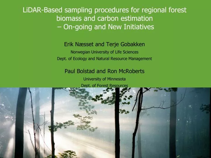
LiDAR-Based sampling procedures for regional forest biomass and carbon estimation – On-going and New Initiatives. Erik Næsset and Terje Gobakken Norwegian University of Life Sciences Dept. of Ecology and Natural Resource Management Paul Bolstad and Ron McRoberts University of Minnesota

E N D
LiDAR-Based sampling procedures for regional forest biomass and carbon estimation – On-going and New Initiatives Erik Næsset and Terje Gobakken Norwegian University of Life Sciences Dept. of Ecology and Natural Resource Management Paul Bolstad and Ron McRoberts University of Minnesota Dept. of Forest Resources
Light Detection and Ranging – A Review • LiDAR = laser range finder • Ground elevations • Canopy heights • Structural information • Leaf area • Percent crown cover • Tree stocking density • Advantages • Cost efficient for large areas • High spatial resolution (~30 cm) • Numerous applications • Forest biomass, growth and change detection, carbon exchange • Wildlife habitat • Disturbance (e.g., pests, blowdowns) Source: TopScan, Germany Source: Hyyppä et al. 1999.
Laser scanning Detailed studies of wood quality
Laser scanning Developing a national system for inventory of biomass/carbon stocks combining airborne laser and field data
Expert meeting on assessment of forest inventory approaches for REDD+ • 31 May/1 June 2011 at FAO headquarters, Rome, Italy Forest Inventory and UN REDD Monitoring in the Tropics: – Proposal for an International Scientific Meeting • Submitted by: • Piermaria Corona, University of Tuscia, Italy • Lorenzo Fattorini, University of Siena, Italy • Lutz Fehrmann, Georg-August-University, Germany • Terje Gobakken, Norwegian University of Life Sciences, Norway • Timothy G. Gregoire, Yale University, USA • Christoph Kleinn, Georg-August-University, Germany • Ronald E. McRoberts, U. S. Forest Service, USA • Erik Næsset, Norwegian University of Life Sciences, Norway • Ross Nelson, NASA, USA • Göran Ståhl, Swedish University of Agricultural Sciences, Sweden • Stephen V. Stehman, State University of New York, USA • Erkki Tomppo, METLA, Finland
Researcher Exchange and Results Researcher exchange • 2004: • PhD. Bruce Cook, one week in Norway • Prof. Erik Næsset, one week in USA • 2006: • Prof. Paul Bolstad, one week in Norway • M.Sc. Ryan Anderson, one week in Norway • 2007: • Prof. Terje Gobakken 7.5 months in Wisconsin • Prof. Erik Næsset, one week at NASA’s Goddard Space Flight Center • 2009 • Prof. Erik Næsset, one week at NASA’s Goddard SFC and Texas A&M Results • 2007: • Ryan Andersen, M.Sc. (now Ph.D. student in Montana) • 2008: • Bruce Cook, PhD. (now NASA's Goddard Space Flight Center) • Melissa Maxa, Senior thesis project Great Lakes Region (Source: NASA) 400 m flux tower (M. Jenson)
The LiDAR research group • Erik Næsset, professor • Terje Gobakken, associate professor • Ole Martin Bollandsås, researcher • Hans Ole Ørka, PhD student • Liviu Theodor Ene, PhD student • Nadja Thieme, PhD student • Vegard Lien, PhD student • Knut Marius Hauglin, PhD student • Rune Østergaard Pedersen, PhD student • Terje Kristensen, PhD student • John Wirkola Dirksen, PhD student • NN1, PhD student. Starting July 2011 • NN2, PhD student. Starting July 2011 • NN3, PhD student. Starting Sept. 2011 Visiting researchers: NASA – physical scientist: Shorter periods 2006, 2008, 2009, 2010 University of Eastern Finland – visiting professor - 6 months in 2009 - 1.5 months in 2011 IASMA Research and Innovation Center, Italia – Marie Curie fellow 1.5 years 2011-2012 Canadian Forest Service – research scientist 1 week 2011 UMN – research scientist 1-2 weeks in 2011?????
PhD Student exchange (Since 2008) • Terje Kristensen • UMN, 12-18 months • Funding: • PhD fellowship allocated by UMB. • The Research Council of Norway, Leif Eriksson mobility • Fulbright • Liviu Ene • Yale University, fall 2008 • Funding: The Research Council of Norway (Nordam-Sam). • Hans Ole Ørka • Canadian Forest Service - Pacific Forestry Center, 6 month in 2009 • Nadja Thieme • Canadian Forest Service - Pacific Forestry Center, 6 month in 2010 • Marius Hauglin • Spatial Sciences Laboratory - Texas A&M University, 6 month in 2010
Selected peer review publications (Since 2008) • Gobakken, T., Næsset, E., Nelson, R., Bollandsås, O.M., Gregoire, T.G., Ståhl, G., Holm, S., Ørka, H.O., & Astrup, R. (2011). Estimating biomass in Hedmark County, Norway using national forest inventory field plots and airborne laser scanning. In submission. • Næsset, E., Gobakken, T., Solberg, S., Gregoire, T.G., Nelson, R., Ståhl, G., & Wydahl, D. (2011). Model-assisted regional forest biomass estimation using LiDAR and InSAR as auxiliary data: A case study from a boreal forest area. In submission. • Nelson, R., Gobakken, T., Næsset, E., Gregoire, T.G., Ståhl, G., Holm, S., & Flewelling, J. (2011). Lidar Sampling - Using an Airborne Profiler to Estimate Forest Biomass in Hedmark County, Norway. In submission. • Gregoire, T., Ståhl, G., Næsset, E., Gobakken, T., Nelson, R., & Holm, S. (2011). Model-assisted estimation of biomass in a LiDAR sample survey in Hedmark county, Norway. Can. J. For. Res., 41, 83-95. • Ståhl, G., Holm, S., Gregoire, T., Gobakken, T., Næsset, E., & Nelson, R. (2011). Model-based inference for biomass estimation in a LiDAR sample survey in the county of Hedmark County, Norway. Can. J. For. Res., 41, 96-107. • Cook, B., Bolstad, P.V., Næsset, E., Anderson, R.S., Garrigues, S., Morisette, J.T., Nickeson, J. & Davis, K.J. 2009. Using LiDAR and Quickbird data to model plant production and quantify uncertainties associated with wetland detection and land cover generalizations. Remote Sensing of Environment, 113: 2366-2379. • McRoberts, R.E., Tomppo, E.O., & Næsset, E. (2010). Advances and emerging issues in national forest inventories. Scand. J. For. Res., 25, 368 - 381. • McRoberts, R.E., Cohen, W.B., Næsset, E., Stehman, S.V., & Tomppo, E.O. (2010). Using remotely sensed data to construct and assess forest attribute maps and related spatial products. Scand. J. For. Res., 25, 340 - 367.