Download
1 / 34
340 likes | 484 Views
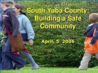
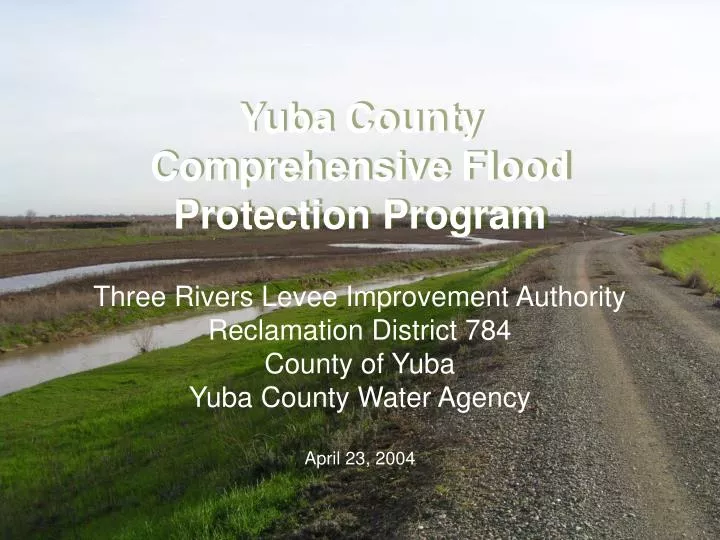
Yuba County Comprehensive Flood Protection Program. Three Rivers Levee Improvement Authority Reclamation District 784 County of Yuba Yuba County Water Agency April 23, 2004. Local Agencies Participating in Flood Control in Yuba County. Yuba County Reclamation District No. 784

E N D
Yuba County Comprehensive Flood Protection Program Three Rivers Levee Improvement Authority Reclamation District 784 County of Yuba Yuba County Water Agency April 23, 2004
Local Agencies Participating in Flood Control in Yuba County • Yuba County • Reclamation District No. 784 • Marysville Levee Commission • Yuba County Water Agency • Three Rivers Levee Improvement Authority • Special Legislative District
Flood History • Post Oroville and New Bullards Bar floods • 1986 Linda Flood • 7,000 acres inundated • 4,000 homes & businesses damaged or destroyed • $95 million in damages (1986 dollars) • 1997 Arboga Flood • 16,000 acres inundated • 800 homes & businesses damaged or destroyed • 3 lives lost
Flood History 1986 Flood View of Linda with Marysville in background
Background (continued) 1997 Arboga Flood View of 1997 flooding along the Feather River
Flood Control Goals • Short Term – Achieve a 200-year level of protection in RD 784 and 300-year level of protection in Marysville through construction of the Corps Yuba Basin Project • Long Term – Achieve a 500-year level of protection (YCWA Supplemental Flood Control Project Goal)
Flood Control Projects • Corps System Evaluation • Corps Yuba Basin • Yuba-Feather Supplemental Flood Control Project Y-FSFCP
Corps System Evaluation Project • Goal was to fix the levees to handle the 1957 design water surface profile • RD 784 & Marysville Ring Levee • Improvements constructed between 1997 & 1999 • Site 7 Extension to be constructed in 2004 • Total cost is $49.7 million • YCWA betterments $2.4 million
Corps Yuba Basin Project History • In 1988, the Corps of Engineers initiated the Yuba Basin Project • 15 years of study and analysis • Target level of protection 200-year RD 784 & 300-year Marysville • 1998 Feasibility Study did not identify a need for work on the RD 784 Lower Feather, Bear & WPIC Levees for 200-year level of protection • Construction initially targeted for 1997 • Initial cost estimate $28 million • Congressional authorization 1999 (Chief’s Report) • Congressional approved construction start 2002
Yuba Feather Supplemental Flood Control Project • YCWA initiated feasibility study after 1997 flood to achieve a 500-year level of protection • YCWA Study & South Yuba Wild & Scenic River SB 496 led to Costa-Machado Water Act (Prop 13) $90 million for Feather & Yuba • Focused on improvements past base case of 200 & 300-year level provided by the Yuba Basin Project
Y-FSFCP Components • Colgate Tailwater Depression • New Bullards Bar Increased Outlet Capacity • Feather River Levee Setbacks (upper & lower) • Forecast Coordinated Operations • Thermalito Reoperation and Oroville Surcharge concepts handed off to DWR
Changing Conditions • 1997 Flood Event • New underseepage guidelines – requires more work to achieve a given level of protection • Revisions to hydrology • DWR Floodplain Mapping Study • Identified FEMA deficiencies in RD 784 • Lower RD 784 freeboard deficiency • Yuba River left bank stability problem
Changing Conditions Impact • Corps Yuba Basin Project • No longer provides a 200-year level of protection for RD 784, especially in southern RD 784 • Underseepage requirement increased cost, requiring increase in Section 902 limit • LRR initiated in 2003 with goal of construction ASAP • GRR contemplated for remainder of RD 784 & MLC • LRR preliminary result identify $108 million project cost, but benefits will only support $90-$100 million • LRR scheduled completion date May 2005 • Corps Yuba Basin Project decision point: Proceed with LRR or switch to GRR given new LRR schedule
DWR Floodplain Mapping Impact • May 28, 2003 DWR released preliminary that identified 100-year deficiencies in RD 784 • DWR Floodplain Mapping Study - unknown impact on the remainder of RD 784 & MLC levees • Levee shown as failed unless enough geotechnical data to show otherwise • Deficient levee reaches require FEMA certification
Proposed Strategy • Goal – 200-year protection for RD 784 and MLC in the short term • Proposed Strategy • Add WPIC and Bear River levees work to the Y-FSFCP • Move Corps Yuba Basin Project to a GRR • Include WPIC, Bear improvements and Feather River levee setbacks in GRR • Request section 104 credit for Y-FSFCP towards Yuba Basin Project GRR
Proposed Strategy Continued • Secure local funding for WPIC, Bear and Yuba levee work • Plumas Lake Mello Roos • Proposition 13 funds • YCWA funds • Construct WPIC, Bear and Yuba levee projects as-quickly-as possible • Leverage local and Proposition 13 expenditures for Yuba Basin non-Federal share • Complete Corps Yuba Basin Project GRR and construct project
South County Floodplain Issues:Local Response • DWR provided notification to locals in May of 2003 • Locals funded and completed a problem identification study in Nov 2003 ($500K) • First phase of alternatives analysis completed March 2004 • Y-FSFCP analysis of levee setback alternatives (underway since 2003) re-tracked to address South County issues
South County Floodplain Program Goals • Identify the extent of issues to be resolved to achieve FEMA certification • Evaluate alternatives to provide the greatest level of flood protection possible • Develop a financing plan • Develop an implementation timeline • Develop a solution that is politically, socially, and environmentally acceptable
Revised Y-FSFCP Strategy • Level of Protection – 200-year minimum goal • Phase 1 and 2 • 100-year WPIC & Upper Bear • Yuba River • Bear River Orchard • Olivehurst Detention Basin • Relocate or Improve Pump Station No.6 • Phase 3 • 200-year with levee setback on Feather & Bear, or • 100-year by improve existing lower Bear River levee
FEMA Fix vs. Y-FSFCP Costs Local Funding: $25M
Y-FSFCP Phase 1 • Goal – Restore design condition for WPIC and Upper Bear • Rec Board permit application has been submitted on the following features: • Strengthen WPIC and Bear River above Hwy 70 to pass the 1957 design profile • Erosion protection • Filling of landside ditch • Levee raising is not included in this phase • Other work that may be added to Phase 1 • Yuba River FEMA critical reach (only strengthening required) • Bear River Orchard Removal • Olivehurst Detention Basin
Schedule for Y-FSFCP • Phase 1 – 2004 • Strengthen WPIC & Upper Bear • Yuba River FEMA Critical Site • Bear River Orchard • Olivehurst Detention Basin • EIR for Levee Setback • Phase 2 – 2005 • Relocate or Improve Pump Station No.6 • Raise WPIC and Bear River levees upstream of Hwy 70 • Land acquisition if setback levee is feasible • Phase 3 • 2006 - Construct setback levee if feasible, or • 2005 - Strengthen Bear River levee downstream of Hwy 70
Local Funding Plan • Mello-Roos or other bond structure under consideration, but is contingent on development of Plumas Lake • Target for net proceeds is about $25M • Initial proceeds as early as July 2004
Contingency Plan • 100-year project can be completed with local funds • Addresses funding or CEQA issues outside of local control • Requires Rec Board approval of programmatic permit for staged 100 & 200-year plans
Corps Yuba Basin Project GRR • Project scope expanded to all RD 784 & MLC • Changing conditions necessitates reanalysis of all RD 784 & MLC levees • Opportunity to integrate YCWA levee setback flood control planning effort into Corps Yuba Basin Project • Address all DWR issues • Yuba River patrol road • Yuba River goldfields • Yuba River right bank levee in Marysville • Add Feather River levee setbacks • Address lower RD 784 levee issues
Corps Yuba Basin Project Local Participation & Cost Share • Y-FSFCP Program • Total cost for this program is $48-$75 million • Project cost potentially creditable through Corps Section 104 authority • Completed in 2-3 years • Addresses FEMA certification • Projected cost for Yuba Basin Project is $225 million • State share = $55 million • Local share = $24 million • Section 104 credit will significant reduce non-Federal share
Summary • Provides improved protection for the existing 24,500 residents quickly • Provides a plan for 200-year protection • Lessens State flood damage liability • Provides significant portion of Corps Yuba Basin Project non-Federal share by leveraging Prop-13 funds through Section 104 credit • Requires Mello Roos funds
Next Steps • Specific requests to Rec Board: • Grant Programmatic approval for Y-FSFCP Program • Necessary for securing local financing • Grant specific approvals for elements targeted for design & construction in 2004 • Support GRR approach for the Yuba Basin Project