Download
1 / 13
130 likes | 268 Views
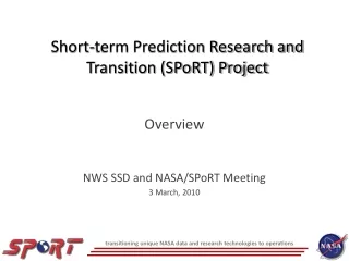
The NASA Short-term Prediction Research and Transition (SPoRT) Center. GOES-R Proving Ground Update 13 November, 2012. Contributions from: Gary Jedlovec, Kevin Fuell, Geoffrey Stano, Matt Smith, Anita LeRoy (UAH). General Outline SPoRT Status Report: Total Lightning Accessing new networks

E N D
The NASA Short-term Prediction Research and Transition (SPoRT) Center GOES-R Proving Ground Update 13 November, 2012 Contributions from:Gary Jedlovec, Kevin Fuell, Geoffrey Stano, Matt Smith, Anita LeRoy (UAH)
General Outline SPoRT Status Report: Total Lightning Accessing new networks RGB Imagery Assessment of Night-time Microphysics w/ VIIRS DNB included. Quick Guide distribution Teletraining to BMX JPSS -Transition of VIIRS imagery Users VIIRS and DNB Quick Guides UAHCI Evaluation Major results User comment quotes Status of product and users QPE Transition Status Plans for Evaluation AWIPS II Visits to CIRA and WFOs
Expanding Total Lightning Access • Visiting Scientist Proposal submitted • Collaboration with CIRA and New Mexico Tech • Aim to incorporate three networks for the pseudo-GLM • SPoRT discussing options to obtain data from additional networks as well North Colorado White Sands
National Centers and Total Lightning • Developing national center specific training for the pseudo-GLM • Coordinating with satellite champions for specific events • SPoRT scripting technical information
Total Lightning and AWIPS II PGLM Flash Extent (DCLMA) PGLM Flash Initiation (DCLMA) • Plug-in working very well for all networks • Trending tool fully functional • Awaiting go-ahead from WFO partners to implement PGLM 30 min Max Density (DCLMA) Corresponding Radar Reflectivity
WFO Evaluations • Aiming for several spring evaluations • Discussing activities with WFOs Albuquerque, Melbourne, and Morristown • Visited Chattanooga / Hamilton County EMA with WFO Morristown • Lightning safety
RGB Imagery Night-time Micro. Evaluation • Via web display (HUN, RAH, also OHX, MRX, BMX) • Visits to HUN morning discussions • Interpretation very new • See benefit of greater cloud information over standard 11-3.9 imagery • BMX teletrainingat their refresher meeting • Quick Guide
JPSS Proving Ground WFO Users • AWIPS I/D2d: ABQ, RAH, TFX, Hybrid-users • RGB Imagery and DNB • Hybrid Imagery (11, 3.9, wv, vis) for Southern Region East and West domains(~7 WFOs) • Night-time Microphysics RGB and DNB included on webpage for Southeast U.S. Visits to WFOs – training on VIIRS basics, Quick Guides for DNB and Instrument Capabilities VIIRS Day-Night Band Radiance Product in SE CONUS area for use in Fog/Low Cloud analysis with RGB imagery Sharp city lights patterns in cloud free areas Diffuse city lights in cloudy areas
JPSS Proving Ground Example of resulting U.S. Army product via DNB product National Center Users: • Suite of Suomi NPP products developed and disseminated (for NAWIPS and on ftp site as KMLs) to OPC/HPC to support Hurricane Sandy • – VIIRS/CrIS Air Mass RGB, VIIRS DNB and RGBs Disaster Support: • VIIRS DNB to USGS Hazard Data Distribution System (HDDS). FEMA and others used data as well • Tiled web service for VIIRS DNB (Reflectance and “blackout” product) for broad use (mobile devices) • U.S. Army using data for their own Night-time Lights analysis (see right) to monitor power loss / restoration • Acknowledgements made to all regarding UW/CIMSS as data source and CIRA/Steve Miller technical expertise in product development/generation
UAHCI Evaluation Results Report drafted and to be sent to participants for their review. Then post to SPoRT Evaluation webpage. • 31 surveys over almost 5 wks Product Status • Working on GOES-W product • Could have a E/W merged product (need better hardware for low latency operations) • Possible subdomain for HI • Users: MLB, MFL, ABQ (HUN on A2), AWC, SPC, Folmer ingesting for Spring Evaluation w/ Nat. Centers, CWSU Atlanta via web
Assisting AWG – NESDIS QPE AK RFC requested a 1- and 24-hr product (see right). • SPoRT created initial product for comparison to RFC product • Bob K. to operationally produce multi-hour products • Call with Bob, West Coast WFOs, AK RFC regarding products and Evaluation during atmos. River season: ~Nov 19 or so
AWIPS II Experimental Products Development Team (EPDT, includes PG Partners) • Workshop delayed until Feb 2013 • Had telecon on first workshop training topic • Install and configuration of ADE (Nov 6) • Next call: AWIPS II architecture, intro to plugin development • Plan to work toward end-to-end plugin development with EPDT team • SPoRT/EPDT will facilitate GOES-R Partners participating to help the NWS develop a software governance plan that is conducive to the work done by the GOES-R Proving Ground Partners.
Visits to CIRA and WFOs CIRA Visit • 3 SPoRT members • Met CIRA team and discussed breadth of PG activities from both. • Discussed coordination of products and AWIPS II WFO visits: Cheyenne, Boulder • Ed Szoke took Kevin F. to visit CYS and then Gary J. and Matt S. to visit BOU • Helped SPoRT to better understand CIRA products, users, evaluations. • Planning with CIRA to form a partnership with these WFOs and TFX and ABQ to evaluate PG products related to common Front Range / Western forecast issues • Kevin F. visited Great Falls (TFX) at the end of trip to CIRA • Examples: There are multiple Dust and Snow-Cloud RGBs. Also provide total lightning support and expose forecasters to future GLM capabilities