Download
1 / 17
170 likes | 297 Views
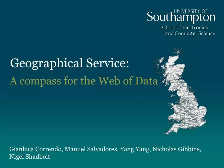
Geographical Service:. A compass for the Web of Data. Gianluca Correndo , Manuel Salvadores , Yang Yang, Nicholas Gibbins , Nigel Shadbolt. Outline. Introduction Public Sector Information Ordnance Survey Qualitative Spatial Relations Geographical Service for GB SCOVO data alignment

E N D
Geographical Service: A compass for the Web of Data GianlucaCorrendo, Manuel Salvadores, Yang Yang, Nicholas Gibbins, Nigel Shadbolt
Outline • Introduction • Public Sector Information • Ordnance Survey • Qualitative Spatial Relations • Geographical Service for GB • SCOVO data alignment • Geographical Service (RESTful API & frontend) • Backlinking service • Future Work
Public Sector Information • UK Government committed to free public sector information • Usually Excel or CSV to RDFize (http://data.gov.uk) • Linked Data already published (e.g. OS, Openly Local, education, and statistics?) • More to come • High volumes of data
Public Sector Information • EnAKTing project investigating how to integrate it, query it, manage it • PSI data sets usually describe the territory and its resources • Geographical information is therefore a key aspect of its classification • How to describe data about territory, and how to exploit it?
Ordnance Survey • Great Britain’s mapping agency • Released an Administrative KB of Great Britain in Linked Data format • From European Region (e.g. South-West England) to single parishes and constituencies • Region connection relations are also described • There is a concrete opportunity of exploiting authoritative knowledge for providing a geographical context to the other information
Qualitative Spatial Relations • Region Connection Calculus (RCC8) proposed by Randell, Cui, and Cohn • Euclidean space representation and reasoning
Geographical Service for GB • All PSI data sets published so far has one geographical dimension: • Different granularity used (from constituency to European region) • Need to align the geographical entities to an authoritative kb • Once aligned need to exploit such a reference • Qualitative Spatial Relations can be used then to retrieve related entities (e.g. all sub-regions of a region) • Need to retrieve back links from reference URIs
Rationale for a Geographic service • Use of URIs alone for providing context to resources is not always enough • A semantic gap can be easily covered exploiting existing knowledge about the domain (in this case about GB geography)
SCOVO Data Alignment • Every SCOVO data set is a collection of SCOVO Items • Every SCOVO Item is a value plus a number of dimensions that put the value into context • Geographical dimensions have been represented as URIs and aligned towards the OS Administrative ontology • Geographical service + Backlinking service retrieve the items relevant for a given region
Geographical service – the data • OS Administrative ontology • Co-reference service for both inward URI normalization and outward result translation • New knowledge (relations between entities) is created in the process
Geographical service – the API • http://geoservice.psi.enakting.org/{command}/ {dictionary}/{format}/{URI} • command = contains or container • dictionary = one of {dbpedia, os, geonames, statistics, geonames, enakting, opencyc, openlylocal, none} • format = rdfor text or ttlor json • URI = input URI of the entity to make the containment closure
Geographical service – the API • The service takes the input URI and find via co-reference system the equivalent URI in OS KB • The contained/container entities are retrieved via SPARQL (forward chaining reasoning upon the OS KB) • The resulting OS URIs are translated in the target dataset (e.g. dbpedia, enakting, etc.) via co-reference system • The URIs are then serialized in the chosen format (i.e. text, rdf/xml, rdf/turtle, or json)
Back-linking support • Once relevant URIs have been retrieved, a further step is usually requested • Relevant URIs are in fact usually used to provide context to other information, it’s that information we’re aiming at • The backlinks issue is long known from hypertext literature • Linked data world is built on top of an hypertext framework (the Web)
Back-linking support • The adoption of hub ontologies/KBs stresses the problem of handling such backward references • Resolving authoritative URIs in fact does not return all the entities that used that URIs • Application indexing services can be built for retrieving such back links exploiting therefore authoritative sources of URIs