Download
1 / 11
110 likes | 261 Views
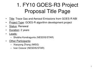
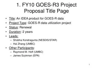
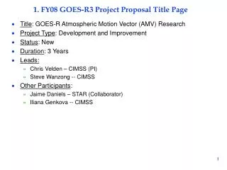
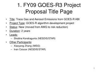
1. FY09 GOES-R3 Project Proposal Title Page. Title : Nearcasts - Filling the gap between Observations and NWP using Dynamic Projections of GOES Moisture Products Project Type : GOES Utilization Proposal – Application of GOES-R ABI

E N D
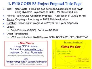
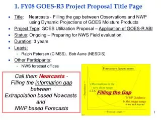
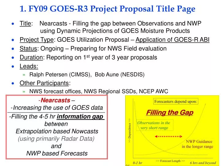
1. FY09 GOES-R3 Project Proposal Title Page • Title: Nearcasts - Filling the gap between Observations and NWP using Dynamic Projections of GOES Moisture Products • Project Type: GOES Utilization Proposal – Application of GOES-R ABI • Status: Ongoing – Preparing for NWS Field evaluation • Duration: Reporting on 1st year of 3 year proposals • Leads: • Ralph Petersen (CIMSS), Bob Aune (NESDIS) • Other Participants: • NWS forecast offices, NWS Regional SSDs, NCEP AWC • Nearcasts – • Increasing the use of GOES data • -Filling the 4-5 hr information gap • between • Extrapolation based Nowcasts • (using primarily Radar Data) • and • NWP based Forecasts Filling the Gap 0-1 hr 6 hrs and beyond
2. Project Summary – Fundamentally unchanged from 2007 Review • The overall goal of this project is to provide forecasters with new tools to help identify areas where convection is and is not likely 3-6 hours in advance of storm development using moisture and temperature products from future GOES satellites. • Due to the perishability of the information, NearCasts requires numerical approaches that are extremely fast and notably different from those used in numerical weather prediction covering longer time periods. • The new Lagrangian approach to objective NearCasting optimizes the impact and retention of information provided by GOES satellites. • Designed to ingest and preserve extreme vertical and horizontal variations of moisture/temperature observed and updated by GOES • GOES data not currently used in NWP over land • Extremes are under-represented in conventional NWP analyses and forecasts. • Initial NearCasting products include 1-6 hour projections of the GOES multi-layer moisture observations, along with predictions of derived areas of convective destabilization. • Existing GOES sounder DPI products used as surrogate for GOES-R ABI • Discussions begun to test system using MeteoSat data • Being expanded to include other stability indices • Methodology directly transferable to GOES-R • Higher spatial/temporal resolution of ABI products will improve products further.
3. Motivation/Justification – Fundamentally unchanged from 2007 Review • Supports NOAA Mission Goals: Weather and Water, Commerce & Transportation, Homeland Security, Geostationary Orbiting Environmental Satellite Acquisitions • The Nearcasting System adds a short-range forecast component to GOES observations. • An area highlighted in the GOES-R3 program plan • According to the most recent version of the GOES-RRR Plan, Nowcasting applications developments (including the time-range of this project) was included throughout the life of the GOES-RRR program. • Although GOES multi-level DPI moisture observations have been shown to improve upon model first guesses and provide mesoscale detail not available from any other observing system, the data are not used over land in operational numerical forecast system. • As such, previous and ongoing investments in GOES satellites are being underutilized. • Uses the GOES moisture/temperature data at full resolution • The methodology used here is directly transferable to GOES-R ABI products • Although the value of GOES observations is eliminated after cloud formation occurs, the Nearcast System anticipates destabilization by dynamically projecting GOES multi-level products to future locations, independent of subsequent cloud development. • Provides evidence of need to support Geostationary Orbiting Environmental Satellite Acquisitions • The hourly-updated Nearcast output should help forecasters identify/isolate areas where severe convection is likely to occur 1-6 hours in advance. • Will reduce size of warning/watch areas, extend the lead time of watches/warnings, increase Probability of Detection and reduce False Alarms – Weather and Water and Homeland Security Goals • Especially useful for hard-to-forecast isolated summer-time convective events – Commerce and Transportation Goal (especially Aviation)
4. Methodology – Fundamentally unchanged (expanded) from 2007 Review How Lagrangian NearCasts work: An Example of “Convective Destabilization” Instead of interpolating randomly spaced moisture observations to a fixed grid (which smoothes the data) and then calculating moisture changes at the fixed grid points, the Lagrangian approach interpolated wind data to locations of GOES multi-layer moisture observations and then moves the full-resolution observed data to new locations, using the primitive equations to dynamically changing wind fields with ‘long’ (10 minute) time steps. . The moved moisture ‘obs’ values from each level are then both: 1) Transferred back to an ‘images’ for display and for use as ‘predicted DPIs’, and 2) Combined (subtracted) to identify meso-scale areas where Convective Instability will develop (where low-level moisture becomes capped by dry air aloft), even after convective clouds appear. Nearcast of Vertical Moisture Gradient (Convective Instability) (900-700 hPa GOES PW -700-500 hPa GOES PW) 3 Hour Nearcast : Valid 0000UTC 13 April 2006 – 2100 UTC 900-700 hPa GOES PW 0 Hour Ob Locations 13 April 2006 – 2100 UTC 900-700 hPa GOES PW 3 Hour Nearcast Image Verification Updated Hourly - Full-resolution 10 km data - 10 minute time steps
5. Summary of Previous Results – Expanded from 2007 Review • Efforts in previous years have used GOES-RRR Nowcasting and CIMSS resources to: • 1) In past years, • Developed and test the new Lagrangian-based dynamical Nearcasting Model, • Integrated GOES multi-layer DPI moisture data as a pre-curser for GOES-R ABI data, • 2) In current year, • Developed visualizations to depict predicted DPIs in formats identical to the observations. • This is critical for rapid assimilation of the Nearcast information during demanding forecasting situations • Efforts in current year include: indications of areas without data in past 6 hours, decreased confidence with time and revalidation as new data become available over time. • WFOs, NWS/CRH and NCEP/AWC agreed to participate in evaluations of the Nearcast products. • Validated need for this type of product and indicated areas for immediate application (especially AWC) • Evaluation sites prefer data in GRIB-II for use in AWIPS rather than as web-based imagery. • Required redirection of visualization efforts during past year to meet user requests. • Test Cases have demonstrated that: • Nearcasts expand the value of current and future GOES moisture products from observations to short-range forecasting tools • GOES DPI data can be inserted directly into model without “analysis smoothing’ • Nearcasts preserve observed data gradients, maxima and minima – image cycling maintains impact of past data • Stability information preserved as data projected into areas of subsequent cloud development • Nearcast Images agree well with lhe location and timing of storm formations and provide accurate/timely guidance, even after clouds have formed • System provides a fast, objective tool which increases the length of time that forecasters can make good use of detailed information from GOES products in their short range predictions (vs. relying exclusively on smoother NWP output) Case of severe hail storm near Madison, WI Not predicted by operational NWP models
6. Expected Outcomes – Fundamentally unchanged from 2007 Review • If successful, WFO and NCEP Service Centers will improve their very-short-range forecasts and the GOES-R program office will have a series of examples showing how to maximize the benefit of temporal and spatial improvements available when GOES data are used effectively. 24 Hr Precip • Provide very-short-range, objective tools (NearCasts) to WFOs which will use existing DPI and future GOES-ABI products to: • Use projections of GOES multi-layer products to update NWP guidance • Identify areas of convective instability, even after cirrus outflow restricts the areas from being observed by GOES IR instruments. • Increase the length of time that forecasters can make good use of quality GOES observations which can supplement NWP guidance for their short range forecasts • Use GOES moisture/temperature products at full resolution • Preserve extreme horizontal and vertical gradients observed in GOES DPI products but missing in NWP • Improvements in spatial and temporal quality of GOES-R ABI will enhance products substantially • Hourly-updated NearCast output will help forecasters identify/isolate areas where severe convection is/is not likely to occur 1-6 hours in advance. • Products should be especially useful for hard-to-forecast isolated summer-time convective events – (especially important to Aviation operations) • Nearcasts of the pre-convective environment will allow forecasters to reduce the size of warning/watch areas, extend the lead time of watches/warnings, increase Probability of Detection and reduce False Alarms – (documented NWS Goals) • Nearcast products are scheduled to be tested initially in mid-western NWS/WFOs and AWC. • Based on positive tests and training, Nearcast Model products (and training materials) will be distributed to a broader set of NWS offices and made available to the private sector via the internet. 10 cm Hail Vertical Moisture Gradient (900-700 hPa - 700-500 hPa GOES PW) Forecast Information Lost under cirrus shield without NearCast
6. Expected Outcomes – Expanded from 2007 Review • Provide very-short-range, objective (nearcast) tools to WFOs which will use current and future GOES-ABI moisture/temperature products to: • Use projections of GOES multi-layer moisture/temperature products to update NWP guidance • Identify areas of convective potential, even after cirrus outflow restricts the areas from being observed by GOES IR instruments, using multiple Stability Parameters. • Increase the length of time that forecasters can make good use of quality observations which can supplement NWP guidance for their short range forecasts • Use GOES moisture/temperature products at full resolution • Preserve extreme horizontal and vertical gradients observed in GOES DPI products but missing in NWP Example of how forecasters will monitor, correct and locally enhance short-range NWP guidance for strong convection using projections of GOES moisture data which are available, even after the storms have begun. Nearcasts of GOES multi-layer moisture data show forecasters that NAM precip guidance: 1) Covers too much area, 2) Has major precip too far south, and 3) Shows no sign of local strong destabilization along WI-IL border, an area where major convection (4” hail) developed Case of severe hail storm near Madison, WI Not predicted by operational NWP models NAM 3 hour Precip Forecast valid 03 UTC 14 April 2006 - .2 cm interval color bands -
7. Major Milestones – Fundamentally unchanged (but expanded) from 2007 Review • FY08– Expanded from 2008 Review (See +s below) Nearcast Model running 24/7 at CIMSS Testing in selected Mid-Western WFO’s Focus on pre-convective environment • Both Organized and hard-to-forecast Isolated Summertime Convection Initial development of VisitView-based forecaster training tools (Underway) + Expanding system to include additional Stability Indices + Expanded evaluation base to include AWC + Enhanced output types to include GRIB-II • FY09 – Expanded from 2008 Review (See + below) • Expand WFO training and testing • Expand to Great Plains areas + Prepare for testing with MeteoSat data over South Africa + Combine GII variables and SAWS NWP products • Transfer of 24/7 operations to either central NOAA location or individual WFOs • Expand development of VisitView-based forecaster and system operator training tools • FY10 – Expanded from 2008 Review (See + below) • Continue WFO training and testing • Expand to Southern and Eastern areas + Test with MeteoSat data over South Africa • Transfer products of 24/7 operations into AWIPS for display and improved forecaster use • Development of VisitView-based training tools to WFO operations • = 0,2,4 6 hr NearCasts of 900-500 hPa TPW GPS TPW Validation Site Forecasters will have new tools to help isolate small areas which will transform from Stable toUnstable in the next few hours
8. Funding Profile (K) – Unchanged from 2007 Review and Request • Summary of leveraged funding • Development phase funded in previous years through GOES-R Risk Reduction program, with NESDIS/ASPB supporting Bob Aune. • During evaluation phase, Bob Aune will continue to support this effort through NESDIS/ASPB and NWS evaluations will be support by individual WFOs • Nearcast methodology can be applied in NWS WFOs before launch of GOES-R – providing early benefit and enhancing utility of existing GOES satellites (as well as future GOES-R ABI products)
9. Expected Purchase Items – Unchanged from 2007 Review and Request • FY07 • Funded from CIMSS GOES-R3 resources • FY08 • (60K): 1 STAR CIMSS Grant for 1 person at ~1/5 time from 1/2008 to 12/2008 • Personnel support (including benefits, IT charges, overhead, etc): 44K • Contracts: N/A • Software charges: N/A • Equipment: 10K • Travel (One Madison-DC trip, One training trip, One AMS meeting) - 6K • Publication Charges - 0K • FY09 • (55K): 1 STAR CIMSS Grant for 1 person at ~1/5 time from 1/2009 to 12/2009 • Personnel support (including benefits, IT charges, overhead, etc): 44K • Contracts: N/A • Software charges: N/A • Equipment: 0K • Travel (One Madison-DC trip, One training trip, One AMS meeting) - 6K • Publication Charges - 5K • FY09 • (50K): 1 STAR CIMSS Grant for 2 persons at ~1/5 time from 1/2010 to 12/2010 • Personnel support (including benefits, IT charges, overhead, etc): 41K • Contracts: N/A • Software charges: N/A • Equipment: 0K • Travel (One training trip, One AMS meeting) - 4K • Publication Charges - 5K
More Stable Less Stable