Download

1 / 23
230 likes | 301 Views
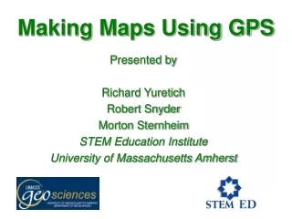
Making Maps Using GPS. Presented by Richard Yuretich Robert Snyder Morton Sternheim STEM Education Institute University of Massachusetts Amherst. Our Sponsor. NASA grant # NNG05GN64G STEM Earth Central In collaboration with National Association of Geoscience Teachers.

E N D
Making Maps Using GPS Presented by Richard Yuretich Robert Snyder Morton Sternheim STEM Education Institute University of Massachusetts Amherst
Our Sponsor NASA grant # NNG05GN64G STEM Earth Central In collaboration with National Association of Geoscience Teachers Spaces still open for upcoming Summer Institutes at UMass Amherst: IPY STEM Polar Connections: July 14-18 Nanotechnology: July 7-11
Today’s Agenda • Latitude and Longitude Angles • How you will use GPS today • Heading and Bearing • Constructing a map using the GPS data that you collect Today’s materials are online at: http://umassk12.net/earth/
A Slice of Earth reveals the locationof Latitude and Longitude angles
Satellites orbiting in a large sphere can indicate where you are on spherical Earth
Your Garmin 72 GPS receiver will receive microwave signals from the network of orbiting satellites. When you are outside, the GPS Information Page will indicate how many satellite signals you are receiving.
Your Garmin 72 GPS receiver will receive microwave signals from the network of orbiting satellites. When you are inside a building, you can use the simulator to become familiar with the Garmin 72 pages and data fields.
GPS 72 Basic Operations (see also GPS Basics handout) 2. PAGE will switch off initial warning message and toggle among the various screens. 1. Power On/Off 4. ROCKER. Use this to scroll up and down through the “Waypoints” and name your base station. 3. ENTER. Press and hold to display “Mark Waypoint” page
Mark your Waypoint • Press and Hold ENTER to display “Mark Waypoint” page. • Scroll to the “Name Field” with the ROCKER • Spell out the name of your waypoint using the ROCKER, then press ENTER. • Scroll to “OK” and press ENTER.
Navigating with the GPS 72 (see also GPS Basics handout) The GPS Information Page is described on Page 9 of the Garmin 72 owners manual and reference guide and in the on-line manual. 2. GOTO will display the waypoints stored in the GPS 1. PAGE will switch to the GPS Information Page showing your latitude and longitude 3. ROCKER. Use this to highight the waypoint that will be your destination. 4. ENTER. Press after you have highlighted your waypoint.
Navigatingwith GPS Information Page • Use the Latitude and Longitude information in the “Location” field to help find your assigned location. • There should be appropriately labeled flagging tape near your destination. Use this as your map point.
Latitude and Longitude Systems • The coordinates of your destinations are expressed as Degree, Minutes, and Seconds. This system is used on USGS Topographic maps For example: 41º 20’ 37” N, 71º 56’ 17” W • There are other ways to indicate coordinates. Meteorologists often indicate the location of Atlantic Ocean hurricanes in Degree Decimal form. For example: 22.76 N, 59.45º W Changing the measurement system in a Data Field is described at the end of Page 3 of GPS Basics.
Determining Bearing and Distance to Base Station 1. Press GOTO to display the waypoints stored in the GPS 2. ROCKER. Use this to highlight the waypoint that will be your destination (i.e. your base station). 3. ENTER. Press after you have highlighted your destination waypoint.
Returning to Base Station (cont.)(see also GPS Basics handout) 4. ROCKER. Use this to move the waypoint to a rectangular box at the top of the page. 5. ENTER. Press to highlight that waypoint in the list. Press ENTER again to show pointer page.
Pointer Page(see also GPS Basics handout) You may need to change the Data Fields (See Page 3 of GPS Basics). 4. MENU. Press this button and use the rocker to highlight “Change Data Field.” 3. Data Fields show various information. Change one field to read “Distance to Next.” 2. Line at top of Compass dial shows the direction you are walking (heading). 1. Black Arrow shows compass direction (bearing) to your selected waypoint
Summary of Tasks • Make sure that your GPS receives sufficient satellite signals for navigation. • Go to the plaza outside of Neiman-Marcus and mark this as your base station. • Use the latitude and longitude coordinates on the GPS Information Page to guide you to your mapping location. • At your mapping site, make the base station your “GO TO” destination. • Record the distance and compass bearing that is shown on the GPS Pointer Page.
If Time Permits! As we gather at the base station we may have time for some teams to collect data about other points of interest in the Copley Square area.
Using GPS Data to construct a Map • Field data will be compiled to construct an accurate, scaled map of the area. • Use protractor to plot compass bearing between data station(s) and base station. • Use metric ruler to plot distance along the bearing at appropriate scale
N Base Plotting Your Bearing • Bearing from data station to base station is 060 (60º). • Reverse direction is therefore 300. • Protractor placed on base station point can be used to plot direction to data station. • Distance will be determined by scale
References Slide 4: http://www.fourmilab.ch/cgi-bin/Earth Slide 5: Earth Science: The Challenge of Discovery; D.C.Heath and Co. 1991 Slide 6: http://commons.wikimedia.org/wiki/Image:ConstellationGPS.gif Slides 7 to 16: http://www8.garmin.com/manuals/GPS72_OwnersManual.pdf Slide 17: http://academic.brooklyn.cuny.edu/geology/leveson/core/linksa/mapcomp.html


![Making maps, many maps! [What is GIS?]](https://cdn1.slideserve.com/3592384/making-maps-many-maps-what-is-gis-dt.jpg)