Download

1 / 9
90 likes | 260 Views
Identifying Risk Areas for Landslides. Florence Carre (JRC, Subgroup leader), D. Seebach, N. Filippi, M. Pizziolo, G. Bertolini, A. Poschinger, J. Fortuny-Guasch, M. Gemmer. LANDSLIDE. Movement of a mass of rock, debris, earth down a slope (Cruden & Varnes, 1996). LANDSLIDE CLASSIFICATION.

E N D
Identifying Risk Areas for Landslides Florence Carre (JRC, Subgroup leader), D. Seebach, N. Filippi, M. Pizziolo, G. Bertolini, A. Poschinger, J. Fortuny-Guasch, M. Gemmer
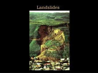
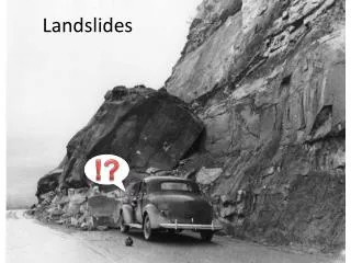
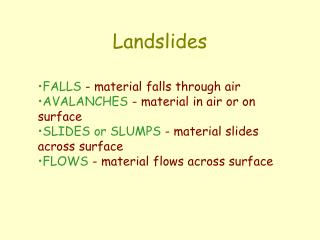
LANDSLIDE Movement of a mass of rock, debris, earth down a slope (Cruden & Varnes, 1996) LANDSLIDE CLASSIFICATION (Cruden & Varnes, 1996)
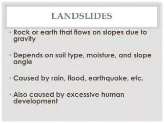
MAIN CAUSES Snow melt and heavy rainfall events water saturation DRIVING FACTORS RELATED TO VULNERABILITY OF SOIL • Geology/bedrock material • Slope • Land cover • Soil permeability TRIGGERING MECHANISMS • Rapid snowmelt • Intense rainfall • Water level change • Human activities • Changes in landuse/land cover • Earthquakes / volcanic eruption
Loss of soil functions and increase of soil vulnerability to other threats MAIN SOIL VARIABLES AFFECTED BY LANDSLIDES Affected soil physical properties: - structure; - bulk density; - water permeability; - erosion - soil organic matter decline - compaction (but also as a driving factor)
Tier I Source: EPSON (European Spatial Planning Observation Network) project http://www.gtk.fi/projects/espon/Landslides.htm
Tier II approach Usually 3 scale maps (Van Westen, 1993) • Synoptic or territorial scale maps (> 1:50,000): inventories maps used by planning agencies to direct allocation of funds, develop emergency preparedness plans and similar tasks • Medium scale maps (> 1:20,000 to 1: 1:50,000): used for preliminary or regional landslide hazard assessments and feasibility studies followed by more detailed work • Detailed scale maps (> 1:5,000 to 1: 1:500): Prepared as part of a landslide hazard assessment of a specific site and should be accurate enough to guide layout of individual structures or specific operations or to plan mitigation
Common criteria (1) Common criteria to delineate landslide risks - Spatial probability of occurrence of landslides (like density of landslide/km²) - For tier I approach, landslides have to be defined in a common way by all the MS in order to compare the density - For tier II approach, the 3 scale maps can be produced according to the purpose
Conclusions • Intensify collaboration with EuroGeoSurveys (EGS) • Elaborate on qualitative approach, since no operational approach has been presented Today’s problems • Improvements in harmonisation are necessary because: - inventories do not follow any commonly agreed standards or methodologies until now - authorities in charge of inventories are either local, regional or national and can be civil engineers, soil scientists or geologists • Only landslides related to civil damages are listed, others can exist and not be listed (above all in unpopulated areas)