Download
1 / 20
200 likes | 303 Views
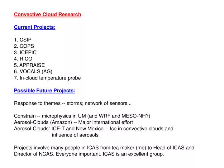
Convective Cloud Research Current Projects: 1. CSIP 2. COPS 3. ICEPIC 4. RICO 5. APPRAISE 6. VOCALS (AG) 7. In-cloud temperature probe Possible Future Projects: Response to themes -- storms; network of sensors... Constrain -- microphysics in UM (and WRF and MESO-NH?)

E N D
Convective Cloud Research Current Projects: 1. CSIP 2. COPS 3. ICEPIC 4. RICO 5. APPRAISE 6. VOCALS (AG) 7. In-cloud temperature probe Possible Future Projects: Response to themes -- storms; network of sensors... Constrain -- microphysics in UM (and WRF and MESO-NH?) Aerosol-Clouds (Amazon) -- Major international effort Aerosol-Clouds: ICE-T and New Mexico -- Ice in convective clouds and influence of aerosols Projects involve many people in ICAS from tea maker (me) to Head of ICAS and Director of NCAS. Everyone important. ICAS is an excellent group.
Research on initiation of convection: 1. Convecitve Storm Initiation Project (CSIP): Southern England, summers of 2004 and 2005 2. Convective Orograpically-induced Precipitation Study (COPS): Black Forest, Germany, summer of 2007. Flash Floods caused by intense rainfall associated with a thunderstorm In the US, more people die yearly in floods (127 on average) than by lightning (73), tornadoes (65), or hurricanes (16) In the UK: “Country in chaos after flash floods and storms”; a familiar headline now -- return time to severe events decreasing
CSIP • While there had been: • Considerable research in the US; most recently IHOP_2002 • Extensive research in UK: Modelling of case studies; Observational case studies using MO network instruments and satellite • There had been no previous UK experiment on convective initiation with which to compare Met Office model predictions • CSIP was a large international experiment centred on Chilbolton • 18 IOPs in 2005; 4 IOPs in 2004 • Met Office Model usually performed well, but some • shortcomings in precise location and timings • Lids important; triggering often involves phenomena that act • individually or in concert to overcome lid • Variety of processes: no “generic triggering mechanism”.
Map of CSIP Thanks to Cyril Morcrette
COPS Major international experiment in Black Forest mountains during summer of 2007. Questions: What is the role of upper tropospheric features for convective-scale QPF in moderate orographic terrain? Does location and timing of CI depend on structure of humidity field in boundary layer? Does precipitation intensity depend on aerosols? What are pathways for heat, mass, water vapour and aerosols associated with thermally-driven flows to enter clouds?
COPS and CSIP major objective: Determine location and timing of the initiation and development of convective storms. • Lids important. • Ways of overcoming Lids: • Convergence lines created by orography, land/sea contrasts, surface moisture gradients, differential heating • Heating; impact of clouds • In complex terrain: e.g. up-valley flow, elevated heat island; • Gravity waves and cold pools (secondary convection) • Mesoscale convergence lines and dry intrusions • Combination of processes
Frontal zone with low $\theta_w$ air overrunning a tongue of high $\theta_w$ air Lid produced by descending dry intrusion Lid relatively weak over surface warm pool -- strongest descent had occurred further upstream and the air was beginning to ascend again Lid raised due to SW-NE convergence line mostly formed by land-sea roughness differences Particular cloud initiated near Dartmoor and had sufficient buoyancy as a result of combination of high $\theta_w$ air and solar heating through gap in line of clouds (Lean et al.\ 2008)
COPS 15 July + Up-valley flow Convergence line
Another COPS objective: understand influence • of aerosols on convective precipitation • - link to MMOCCAA and future expts • Venting of aerosols out of valleys into clouds • Role of tranformation of aerosols by previous • clouds • Saharan dust outbreaks Strong updraft over Murg associated with increase in humidity and concentrationof aerosols Venting of water vapour and aerosols from Murg Valley
ICEPIC: Study of the initiation and development of ice and precipitation in cumulus clouds. 1. First ice -- do the numbers match up with concentration of ice nuclei? Don't know. Didn't manage this. Only way to do this in individual Cumulus clouds is to study clouds that are anchored to a feature - New Mexico(2012). Or statistically, as in RICO - ICE-T (2012?). Also see APPRAISE for mixed-phase layer clouds. 2. There are many more ice particles than ice nuclei -- why? We showed quantitatively that the Hallett-Mossop process of secondary ice production can explain the observed rate of production of ice. MAC3 model results confirm that the HM process is important. However, MAC3 also shows that supercooled raindrops are important and we didn't observe these. 3. Explain quantitatively with models the production of precipitation -- that means getting the riming rate correct having explained 2. The rain rate produced by MAC3 was comparable with the observed rate. BUT, the concentration of aerosols was critical.
ICEPIC (cont) 4. The UM has errors in the quantity of precipitation. The interaction of the parametrized autoconversion and ice nucleation process can lead to an excessively rapid glaciation and vertical development of the simulated clouds. For example, in simulations of New Mexico clouds, autoconversion first occurred at and above the freezing level and the raindrops were then rapidly frozen by accreting primary ice crystals formed by the parametrized primary nucleation. These frozen raindrops then grew further by riming and, because this occurs with the temperature range of -3 to -8 C, acted as efficient centres of secondary ice nucleation via the Hallett-Mossop process. Similar for ICEPIC clouds. Critical to get autoconversion right - see results from RICO. Also freezing -- see APPRAISE and future NM, ICE-T and CONSTRAIN?
RICO Study of the processes responsible for theformation of warm rain in shallow maritime cumulus clouds. (Rain In Cumulus over the Ocean) Result: quantitatively explain the formation of rain in shallow maritim cumulus by collision and coalescence with MAC3 model using the observed aerosol size distribution. First time; 50-year old problem. Observations MAC3 Model
APPRAISE: Aerosol Properties, Processes And InfluenceS on the Earth's climate Core position: Zhiqiang Cui -- bin microphysics in LEM. Almost complete. Important Aerosol Interactions in Mixed Phase Clouds • determine the nucleating ability of specific ice nuclei and the initiation and • development of ice in mixed phase clouds. • • determine how aerosol particles control the cloud microphysics, preciptiation • and dynamics in mixed phase clouds. • • determine the type and phase partitioning of absorbing material above below and within • clouds and the role of this material in ice nucleation. • • reduce the uncertainty in the contribution of indirect radiative forcing by better • understanding of the role of aerosols in the microphysics of mixed phase cloud. • Few flights last winter; most of the flying is in January and February 2009 over Chilbolton
The VOCALS-UK Consortium will deliver new insights into the influence of marine stratocumulus clouds on global and regional climate and provide much needed improvements in our ability to quantify the processes that influence stratocumulus clouds and man’s influences on them. Alan Gadian BAe-146 Do-228 C-130 Multi-platform sampling along the 20°S cross section will deliver: a synthesised data set for testing of climate model representations of the SEP boundary layer. A series of important case studies
VOCALS Bridging the scales between climate and cloud processes VOCALS: VOCALS will act to bridge the gap between climate models and key cloud processes by: Diagnosing and testing important aspects of Climate model performance in Sc cloud regions – nested model resolution is key to this Developing new process knowledge and parameterising it in a way that is effective for climate models It will provide process studies with a climate backdrop to the VOCALS experiment – an important context Courtesy Hugh Coe
In-Cloud temperature probe Joint UFAM/FAAM/NCAR/Met Office project to produce a temperature probe that works in cloud. Ophir radiometric probe is primary candidate: see Wei, Blyth and Raymond (1998; JAS) Early stages for UK project; possible PhD student