Download
1 / 32
330 likes | 772 Views
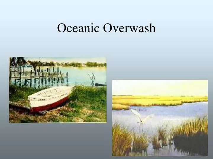
Oceanic Overwash. Beach Diagram. Oceanic Overwash. The washover fan is a fan-shaped accumulation of sand and shell that is deposited in a thin layer during intense storm conditions when part or all of the beach-dune system is overtopped or breached by incoming waves and storm surges

E N D
Oceanic Overwash • The washover fan is a fan-shaped accumulation of sand and shell that is deposited in a thin layer during intense storm conditions when part or all of the beach-dune system is overtopped or breached by incoming waves and storm surges • Fans may come together to form a washover apron • Sediment accumulations may be a few tens of centimeters or up to 1 meter thick • Sediment will cover vegetation on the back side of the island, but plants can grow up through the sediment, reworking the layering of the sediments
Overwash and Storms • Strong wind and waves causes storm surges to wash over low dunes or create breaks in the dune system • New inlets can be formed in low lying areas on the island
Overwash and Transgression • Sediment is transferred to the back side of the island by overwash • Sediment may bury marshland on the lagoon side, building up the back side of the island • Overwash process erodes sediment from the front side and carries it to the back • The combination of erosion on the front and buildup on the back of the island are factors that lead to island transgression
Man-made Interventions • Groins-A shore protection structure built (usually perpendicular to the shoreline) to trap lateral drift or retard erosion of the shore • Jetties-structures intended to keep sand from flowing into a channel; intended to protect an inlet • Sea walls-rock or concrete structures built parallel to the shoreline; intended to protect buildings by repelling the sea • Beach replenishment-Building up the beach system by depositing sand
Beach Replenishment • Beach replenishment is used to add dredged sand or sediment from an inland source to the beach system. • Procedure is expensive and not a permanent solution • Some prefer this temporary fix to the more permanent structures that may cause more damage in the long run
Disappearance of Islands Long-term rates of change between 1855 and 1989 show both accretion and erosion for barrier island shorelines facing Louisiana’s coast. Between the late 1800s and the 1980s, deposits left from washovers caused some of these shorelines to migrate landward at rates up to 24.0 meters per year. Erosion, in contrast, has caused loss on other shorelines at rates from 1 to 5 meters per year.
Disappearance of Islands The timeline above shows anticipated years of disappearance for several of Louisiana’s barrier islands through 2110. Although these barrier islands are in danger, other more stable barriers exist. For example, Grand Isle has a life expectancy about 900 years longer than that of Timbalier Island
On-line References • http://books.nap.edu/books/030904806/html/70.html#pagetop • http://coastal.er.usgs.gov/hurricanes/dennis/buxton/ • http://members.nbci.com/igorz/MIWO.html • http://www.beachbrowser.com/Archives/Environment/A…/Barrier-Islands-Always-changing.ht • http://www.csc.noaa.gov/products/nchaz/htm/lidtopo.htmhttp://www.lacoast.gov/Programs/CWPPRA/Watermarks/Fall99/barrier.fa99.htm
References • http://www.ncsu.edu/coast/shell/migration/migration.html • http://www.ncsu.edu/coast/shell/terms.html • http://www.salem.mass.edu/~lhanson/gls214/gls214_tec_clas.htm • http://www.seafriends.org.nz/oceano/beacheng.htm#sea%20walls • http://www.seashell.com/kbphotos.htm • http://www.vcrlter.virginia.edu/~bph/NSFTalk/NSFTalk.html
References • Davis, Richard, 1994, The Evolving Coast: W.H. Freeman and Company, New York, pp 166-183. • Fox, William, 1983. At the Sea’s Edge, Prentice-Hall, Inc., pp. 151-175. • Pilkey, Orrin, 1990. The Beaches are moving (videorecording). • Schwartz, Maurice, 1973, Benchmark Papers in Geology Barrier Islands: Dowden, Hutchinson and Ross, Inc., Stroudsburg, Pa.