Download
1 / 19
190 likes | 370 Views
Group : Pix’r’Us Project : PhotoLab Company : Milsoft Supervisor : Murat YUKSELEN Website : http://senior.ceng.metu.edu.tr/2008/pixrus/. Who are we?. Outline Introduction Project Description - Photolab What is Photogrammetry PPS Overview PPS Functionalities Did’s and Will Do’s

E N D
Group : Pix’r’Us Project : PhotoLab Company : Milsoft Supervisor : Murat YUKSELEN Website : http://senior.ceng.metu.edu.tr/2008/pixrus/
Outline Introduction Project Description - Photolab What is Photogrammetry PPS Overview PPS Functionalities Did’s and Will Do’s Demo Questions and Answers
What is Photolab about? Photolab is a Photogrammetry Software development project which is focused on: - Image Mosaicking - DEM Generation - Orthophoto Generation supported by Milsoft.
What is Photogrammetry? Photogrammetry is the first remote sensing technology ever developed, in which geometric properties about objects are determined from photographic images. Historically, photogrammetry is as old as modern photography itself, and can be dated to mid-nineteenth century.
Where Photogrammetryis used? Topographic mapping,-Architecture, engineering, manufacturing, -Quality control-Geology-In movie post production, eg: Fight Club
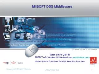
PPS – Pix’r’us Photogrammetry Suite, is a Multiple-Document Interfaced photogrammetry tool with functionalities; DEM Creation Orthophoto Creation Image Mosaicking
PPS is developed in C++ External libraries used; OpenCV GDAL OpenGL WX Widgets
So far we have; Developed the interface Commonly used functionalties,eg : save/load Integrated all external libraries Functionalities added; Image Mosaicking – using homography Image Mosaicking – using camera parametrs Orthophoto Creation Image editor
Image Mosaicking Combining two images by using common points between them.Example : + =
Image Mosaicking How it works - Image registration a. Find Corners – Harris Corner Detection b. Calculate Putative Matches c. Calculate Homography Matrix -Combine them! – with interpolation methods
DEM: Digital Elevation Model (DEM) is digital representation of ground surface topography or terrain. DEMs are the first step to rectification of aerial photos. PPS will generate DEMs by using multiple images.
DEM: How it works? { under bi yerlerde }
Orthophoto: An orthophoto or orthophotograph is an aerial photograph that has been geometrically corrected (“orthorectified”) such that the scale of the photograph is uniform, meaning that the photo can be considered equivalent to a map. IMAGE:
Orthophoto: How it works? - Using camera calibration parameters, calculate world coordinates of every point of the image, - With this information construct the geometrically corrected image
Image Editor: A simple Image Editor, which can adjust attributes such as; - Brightness - Contrast also can do; - Scale - Rotation simple image operations such as; - Laplace, sobel, smoothing filters, histogram equalization etc.
For more info and reports; senior.ceng.metu.edu.tr/2008/pixrus/ QUESTIONS PLEASE