Download
1 / 28
280 likes | 430 Views
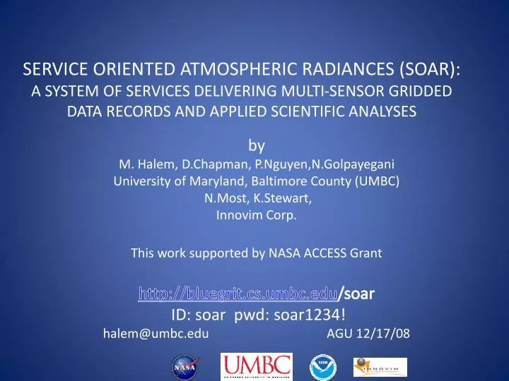
SERVICE ORIENTED ATMOSPHERIC RADIANCES (SOAR): A SYSTEM OF SERVICES DELIVERING MULTI-SENSOR GRIDDED DATA RECORDS AND APPLIED SCIENTIFIC ANALYSES. by M. Halem, D.Chapman , P.Nguyen,N.Golpayegani University of Maryland, Baltimore County (UMBC) N.Most , K.Stewart , Innovim Corp.

E N D
SERVICE ORIENTED ATMOSPHERIC RADIANCES (SOAR): A SYSTEM OF SERVICES DELIVERING MULTI-SENSOR GRIDDED DATA RECORDS AND APPLIED SCIENTIFIC ANALYSES by M. Halem, D.Chapman, P.Nguyen,N.Golpayegani University of Maryland, Baltimore County (UMBC) N.Most, K.Stewart, Innovim Corp. This work supported by NASA ACCESS Grant http://bluegrit.cs.umbc.edu/soar ID: soar pwd: soar1234! halem@umbc.edu AGU 12/17/08
Overview • Rationale for SOAR as SOS • Architecture • SOAR system walk through • Examples of climate analysis services • Summary
What is SOAR? Service Oriented Atmospheric Radiances • A web-based service oriented framework to improve access and use of satellite acquired atmospheric IR radiance data • Maps multi-sensor radiance data from orbital coordinates stored at distributed archives onto lat-lon grids of arbitrary resolution on-demand • Serves up fundamental data records in image and/or structured data formats • Provides observation-based analysis services for the study and intercomparison of long historical IR data records • Currently serves up AIRS and MODIS data and selected periods of HIRS3, VTPR and AVHRR3
What makes SOAR a system of services? • SOAR includes a general ’Downloader’ for accessing multi-sensor instrument data from distributed archives from multiple satellites • SOAR contains a generalized ‘Gridder’ that incorporates the sensor’s spatial response function to accurately calibrate the emitted radiance from each observed footprints portion of a grid cell • SOAR is based on an SOA architecture that employs a cloud computing paradigm for efficient data intensive processing • SOAR provides a set of analysis tools application specific to the geometry of the respective instrument data sets
Why we need SOAR? • Maps level 1B granules into gridded level 3 radiances • Increases accessibility and usability by scientists • Most op’n’l forecast centers assimilate gridded radiances • Provides analysis services based directly on observations • Greatly reduces data volume (lossy compression) • A common framework for gridding multi instruments • No level 3 gridded radiance products available from AIRS and MODIS or HIRS/AVHRR instrument teams
Web Service Provider Web Service Client UDDI Directory Web Service Lookup Publish Services WSDL Bluegrit Supercomputer Cluster User (Browser) SOAR Client Server SOAR Web Process Services SOAP HTML URLS HTTP File Share(Binary Data/Images) SOAR Web Service Architecture GDAAC MODAPS NCDC NCAR
SOAR Downloader • A C++ based application for each sensor • Downloading formats tailored to each sensors • data files as a separate service on UDDI • Sensor access invoked by soap message specified • through client server pull down window • Accesses on-line data sets over internet using • protocols such as ftp, http, etc.
SOARs Generic Gridder • Philosophy: -- Common gridding algorithms for many instruments. • Spatial calibration with recursive ray casting algorithm • Spectral response functions for calibrating multi-sensors • Orbital drift calibrations with neural network algorithm. • Framework developed for gridding radiances from many scanning instruments. • Currently implemented for AIRS, MODIS, AIRS Visible -- Extending to HIRS2/3, HIRS4 and VTPR • Incorporating artificial neural network algorithm into Gridder.
AVHRR VTPR HIRS MODIS AIRS Transactions SOAR System of Services Cloud Computing System Services • Query & Request Instrument Data • Transactions recorded in database • Analysis Routines • NCAR Graphics Visualization • Real-time Data Gridding • Subset by resolution (1°x 0.5° native) • Subset by geographic region • Remote Data Acquisition SOAR Web System Data Query Web Application Analysis Routines Data Visualization Engine Gridder Engine Downloader Engine Staged Gridded Radiance Data • MODIS gridded data (Nov’04 – Oct’08) • AIRS gridded data (Sep’02 – Oct’08) • Placing new datasets into production: HIRS, VTPR, SIRS, AVHRR, SBUV, OMI Pre-Gridded data
HIRS3 Ch 8 (12um) AIRS 528 ch 528 (12um)Jan. 1-14, 2005
Some Analysis Routines • Monthly, Seasonal, Yearly Averages and Anomalies • Tracking monthly shifts in Inter Tropical Convergence Zone • Madden Julian Oscillations (EEOFs) • EL Nino Southern Oscillation (ENSO) • Outgoing Long Wave Radiation (OLR) and Latitudinal OLR • AIRS-MODIS Intercomparisons by Grid cell or Region • Quasi-Bienneial Oscillation
Feb 2005 anomaly Feb 2007 anomaly Feb 2006 anomaly AIRS Monthly anomaly 0.5ox1o at 12.18 µm • Year to year variances • Cold radiances Feb 05(strong El Nino year) convective cloud, Warm radiances Feb 07 cloud clear surface in Western Pacific • Similar in Indian Ocean and West Pacific area • Feb 05 warmer than other 2 year in East US (hurricanes) • Variances in Intertropical Convergence Zone
MJO- results Jan1707 Jan1507 Jan1307 Jan1107 B) Jan0907 Variances color code Jan0707 The first EOF explaining about 14.3% variance Jan0507 BT color code Jan0307 Jan0107 Dec2906 Dec2706 lag5 Dec2506 lag4 Dec2306 lag3 lag2 Dec2106 lag1 Dec1906 Variances color code Dec1706 C) Dec1506 A) The extended EOF captures the dynamics using a temporal lag of 2 day running mean. 2 day running mean of MODIS channel 32 (Surface/Cloud Temperature) at 0.5ox1 11.7 µm -12.2 µm 5S-5N 0-180E Brightness Temperature descending orbit from Dec 15 2006 to Jan 17 2007.
AIRS/MODIS total OLR 0.5ox1o • AIRS/MODIS total OLR • isentropic assumption • Compare with CERES/ERBE OLR Feb. 2005 vs April 1985
Summary • SOAR SOS provides transparent access, gridding and visualization on demand of the following multi- sensor IR radiance data sets: AIRS, MODIS, AIRS VIS, HIRS3, VTPR; • SOAR incorporates a variety of analysis tools that provide multi- year monthly and seasonal anomalies, MJO, ENSO, OLR and statistics within a grid cell as well as regional and global; • SOAR system provides multiple gridding options for arbitrary spatial/spectral resolutions for multi sensor intercomparisons; • SOAR Scientific Findings: • AIRS and MODIS IR spectral radiance measurements have not degraded in over 6 years • AIRS and MODIS gridded IR spectral radiances have potential to provide long term (>10 year) Fundamental Decadal Data Record • MJO can be tracked directly from raw observations with fewer uncertainties
Client Web Service Bluegrit User Submit login Subset/Average Data Get login page New Request Form Render Data as Image login() Session Key Request Results Get Request Results Result List New Request Results Display Welcome Page/Recent Results Get user results() :sessionKey Science Image File Login Page (HTML) Raw Data File Handle Request Status :requestID Request Status Page :requestID Condensed Data File Handle Get radiance data() :sessionKey Submit New Request Form Get Results(requested) :sessionKey Get raw data Set Status File URL(s) Image/Animation/Data URL(s) SOAR Service Interaction Diagram
What is SOAR? • A web based system with an interface for accessing and invoking gridding and analysis services on level 1B Infra-red radiance data • Employs SOA technologies to discover and select services for use of multi -sensor infra-red radiances • Serves up pre-gridded (lat-lon) AIRS and MODIS IR spectral radiances on-demand and requested image and/or structured data formats • Provides a platform for users to exploit IR data for climate analysis with traditional methodologies
http://bluegrit.cs.umbc.edu/soar/ NASA GSFC archived Servers Sensor’s datasets display Requests • requests • visualize • analysis • download Web Server (Bluegrit) 10Gbps • Gridding routines • Subset, images • Simple statistic tools • Convolution routines • Climate applications Schedule jobs Gridding routines Processor Server (Bluegrit) Bluegrit, IBM Blade Center JS20 Blades & JS21 blades Gridding MODIS/AIRS in SOAR system(SOAR- Service Oriented Atmospheric Radiances)
SOAR Technologies Used • Apache Tomcat – application server • Apache – web server • C/C++ – data processing utilities • Java – application programming • Apache AXIS – SOAP protocol library • PHP – web client programming • PostGRESQL – application database • Apache ANT – build and deployment scripting • Subversion – configuration management