Download
1 / 34
340 likes | 450 Views
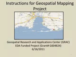
Middle Verde Geospatial Database Project. Rob Ross and Abe Springer Arizona Water Institute Geospatial Research and Information Laboratory Northern Arizona University May 21 st 2008. Outline. Introduction to project Discussion of Geographical Information Systems (GIS)

E N D
Middle Verde Geospatial Database Project Rob Ross and Abe Springer Arizona Water Institute Geospatial Research and Information Laboratory Northern Arizona University May 21st 2008
Outline • Introduction to project • Discussion of Geographical Information Systems (GIS) • Data compilation and verification • Design of conceptual model • Design of analytical model • Phase two of study
Introduction • Yavapai County funded study to compile data for use in surface water flow model • Objectives • Compilation of data • Editing and verification of data • Design of surface water flow (hydraulic) model from GIS information
What is a GIS? • Geographic Information System • Collection of information including geographic data (maps) and qualitative and quantitative information (names, area, flow rates, etc.) to create a graphical representation of a system • Metadata describing the quality and scope of data (data about the data)
Attributes and Layers • Attributes are tables of information linked to a graphical representation • Layers are groups of shapefiles or file database information used to organize information • Attributes enable labeling to show values/names of areas of interest
Types of information included in GIS • Line shapefiles • Point shapefiles • Polygon shapefiles • Added information (pictures, sound/video files, etc.) • Attribute tables
Uses for GIS • Spatial decision support systems - ability to analyze geographic data to support decisions • Automated spatial modeling - simulation and forecasting (i.e., surface flow model reacting within geographic constraints over time) • Network analysis - calculate distances in relation to other data
Projection systems • Accurately display information from a spherical world as a flat map • Use coordinate projection systems to represent actual locations on maps • Many data sources come from different data projections • Convert into common projection
How Projections Work http://erg.usgs.gov/isb/pubs/MapProjections/graphics/mercator.gif
Data Collection Sources • Yavapai County GIS Department • Arizona Department of Water Resources 2000 report • Salt River Project GIS/Cartography department • USGS • Eureka and Diamond S ditch associations
Data Issues • Compiled data from multiple sources • Differences in collection and scale • Variant projection systems • Different tolerance criteria • Sources used for different purposes • Data collected at different points over long period of time
Primary Data Layers • Irrigation • Ditches • Means Conveyance (laterals) • Vegetation • Aerial photography • Well data
Secondary Data Layers • Land Parcel information • Springs • Verde river channel • Tributary channels • Roads • Cities
Editing Protocol • Layers edited over 12 inch pixel resolution aerial photography (PhotoMapper software) • Edited for detail at 1:750 scale • Multiple fields merged for simplicity, where common attributes permit • Polygons not drawn around buildings/roads/property lines • Data updated where obvious changes are present • Consistent methods for different layers to create uniform data system
Accuracy of edited layers • 5 feet with irrigation layers • 5 feet in ditch layers • 5-20 feet in lateral locations • Error due to sub-grade duct routing and estimation of boundaries of irrigation/vegetation layers • Well layers are taken “as is” due to large number of locations, and access issues
NEMO NEMO does not provide coverages at a ditch/diversion Scale, nor is their data ground checked.
Phase Two • Examination of modeling software • Determination of necessary features in software • Preparation of surface water flow model for Middle and Upper Verde River
Hydraulic Models • Simulate flow of water in channels • Channels can be natural and constructed • Simulate surface-water/groundwater interactions
Hydrologic Models • Simulate runoff in watersheds • Typically difficult if not impossible to use in arid regions
Recommendations • Use hydraulic model to simulate steady baseflow in river and diversions • Unsteady baseflow during diversion season • Use HEC-RAS in WMS • GIS based 1D model • Can also be used to create floodplain maps
Summary • Compiled all known existing information • Editing has greatly increased accuracy of data, and provided operation data • Combination of remote sensing and field checking has verified information • GIS will serve as a complete input system for surface water flow model • Hydraulic flow model is most appropriate for region
Acknowledgements Mark Manone and GRAIL Leslie Graser, ADWR Jeanmarie Haney, TNC Kevin Blake, Yavapai County GIS GIS/Cartography Department, SRP Kyle Blasch and Don Bills, USGS John Rasmussen, Yavapai County John McReynolds and Steve Ayers, Eureka Ditch Association Frank Geminden, Diamond S Ditch Association