Download
1 / 14
140 likes | 261 Views
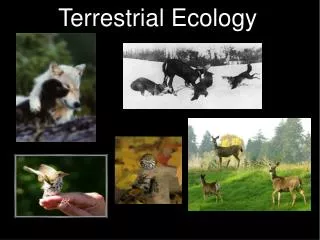
Terrestrial Ecology Working Group Data Products and Access. Teleconference May 2, 2011. Working Group Members. Agenda. Introduction WG Goals / Charter Discussion. Data Products and Data Access Working Group: Charter (1/3). What new data products would advance TE research goals?

E N D
Terrestrial Ecology Working GroupData Products and Access Teleconference May 2, 2011
Working Group Members Data WG
Agenda • Introduction • WG Goals / Charter • Discussion Data WG
Data Products and Data Access Working Group: Charter (1/3) • What new data products would advance TE research goals? TE Research Goals: http://cce.nasa.gov/terrestrial_ecology/about.html *Data Products such as: -long-term data records that need to be created or better supported -enhancing existing data products (EOS and PI-led efforts) -new mission and cross-mission data products (current and future) -data from non-NASA data sources • How could the TE program invest resources to make data sets easier to access, manipulate, and combine with other sources of information and/or models? -may involve semantics, metadata, physical formatting, and "high grading" (e.g. improving quality via filtering, gap-filling, etc), as well as the availability of software tools and services Data WG
Data Products and Data Access Working Group: Charter (2/3) • Members will be expected to bring their own perspectives, but also represent broader research constituencies. • Working Group will have connections with other TE Working Groups, including those for Modeling, Field Campaigns, and Airborne Observations • Provided an issue is relevant to TE field campaigns and of importance to the TE community, the WG will have the ability to identify a new issue for its consideration and develop the agenda to address it, for example: • Recommend inclusion in a new NASA solicitation (e.g., MEASURES, ACCESS, etc.) • Establish an informal consortium • Other approaches Data WG
Data Products and Data Access Working Group: Charter (3/3) • Details regarding the operations of the WG will be determined by the WG in consultation with the CC&E Office and the TE Program Manger. • Recommendations from the working group will be conveyed to the CC&E Office and the TE Program Manager for their consideration and potential implementation. • Recommendations will be shared with the broad TE community through the TE Web site and other appropriate means. • Does the charter need to be modified? Data WG
Discussion • What new data products* would advance TE research goals? • TE Research Goals: http://cce.nasa.gov/terrestrial_ecology/about.html *Data Products such as: • long-term data records that need to be created or better supported • enhancing existing data products (EOS and PI-led efforts) • new mission and cross-mission data products (current and future) • non-NASA data sources? Data WG
What new data products would advance TE research goals? (WG ranking) • High spatial and temporal resolution (1-km and 3-hourly) climate, Global coverage. Climate data to include PAR and diurnal variability needed to drive land-surface model/photosynthesis schemes. • Gridded species richness and occurrence data to look at biodiversity (at 25-km resolution). Plants and animals (eBird database). (PPBio-INPA in Amazonia) • Multi-faceted product containing forest height, biomass, and age. (Combining many existing products (LIDAR, LEDAPS). • Global database of ground-based in situ validation data for remote sensing products. Forest inventory data (e.g., Height, basal area, biomass, age, crown dimensions of forest study plots globally (validation / evaluation data set). • Ground-based data to validate remote sensing products (improved spatial representativeness; match ground-based spatial resolution with that of the satellite data) • Hyperspectral Reference Library of leaf-level hyperspectral optical properties (full spectrum; biogeochemical content) and soil reflectivity. Collected using standard measurement techniques; full contextual information. • Long-term data records for dynamics of inland waters, cloud corrected global irradiance, atmospheric optical properties, in addition to the existing MEASURES products (landsat, NDVI, etc.). • High-spatial resolution soil data, including type and depth • Ancillary data to support interpretation of data from new NASA sensors • Gridded products that help us understand land management (not just land cover) are important for substantially improving (a) estimates of carbon fluxes, and (b) reducing uncertainty. • Global gridded data on land-cover, land-use, land-use transitions, and land cover changes (past, present, future) • Expand spatial and temporal coverage: 4. LEDAPS (J. Masek, GSFC) • Expand spatial and temporal coverage: 5. Global Fire Emissions Dataset – GFED (J. Randerson, UCI) • Expand spatial and temporal coverage: 6. VULCAN Fossil Fuel Emissions (K. Gurney, Purdue) Data WG
How could the NASA's TE program invest resources to make data sets easier to prepare, access, manipulate, and combine with other sources of information and/or models? (WG Ranking) • Data coordinator to act as a liaison between investigator and data center; make it easier for investigator to compile and submit data to a data repository. Responsible for seeing that data from PI gets into the archive in a suitable form and well documented. • Data publications containing raw data produced in funded projects, as well as that used in journal articles, so that others can use data for other purposes • Single portal that enables exploration and access to Earth Science data including visualization; data are readily integrated. • Require a policy to make data readily available 12 months after collection in a standard format to facilitate use (and metadata readily available after 30 days). • Extract and integrate multiple remote sensing products for a small area over time (AVHRR, MODIS, LEDAPS (reflectance and disturbance), LandSat, etc.). • Develop tutorials/ curricula / class room material tutorials on how to prepare data to share. • NASA could facilitating the expeditious preparation of data and metadata for sharing, including preparing data products in a standard formats with standard variables. • Community standards for TE-relevant variables and data files • Recommend that accuracy and uncertainty be fully characterized and included with each product (integral part of the data product) for remote sensing and ground-based (in situ) data. • Methods to access data in time centric methods. • Timely access to airborne data • Tools to propagate uncertainty (in quadrature) Data WG
Next steps: • Combine data and services with TE Modeling working group • Solicit feedback from larger TE community • Develop an agenda to address data and services needs • Next telecon: ~August Data WG
What new data products would advance TE research goals? (1/2) Data WG
What new data products would advance TE research goals? (2/2) Data WG
How could the NASA's TE program make data sets easier to prepare, access, manipulate, and combine with other sources of information and/or models? Data WG