Download
1 / 48
490 likes | 834 Views
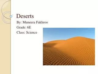
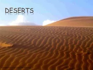
Deserts. Climate Distribution and subtypes Landscape-substrate-soils Limiting factors Adaptations to aridity Adaptations to high temperatures. Definitions. Boundary defined by absolute precipitation (e.g. <4 inches or 100 mm mean annual precipitation). Not an adequate definition.

E N D
Deserts Climate Distribution and subtypes Landscape-substrate-soils Limiting factors Adaptations to aridity Adaptations to high temperatures
Definitions • Boundary defined by absolute precipitation (e.g. <4 inches or 100 mm mean annual precipitation). Not an adequate definition. • Boundary defined by intensity of moisture deficit (e.g. ratio of available precipitation to evaporative demand; see, for example, the Budyko-Lettau dryness ratio)
Budyko-Lettau dryness ratio D = R / (L x P) where D = dryness ratio; R = mean ann. net radiation;P = mean ann. precipitation; L = latent heat of vaporization of water Original definition: D > 2.3 = semi-desert; D ≥ 3.4 = desert. UNESCO: D ≥ 10 = “extreme desert”
Dryness ratio 8 7 semiarid desert (D≥2.3) (D≥10)
Unpredictability:areas with >30% variability in precipitation
Causes of regional aridity • Persistent atmospheric subsidence associated with the presence of sub-tropical anticyclones suppresses convectional activity (e.g. Sahara, Kalahari, Australia) • Absence of humid airstreams (e.g. Gobi) • Localized subsidence in rain-shadow areas (e.g. Great Basin) • Absence of cyclonic disturbances (e.g. Sonora) • Inhibition of convectional activity by cold coastal currents (e.g. Atacama, Namib)
“Coastal fog deserts” E.g. Atacama desert Namib desert
Temperature Arid areas that are subject to sub-freezing conditions (e.g. Gobi, Great Basin) are “cold” deserts. Areas where air temperatures seldom or never fall below 0°C are “hot” deserts (e.g. Sonora, Sahara)
Sonoran cacti: saguaro(Carnegiea gigantea) range controlled by exposure to freezing temperatures
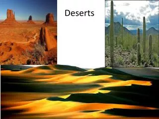
Desert landscape-substrate elements upland / hillslope pediment/bajada/reg dunefield/ erg deflation erosion playa - sabkha solutes deposition gravelly soils skeletal soils sandy silts sands
Limiting factors Five interlinked “stresses” for biological community: REGIONAL 1. “permanent’ moisture deficit; 2. high surface temperatures during day; large diurnal variation; 3. highly irregular and variable moisture supply; LOCAL 4. mobile substrates; and 5. saline substrates
Limitation of primary productivity in arid ecosystems (data from Tunisia) 500 400 300 200 100 0 skeletal soils of uplands Mean ann. rainfall (mm) gravelly soils of pediments and alluvial fans 0.01 0.1 1.0 10 Net primary production (kg ha-1 yr-1)
Forms of adaptation to stresses in arid environments Four strategies: 1. minimize heat intake or maximize heat outflows; 2. maximize food reserves in times of plenty; 3. maximize water inflows; and 4. minimize water outflows
Evasion tactics to minimize exposure to heat and drought 1. Organism dormant for substantial part of life-cycle:e.g. ephemeral plants, some reptiles, most insects persist through extended droughts as seeds, eggs, or larvae (only the reproductive forms remain). 2. Nocturnal or crepuscular foraging (hottest parts of day spent in burrows or shade). [Is crassulacean acid metabolism an equivalent tactic for succulent plants? CAM - stomates open at night; CO2 absorbed, assimilated during day when stomates closed to minimize water loss]
Desert ephemeral flora • Large seedbanks (esp. in sites protected from wind, e.g. around base of bushes; 100,000 seeds m-2); • Long seed viability in dry soils; • Rapid germination if rainfall sufficient (signalled by leaching of inhibitors in seed coats [e.g. only rains >25mm in Arizona produce germination] or scarification of thick seed coat in flash floods) • Short time [6-8 weeks] to seed-set; • Some species heteroblastic [produce seeds with varying germination requirements].
Refuging tactics: chuckwalla lizard How much cooler is it at a depth of 20 cm?
flow salinity water temp. Refuging by desert aquatic speciese.g. pupfish in Death Valley desert pupfish winter summer winter Salt Creek, Death Valley live lay eggs hatch /die
Reducing heat load • Low surface-area/volume ratio; • Reflective skin/bark(colour changes in lizards) • Vertical shoot-body architecture Fouquieria/Idria columnaris (the ‘cirio’ of central Baja)
Reducing heat load:a joshua tree (Yucca brevifolia)in the Mojave desert
Maximise food reserves in times of plenty • camel’s hump; • berber sheep (fat reserves in tailvary from 2-10 kg); • pack rats/gerbils hoard seeds; • succulents store water.
Maximise water inflows • extensive lateral (cacti) or vertical (mesquite) roots; • rapid root growth after rains • beetles in Namib desert stand on hind legs to catch fog droplets on raised abdomen; • mice in Arizona often feed on low-protein herbage with high water content • camels can drink 100 L of water in 10 min! • practice opportunistic migration to water and food sources (desert locusts, nomadic pastoralists)
Shrub/tree root patterns, Arizona Plant spacing determined by moisture availability and rooting niche 40
Water conservation:expandable storage organs and palisade tissue in succulents
Minimize water loss 1. Transpiration reduced in desert plants by microphylly, deciduousness, sunken stomata, waxy or pubescent leaves. 2. Water loss in desert fauna reduced by dry faeces, low urine prodcution, low dilution of uric acid, adaptive hyperthermia (camel’s body temperature can vary by 6°C when animal is dehydrated). 3. Tolerate dessication: camel can withstand water loss = 25% of body weight
Reducing water loss: microphylly, deciduousness, photosynthetic bark and shoots Pachycormus discolor
Reducing water loss: microphylly in ocotillo (Fouquieria splendens)
Pink = desert; yellow=savanna grassland; brown=dry forest NB Lake Mega-Chad (bigger than Caspian Sea at present, and at least 40 m deep) http://www.uni-mannheim.de/phygeo/8000BP.htm
Evidence for late Holocene climate change in the Sahara Lake sediments and pollen Rock drawings, Tassili
Desertification in progress?Rainfall in the Sahel zone of W Africa Cause: ? Effect: desertification? Protracted drought
Grazing Vegetation Albedo Convectional rainfall Grazing Vegetation Albedo Convectional rainfall Desertification on savanna margins: Rapp’s albedo hypothesis Settlement Nomadism + - - + - + + - + -