Download
1 / 30
300 likes | 548 Views
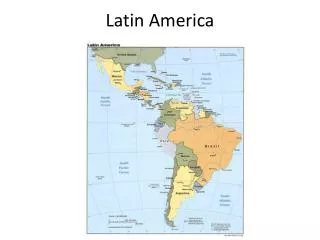
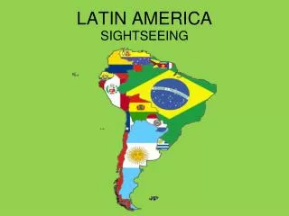
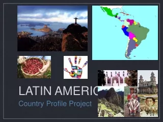
Landforms and Resources of Latin America. Regions of Latin America. Mexico Central America Caribbean South America Brazil. Mountains and Highlands. The Andes Mountains- The Andes are a part of the mountain range that runs through a portion of North, Central and South America.

E N D
Regions of Latin America Mexico Central America Caribbean South America Brazil
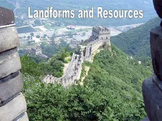
Mountains and Highlands • The Andes Mountains- • The Andes are a part of the mountain range that runs through a portion of North, Central and South America. • United States- The Rocky Mountains • Central America- The Sierra Madres • South America- the Andes • There are many volcanic peaks throughout the Andes.
Andes Characteristics • Many volcanoes • The longest mountain range in the world, nearly 5,000 mile long. • Creates a barrier between the coastal cities on the west coast and the interior of the continent.
Highlands • The other mountainous regions in Latin America include the following: • The Guiana Highlands • The Brazilian Highlands
The Plains of Latin America There are vast plains regions in Latin America well suited for agriculture Llanos: Colombia and Venezuela Pampas: Argentina and Uruguay Amazon River Basin: Brazil
The Amazon River and Other Major River Systems • South America has three major River Systems: Amazon River: Brazil Orinoco River: Venezuela and Colombia Paraná River: Brazil, Paraguay and Argentina
The Mighty Amazon • Amazon : Flows 4,000 from west to east and empties into the Atlantic Ocean. Source is the Andes Mountains close to the Pacific Ocean.
The Orinoco River • The Orinoco River flows mainly through Venezuela and Colombia. It creates part of the border between the two countries.
The Paraná River • The Paraná river begins in the Brazilian Highlands and flows southward through Paraguay and Argentina. It meets with several other rivers to create the Rio de la Plata a very important estuary in South America.
Islands of the Caribbean • Three Main Island Groups make up the West Indies: The Bahamas The Greater Antilles The Lesser Antilles
The Bahamas • The Bahamas are made up of hundreds of islands off of the southern tip of Florida. Nassau is the capital and largest city in the Bahamas.
The Greater Antilles • The Greater Antilles is made up of the largest islands in the Caribbean including Cuba, Jamaica, Hispaniola (Haiti and Dominican Republic), and Puerto Rico.
The Lesser Antilles • The Lesser Antilles includes the smaller islands in the region southeast of Puerto Rico. They are divided into two groups- the Leeward island and the Windward islands.
Resources Gold Silver Oil Natural gas Hydroelectric power Copper Timber Agricultural Products
Climate and Vegetation Tropical Wet Rain forest (Brazil) Tropical Wet and Dry Llanos and Pampas (Venezuela and Argentina) Semiarid Patagonia- Argentina Desert Atacama Desert-Chile
Mid-Latitude Climates Humid Subtropical Paraguay, Uruguay, southern Brazil, Bolivia, and Argentina Mediterranean West coast of Chile Marine West Coast Southern Chile, eastern Argentina Highlands
Vertical Climate Zones About 15,000 ft Terra Helada (Mountain Tundra) Tree Line 10,000-12,000 ft Tierra Fria (Cloud Forest) 6,000 -6,500 ft Tierra Templada (Wet forest) 2,500- 3,000 ft Tierra Caliente (Dry Forest and swamp)
Human-Environment Interaction Agriculture: Slash-and-burn technique used to clear the land for farmland in the Amazon River basin.
Human-Environment Interaction • Agriculture: Terraced Farming is an ancient technique introduced by the Inca for growing crops on the side of a mountain. This reduces soil erosion.
Urbanization • Push and Pull factors: People in Latin America are moving from rural areas into urban areas in search of better opportunities. This has created many problems such as the development of slums in the big cities.
Push Factors • Push factors: reasons why people feel forced to move away from rural areas examples: Poverty, poor medical care, poor educational opportunities, low-paying jobs
Pull Factors • Pull factors: reasons why people are drawn to live in the cities. Examples: Possibilities for work, education, medical care.
Rapidly Growing Cities CityPopulation (2000) • Mexico City, Mexico 99,639,000 • Buenos Aires, Argentina 37,048,000 • Lima, Peru 27,136,000 • Sao Paulo, Brazil 16,800,000 • Santiago, Chile 15,211,000 • Rio de Janeiro, Brazil 11,029,300
Urban Sprawl • Unemployment • Crime • Illegal Drug trafficking • Slums • Pollution • Sanitation • Shortages of clean drinking water and housing
Tourism • Advantages: • Creation of new jobs • Reduction of the income gap between rich and poor
Tourism • Disadvantages: • Congestion • Pollution • Strain on local resources • Resentment and hostility • Large public debt due to building tourist facilities