Download
1 / 26
260 likes | 392 Views
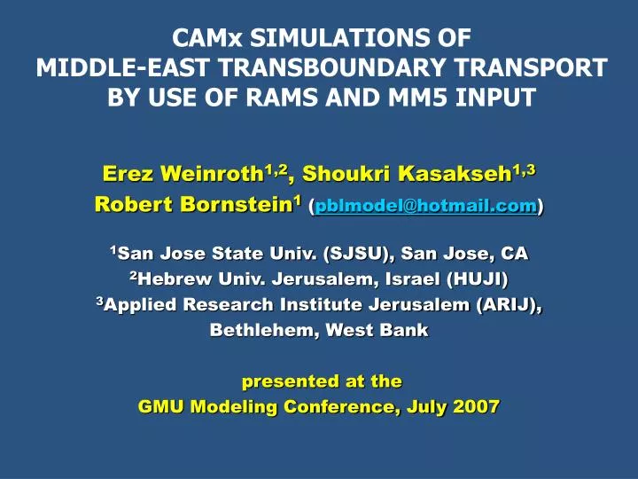
CAMx SIMULATIONS OF MIDDLE-EAST TRANSBOUNDARY TRANSPORT BY USE OF RAMS AND MM5 INPUT. Erez Weinroth 1,2 , Shoukri Kasakseh 1,3 Robert Bornstein 1 ( pblmodel@hotmail.com ) 1 San Jose State Univ. (SJSU), San Jose, CA 2 Hebrew Univ. Jerusalem, Israel (HUJI)

E N D
CAMx SIMULATIONS OF MIDDLE-EAST TRANSBOUNDARY TRANSPORT BY USE OF RAMS AND MM5 INPUT Erez Weinroth1,2, Shoukri Kasakseh1,3 Robert Bornstein1(pblmodel@hotmail.com) 1San Jose State Univ. (SJSU), San Jose, CA 2Hebrew Univ. Jerusalem, Israel (HUJI) 3Applied Research Institute Jerusalem (ARIJ), Bethlehem, West Bank presented at the GMU Modeling Conference, July 2007
Outline • Project background • Intro to Mid-East met • Methodology • Results: • Synoptic-scale patterns • Mesoscale factors (obs) • Mesoscale simulations • RAMS and MM5 • CAMx • Conclusions & future work
Background • USAID-MERC project (2000-2006) • Scientists from Palestine, Israel, &USA • Objectives accomplished: • Installation of environmental monitoring stations in West Bank and Gaza • Preparation of environmental databases on SJSU web page • Field campaigns during periods of poor air quality • Application of numerical models for planning • RAMS & MM5 meso-met • CAMx photochemical air-quality
Carmel and Galil Jordan Shomron and Judea Israel Topo-heights & O3 sites Meso-met sites
IMS 700 hPa, July 29, 0000 UTC * • Black Sea dominated by 700 hPa Low-p system • inland lobe of Azores H thus split (W & E segments) • Protrusionfrom W-segment penetrates inland to • Western Saudi Arabia Black Sea H Med H
H L Black Sea Turkey 1002 * Med 1008 IMS SFC Obs, July 31, 0000 UTC • Sfc Persian-through thermal-Low protrusion (1002 hPa contour) continued to expand westward • Protrusion from high (1008 hPa contour) retreated
Night obs of sfc flow: 3-AM LST (00 UTC) H • Flow Dir:weak down-slopeoff coastal-mountains at • Coastal plain: offshore(to W) from W-facing slopes • Haifa Pen.(square): offshore(to E ) from E-facing slopes • Inland sites: directedinland (to E) from E-facing slopes • Low-O3 • generally <40 ppb) • Haifa still at 51 ppb L L
Day Obs: 1200 NOON LST L • Winds: • Reversed • Stronger: up 6 m s-1 • Coastal plain: Onshore/upwind, from SW • Inland sites: Channeling (from W) incorridor(box) fromTel-Aviv to Jerusalem area (at Modiin site). • Higher daytimeO3 • max at Mappil, 66 ppb • 2nd max at Modiin, 63 ppb H H L
900 Km 270 Km 180 Km 900 Km 370 Km 270 Km RAMSConfiguration • 3 Grid Spacings • 20 km over E-Med for background synoptic forcing • 5 km over Israel, West Bank, and Gaza for meso-scale sea/land & mt/valley flows • 1.25 km for Tel Aviv-Jerusalem transport-corridor • Domain GPs: 45 x 45, 74 x 54, and 146 x 218 for Domains 1-3 • 24 vertical levels • 1st full grid cell at 125 m • Topography: GTOPO30 • ECMWF for IC and BC • Model run at HUJI • Simulations start: 00 UTC on 1 August 97 & end 72-h later
MM5 Configuration • Version 3.7 • 3 domains • 15, 5, 1.67 km Grid Spacings • 59 x 61, 55 x 76, 58 x 85 Grid Points • 32 σ-levels • up to 100 mb • first full σ-level at 19 m • Lambert-conformal map projection (suitable for mid lat regions) • Two-way nesting • 5-layer soil-model • Gayno-Seaman PBL • Simulations • Start: 00 UTC, 29 July • End: 00 UTC, 3 Aug • Single CPU , LINUX (SJSU-Lightning)
L H * L H • ECMWF-pressures correctly captured movements of large- • scale surface pressure-systems • Thus ECMWF provided good SFC IC/BC for RAMS & MM5
Obs (below); 7 AM, 1 Aug: all down-slope (off-shore, except where inland-direct at inland sites) RAMS • RAMS 7 AM SFC WINDS (ABOVE) • Off coast: Southwesterly (no obs) • Coastal plain: Downslope/offshore from SSE • Inland: Inland directed • Southern: from NW vs. from W in obs
Obs, 7 AM, 1 Aug: all down-slope, off-shore (except where inland-direct at inland sites), reproduced from previous slide • MM5 7 AM sfc winds (above) • Off coast: onshore from W (like ECMWF; no obs) • Coastal plain: downslope/offshore from SSE • (in obs & RAMS; can’t be in coarser ECMWF) • Inland sites: inland directed (obs & ECMWF) • Southern: obs&MM5 are westerly; RAMS was NW
Obs, 1 PM, 1 Aug: All westerly/onshore flow RAMS • RAMS 1 PM sfc winds (above) • Off coast: Onshore from SW (no obs??) • Coastal plain: upslope/onshore (in obs, but can’t be in coarser ECMWF-results) • Inland sites: inland directed (in obs, MM5, & ECMWF) • South (circle): NW in RAMS, as in obs
Obs, 1 PM on 1 Aug: All westerly/onshore flow • MM5 1 PM sfc winds (above) • Off coast: onshore from W (like ECMWF; no obs) • Coastal plain: upslope/onshore (in obs & RAMS) • Inland sites: inland directed (in obs & RAMS • South (circle): NW (in RAMS & Obs)
Mid-east Obs vs. MM5: 2 m temp(Kasakech ’06 AMS) First 2 days show GC/Syn trend not in MM5, as MM5-runs had no analysisnudging Obs Run 1 Run 4: Reduced Seep-soil T July 29 August 1 August 2 obs MM5:Run 4 July 31 Aug 1 Aug2 Standard-MM5 summer night-time min-T, But lower input deep-soil temp better 2-m T results better winds better O3
Obs vs. MM5: V (m/s) Note: non-reproduced synoptic trend in max-speed Run 3 OBS July 31 August 1 August 2
Emission Inventory: 1997-8 • 15Large Stationary (point) sources (58% fuel consumption) • 400Medium Stationary (point) sources (7%) • Small Stationary (area) sources (12%) • Solvents (area) sources • Biogenic Stationary (area) sources (isoprene and monoterpene) • Mobile (area) sources, both ground based and aerial (22%)
O3 ppb 0 0-20 20-40 40-60 60-70 70-80 80-90 90-95 95-105 105-120 RAMS/CAMx (left) O3 vs. airborne Obs (right) at 300 m: > Secondary-max: over Jerusalem; in obs (but underestimated by 15%) from coastal N-S highway sources > Primary-max: found in Jordan (no obs) from Hadera power-plant Flight Path Jerusalem Irbid, Jordan . Hadera Power Plant 1 Aug, 1500 LST
Legend O3 ppb 0 0-20 20-40 40-60 60-70 70-80 80-90 90-95 95-105 105-120 > All emission sources (see below, left & previous slide) > All industry sources (see below center) > Main (tall-stack) industry sources > Medium and small (low-stack) industry > Without Industry (only Vehicles, Solvents & Vegetation) (below right) > Vehicles only > Without vehicles (only all-Industry, Solvents & Vegetation) > Without emissions (only IC and BC) 300 m CAMx ozone from 3 of the 8 Emission Input Scenarios (below) All emission sources All industry sources Without industry sources 1.8.97 15:00 1.8.97 15:00 1.8.97 15:00 1.8.97 15:00
SUMMARY (1 of 2) • Synoptic-obs during a summer sfc Persian-Trough period • 700 hPa L moved southward over area Azores High retreated • Sfc-L moved to W reduced-subsidence from high inversion-base raised • Persian sfc-L was N of (not over) area typical (but, not episode) sfc O3-levels • Meso-obs showed • Meso (daytime Mt/sea + nighttime valley/land) breezes • JerusalemO3-max: from inland-transport of coastal auto-emissions
SUMMARY (cont.) Model-results showed • RAMS & MM5 reproduced surface-flows • Daytime sea breeze and upslope flows • Nighttime land breeze and downslope flows • CAMx/RAMS • Reproduced obs JerusalemO3-max (due to coastal-autos) • Showed even larger (previously-unknown) max over Jordan (due to Hadera power-plant emissions)
CURRENT & FUTURE WORK • Improved MM5-simulations • FDDA analysis nudging to better capture synoptic trends • Move to urbanized (next talk): uMM5 & uWRF • Compare RAMS & MM5 • Inputs to CAMx • Verify sfc & PBL transport-patterns • New USAID/MERC obs & modeling projects with • Jordan (started June 2007) • Lebanon (pre-proposal invited for Dec 2007)
Key References • Matveev, V., et al., 2002: Long-range trans-portation of air pollutants from Europe to Israel. Isr. J. Earth Sci., 51, 17-28. • Doron, E., and J. Neumann, 1977: Land and mountain breezes with special attention to Israel’s Mediterranean coastal plain. Israel Meteor. Res. Papers, 1, 109-122. • Dayan, U., and L. Koch, 1996: Ozone concentration profiles in the LA Basin – A possible similarity in the build-up mechanism of inland surface ozone in Israel. JAM, 35, 1085-90. • Ranmar, D., et al., 2002: Impact of coastal transportation emissions on inland air pollution over Israel: utilizing numerical simulations, airborne measurements, and synoptic analyses. JGR, 107. • Weinroth, E., 2004: RAMS/CAMx modeling. Ph.D. dissertation, HUJI, 127 pp.
Thanks… Questions ?