Download
1 / 32
320 likes | 512 Views
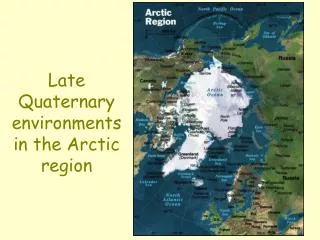
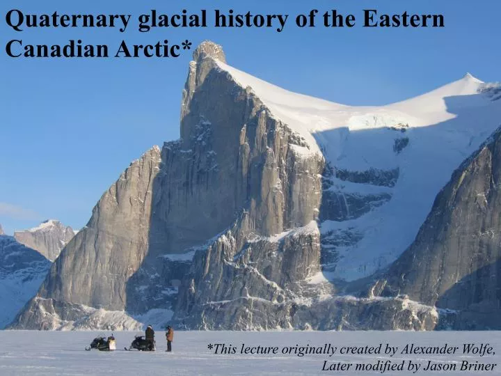
Quaternary glacial history of the Eastern Canadian Arctic*. *This lecture originally created by Alexander Wolfe, Later modified by Jason Briner. Queen Elizabeth Islands Baffin Island Ellesmere Island Devon Island Baffin Bay Foxe Basin. SOME FACTS CONCERNING ARCTIC CANADA.

E N D
Quaternary glacial history of the Eastern Canadian Arctic* *This lecture originally created by Alexander Wolfe, Later modified by Jason Briner
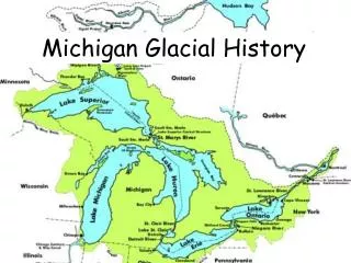
Queen Elizabeth Islands Baffin Island Ellesmere Island Devon Island Baffin Bay Foxe Basin
SOME FACTS CONCERNING ARCTIC CANADA The Canadian Arctic Archipelago incorporates over 1.3 million km2 of land surface. It is a large and remote region (population ~20,000, primarily Inuit) The low, mid, and high arctic sectors are defined by ecotonal boundaries (shrub tundra, heath tundra, polar desert, respectively) The Archipelago contains six of the world’s thirty largest islands, including Baffin Island, the fifth largest (507,450 km2). Physiographically, the western and central arctic islands, as well as Foxe Basin, are of low relief (<200 m asl), and are comprised of variably folded and faulted, Paleozoic to Cenozoic carbonate lithologies The eastern axis of the Archipelago is more mountainous, with peaks up to 2665 m above sea level (asl) on northeastern Ellesmere Island (Barbeau Peak), and 2156 m asl on Baffin Island (Tête des Cirques). Precambrian granitic basement rocks outcrop from east-central Ellesmere Island south through eastern Devon Island, and extend across most of eastern Baffin Island
Modern glaciers and large ice caps (up to 800 m thick) occupy much of the mountainous regions of Baffin, Ellesmere and Axel Heiberg islands, while to the west, fewer ice caps remain (Meighen, Melville islands) Glaciation levels and equilibrium line altitudes largely mirror topography, and are of the range 400-600 m asl However, these decline (<400 m asl) northward and westward across the Archipelago, reflecting a gradient of decreasing total degree days >0˚C topography
Glaciated axis Higher elevations Proximal to Davis Strait
Cold summers along the coast (reduced potential ablation) Frigid winters everywhere very slight coastal effect influence of Arctic Ocean outflow (Baffin Current) ≥70% of precipitation occurs as snow, in patterns relating to proximity to Davis Strait and the NW Labrador Sea
And so: • THE RECORD IS FRAGMENTARY • THE RECORD IS SUBJECT TO DEBATE Minimalist LGM ice Andrews (1980’s) Maximalist LGM ice Hughes (1989)
The late Quaternary record of the Queen Elizabeth islands Shifting paradigms in a ‘difficult’ region
The >25 year debate: Innuitian Ice Sheet versus Franklinian Ice complex
One solution: the ‘middle-man reconstruction’ as seen here (Hodgson 1989, DNAG volume)
MODERN ORIGINS OF THE INNUITIAN ICE SHEET (Weston Blake, Jr, Geological Survey of Canada) • 1970 CJES: a pumice strandline of mid-Holocene age tilts from east (16 m asl) to west (25 m asl) along the north coast of Jones Sound, over ca. 150 km
• 1975 (Blake, Geogr. Ann.): the postglacial marine limit (~9000 14C BP) along southern Ellesmere Island is shown to trend upwards to the west (30-120 m asl), indicating a major former ice load in the Grinnnell Peninsula region (NW Devon Island), and possibly current submergence in the east
If dates can be obtained on beaches, and the marine limit can be determined, then emergence curves can be generated which, ideally, reflect the last glacial load (Washington Land, NW Greenland, Bennike 2002)
Support for Innuitian Ice Sheet came largely from theoretists (here, Denton and Hughes, 1981), who dogmatically favored the ‘large ice’ model
Further support came from the Greenland Quaternary community (Weidick, Funder, Kelly, Bennike), given high marine limits on both sides of Nares Strait (NE Ellesmere, NW Greenland; ~40 km) That’s a lot of emergence for an ice-free corridor!
But, a major voice of opposition to the Innuitian Ice Sheet was also heard (John England and students), based on: • the non-glacial appearance of much of this landscape • the abundance of old shells and highly weathered glacial and periglacial deposits • the very real constraint of extreme aridity in the central QEI (these are the driest regions of Canada, after all << 200 mm/yr); the ice core accumulation record implies even drier conditions at the LGM. • Instead of ice, Nares Strait, Jones Sound, and the other inter-island channels were occupied by a Full-Glacial Sea, and the islands supported a Franklin Ice Complex with limits 10-30 km from modern glacial extents.
What about the uplift record, which is pretty impressive? “The relationship between glacial and marine deposits in the central Queen Elizabeth Islands has yet to be stratigraphically demonstrated” (England 1976) “On west-central Ellesmere Island, isobases (110-150 m asl) trace a plunging ridge, aligned with geological structure, across an area considered to have had minimal ice cover during the last glacial maximum. The ridge may record an important structural influence associated with the geologically youthful Sverdrup Basin. Collectively, this evidence cautions against the view that postglacial emergence has a universally, predictable signature closely portraying former ice loads” (England 1997).
The pendulum swings (1997-2004) Dyke and Prest 1987 The glacial map of Canada adapts the small ice model
Dyke et al. (including England) 2002, QSR: The ‘new’ model
What happened? • Dyke mapped Devon Island, revealing large scale glacial features along Wellington Channel and Jones Sound, datable to the last glaciation • England reinterpreted everything, aided in part by cosmogenic ages (36Cl) on Greenland granite erratics from western Nares Strait, that overly highly weathered terrains • Blake has now been partially vindicated • Nunataks probably persisted, however, in several regions, potentially of sufficient size to be biologically relevant.
Dyke, 1999 QSR 1 2
Retreat pattern of ‘big ice’ from eastern Wellington Channel
Nature 1999: old erratics from Greenland ain’t so old afterall With rare exceptions, of course
Definitive cluster of ages around 10 ka, with occasional older dates
Today’s ‘consensus’ view England (1998 JQS): “These studies resolve a longstanding debate, and initiate new opportunities concerning the reconstruction of high-latitude paleoenvironmental and paleoclimate change.” What about the older record? What about the LGM nunataks?
Dyke et al. (2002) compiled all finite pre-Holocene 14C dates ton constrain the middle Wisconsinan ice limits, as best as currently possible: indeed, the presence of nunataks appears supported?
CONCLUSIONS • Reconstructing the last glaciation of the Queen Elizabeth Islands has not proven an easy task, resulting in widely different interpretations across the region • Relatively large ice bodies appear to have coalesced in many regions, certainly buttressed to the NE by Greenland ice • The extent of Innuitian ice to the west in the lowland sector is largely unknown, but the Rignes islands do bear glacial erratics of Precambrian Shield provenance (Atkinson 2004, CJES). How this limit dovetails with the eastern extension of Beringia awaits further exploration • In certain areas, ice-free nunataks appear to have survived • Earlier events (pre-LGM) remain cryptic at best