Download
1 / 9
0 likes | 29 Views
Auckland-based leader in Architectural Drafting, Designing Solutions, and Point Cloud to BIM Services. Unlock our proficiency in transforming data into precision.

E N D
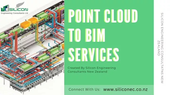
POINT CLOUD TO BIM SERVICES POINT CLOUD TO BIM SERVICES SILICON ENGINEERING CONSULTATNS NEW ZEALAND Created By Silicon Engineering Consultants New Zealand www.siliconec.co.nz Connect With Us:
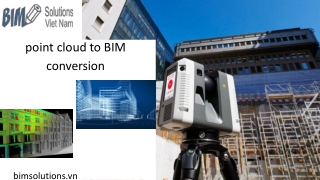
Point Cloud to BIM Services: How point cloud data is captured (e.g., laser scanning, photogrammetry). • Laser Scanning: Point cloud data is captured using laser scanners that emit laser beams to measure distances and create precise 3D point clouds of objects or environments. • Photogrammetry: Photogrammetry involves capturing point cloud data through the analysis of multiple 2D images, using features and parallax to reconstruct 3D structures. • LiDAR Technology: LiDAR (Light Detection and Ranging) systems use laser pulses to measure distances and create detailed point clouds, commonly used in mapping and autonomous vehicles. • Structured Light Scanning: This method projects a known pattern of light onto surfaces and captures the deformations of the pattern to generate 3D point clouds, often used in industrial applications. • Terrestrial and Aerial Platforms: Point cloud data can be collected from both ground-based and aerial platforms, enabling versatile applications such as land surveying, archaeological documentation, and urban planning.
Scan to BIM Services Benefits of utilizing point cloud data in construction projects. • Precision and Accuracy: Point cloud data ensures precise measurements, aiding architects and engineers in accurate modeling, reducing errors, and enhancing overall construction quality. • Efficient Design and Planning: Point clouds enable architects to visualize existing structures, facilitating better design integration and renovation planning, resulting in more efficient use of resources. • Cost-Effectiveness: By reducing design errors and facilitating precise measurements, point cloud data minimizes rework, saving construction costs and improving project profitability. • Enhanced Collaboration: Point clouds facilitate collaborative efforts among construction teams, architects, and stakeholders, fostering better communication and understanding of the project, leading to streamlined decision-making.
CAD BIM Services Comparison of different software and tools options available in the market. • Features and Capabilities: Compare software based on their features, such as 3D modeling tools, rendering options, and compatibility with various file formats to meet specific project requirements. • Ease of Use: Evaluate user interfaces, intuitiveness, and learning curves. User-friendly software enhances productivity, especially for teams with varying levels of expertise. • Cost and Licensing: Analyze pricing structures, subscription models, and additional costs for plugins or extensions. Consider long-term affordability and scalability for the project's duration. • Technical Support and Updates: Assess the quality of customer support, availability of tutorials, and the frequency of software updates. Regular updates ensure compatibility with evolving technologies and standards. • Integration and Compatibility: Consider how well the software integrates with other tools and platforms. Compatibility with third-party applications can streamline workflows and enhance collaboration between different project phases.
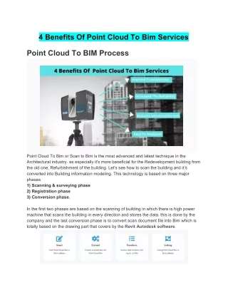
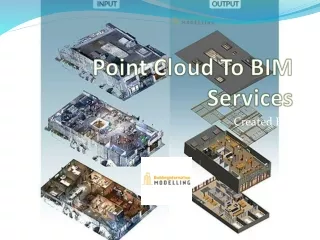
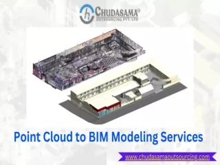
Point Cloud to BIM Solutions Step-by-step process of converting point cloud data to BIM models. • Data Acquisition: Start by capturing point cloud data through methods like laser scanning or photogrammetry, ensuring comprehensive coverage of the site or object. • Data Preprocessing: Clean and filter the raw point cloud data to remove noise and outliers, enhancing the accuracy and reliability of the information. • Point Cloud Registration: Combine multiple scans and align them accurately in a common coordinate system, ensuring seamless integration and continuity in the final BIM model. • Feature Extraction: Identify key features like walls, floors, and structural elements within the processed point cloud data, converting them into recognizable objects using specialized software tools. • BIM Modeling: Utilize BIM software to create 3D models based on the extracted features, incorporating additional information such as materials, dimensions, and metadata for a detailed and informative Building Information Model.
As Built to BIM Services How Point Cloud to BIM services are used in various industries (architecture, engineering, construction, etc.). • Architecture: Architects use Point Cloud to BIM services for precise site analysis, enabling accurate renovations, preservation efforts, and seamless integration of new designs with existing structures. • Engineering: Engineers utilize the technology for infrastructure projects, ensuring precise measurements and clash detection, optimizing designs, and facilitating accurate retrofitting of bridges, roads, and utilities. • Real Estate: In the real estate sector, Point Cloud to BIM aids in creating immersive 3D visualizations of properties, enhancing marketing efforts, allowing potential buyers to explore spaces remotely, and facilitating informed decision-making. • Heritage Preservation: Cultural heritage professionals use Point Cloud to BIM for detailed documentation and preservation of historical sites and artifacts, ensuring accurate restoration, conservation, and protection of cultural heritage for future generations.
BIM Shop Drawing Services Emerging trends in Point Cloud to BIM services. • Automation: Increasing automation through AI and machine learning streamlines point cloud data processing, reducing manual intervention and speeding up the conversion to BIM models. • Augmented Reality (AR): AR applications are integrating point cloud data to enhance on-site visualization, aiding in construction, maintenance, and facility management. • Cloud-Based Collaboration: Cloud platforms enable real-time collaboration on point cloud data and BIM models, fostering teamwork among geographically dispersed project stakeholders. • Mobile Solutions: Mobile apps are emerging for point cloud data capture and on-site validation, allowing for quicker data acquisition and immediate feedback. • Sustainability Integration: Point Cloud to BIM services are incorporating sustainability analysis, enabling architects and engineers to optimize designs for energy efficiency and environmental impact reduction.
Contact Us: E-mail : panchal@siliconec.co.nz URL : www.siliconec.co.nz Address : 188A Stoddard Road, Mt Roskill, Auckland, 1041. Address 2 : Unit 32, Building 8, 15 Accent Drive, East Tamaki, Auckland