Download
1 / 25
260 likes | 729 Views
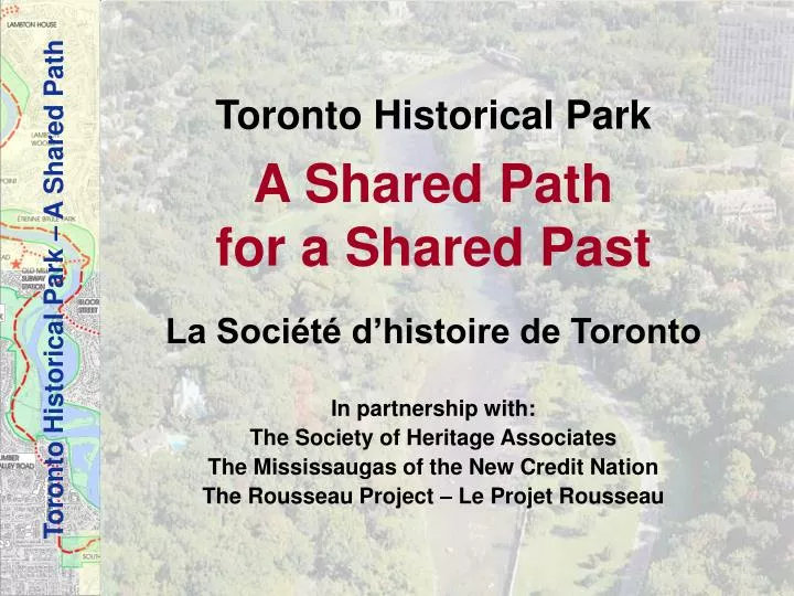
Toronto Historical Park A Shared Path for a Shared Past La Société d’histoire de Toronto In partnership with: The Society of Heritage Associates The Mississaugas of the New Credit Nation The Rousseau Project – Le Projet Rousseau. The Shared Path.

E N D
Toronto Historical Park A Shared Path for a Shared Past La Société d’histoire de Toronto In partnership with: The Society of Heritage Associates The Mississaugas of the New Credit Nation The Rousseau Project – Le Projet Rousseau
The Shared Path • Along both sides of the Humber River: Canadian Heritage River • A heritage greenway • Comprised of all public lands from Dundas Street to Lake Ontario
Toronto Historical Park • The Shared Path • Toronto Carrying Place • A rich heritage to be shared: • First Nations • French • English • Sites and historical houses • Parks and public trails • Natural reserves • Features of urban geography
The Shared Path: Master Plan • Feasibility Study – Report by Todhunter Associates Inc. • Meetings with stakeholders • Politicians • Historical and heritage associations • Residents of Humber River neighbourhoods • Toronto Regional Conservation Authority (TRCA) • Toronto residents in general • Identification of project champions • Implementation Plan • Schedule • Search for sponsors • Search for funding • Implementation of the Shared Path
The Shared Path Concept • To tell the story of a river and life on its shores • To tell the story of three nations • Exploration • Passage, commerce, settlement • Contacts, mutual aid and exchange • A cultural heritage concept : • Identifying a Shared Path • Proposing 13 Interpretive Features • Integrating Public Art
Identifying a Shared Path The West bank of the river – starting from the South end • Lake Ontario • South Humber Park • Stephen Drive • Humber Valley Road • Kings Mill Park • Old Mill Subway Station • Home Smith Park • Dundas Street Crossing
Identifying a Shared Path (continued) The East bank of the river – starting from the North end • Dundas Street Crossing • Lambton House • Lambton Woods • Baby Point • Etienne Brûlé Park • Riverside Drive • South Kingsway • Jean-Baptiste Rousseau Site • Sir Casimir Gzowski Park • Pedestrian bridge • Lake Ontario
II. Proposing 13 Interpretive Features Pavilions • First Pavilion – Humber River Historical Park – The Shared Path • Baby Point Panels • Humber River - Ancient River Valley • Humber River Marshes • South Humber Park • Dundas Street Bridge Crossing and Lambton House • Magwood Park Garden • Etienne Brûlé Plaque • Champlain Memorial Audio-visual Information Stations • Old Mill Subway Station Discovery Centre • Ancient River Valley near Bloor Street Interpretive Centres • Teiaiagon - First Nations Settlements • The Toronto Carrying Place, second French fort and Jean-Baptiste Rousseau site
First Pavilion – Humber River Historical Park – The Shared Path • Feature • A pavilion on the West side which would face the Gzowski Park Trans Canada Trail on the East bank of the river • Addition of First Nation symbols to the bridge • Shared Path • Introduction to Historical Park – The Shared Path • Description of the Path – map – historical sites • History of the local First Nations • Link to Fort Rouillé at the CNE • Site • Humber River, Lake Ontario, Fort Rouillé
2. Ancient Humber River Valley • Feature • Panels: Ancient riverbanks and pathways • Illustration of the Toronto Carrying Place path (on the East bank) as seen from the West bank • Shared Path • Geological history, river delta, riverbanks • Toronto Carrying Place passage of First Nations, French and English • Site • Humber River shoreline near Lake Ontario
3. Humber River Marshes • Feature • Panels: the Humber River: a natural reserve • Shared Path • First Nations seasonal activities: winter hunting, spring and summer fishing • First Nations seasonal use of marsh lands for harvests • Harvesting of medicinal herbs • Site • Proximity of marshes – river – flora and fauna
4. South Humber Park • Feature • Panels: Unique savannah • Shared path • Significance of oak-pine savannah • Carolinian forest species and use of the forest by First Nations • Site • Savannah controlled burn site
5. Old Mill Subway Station • Feature • Old Mill Station as gateway location • Murals on interior and exterior walls of station • Use of the windows • Audio-visual information stations • Shared Path • Introduction to Historical Park – The Shared Path • Description of path – map – historical site • Historical overview: First Nations • French • English • Site • Old Mill Subway Station • Humber River
6. Ancient Humber River Valley near Bloor Street • Feature • At Bloor subway station: Discovery Centre at the “Kiss and Ride” passenger pick-up waiting area • Introduction to Historical Park – The Shared Path • Description of path – map – historical sites • The Humber River: a changing ecosystem • Shared Path • Navigation landing place from Lake Ontario – Kings Mill rapids • Last river crossing point before Lake Ontario • Across from the Toronto Carrying Place Trail (East bank) • Mills - Hurricane Hazel • Site • Old Mill Bridge, banks of the Humber River and its meandering sequence
7. Dundas Street Bridge Crossing and Lambton House • Feature • New bridge over the river at old Dundas Street • Lambton House panels • Shared Path • Upper Canada Colonial • Crossings, bridges, mills, • Hamlet of Lambton Mills (1811) • Lambton House • Davenport Trail: ancient Lake Iroquois • Site • Ancient crossing of Toronto Carrying Place and Davenport Trail • Tyrrell Bridge pillar • Historical Lambton House
8. Magwood Park Garden • Feature • Panels and demonstration gardens • Restoration of rare savannah • Shared Path • Rare example of oak savannah in moist regime • Canadian Wildflowers by Agnes FitzGibbons • Use of the plants of this savannah by the First Nations, French and English • Naturalisation of lawn area • Agriculture in Humber River Valley • Site • Small forest, wetland • Humber River • Lambton House • Baby Point
9. Teiaiagon: First Nations Settlements • Feature • Interpretive Centre on Baby Point promontory: Life at Teiaiagon • Shared Path • Geological evidence • Archaeological evidence of occupation of site by humans since the glacial period • Village of Teiaiagon • Treaty of 1828 with the Mississauga – Peter Jones • View of Baby Point from the banks of the river • Site • Étienne Brûlé Park, Baby Point
10. Baby Point • Feature • Pavilion • The first French fort • Jacques Baby and the Family Compact • Shared Path • Baby Point marine shale on the east bank: 450 million years – 300m wide channel cliffs on either side – Waters: meander scars – floods – disasters • 1890: 4 m deep; 2006: 1 m only • History of first French fort • History of Jacques Baby • History of Family Compact • History of the founding of Toronto • Site • The Humber River • Baby Point
11. Champlain Memorial • Feature • Champlain memorial historical plaque • Shared Path • His passage in the Humber area • Exploration and settlement by the French in North America • First French fort • Site • Shores of the Humber River Portage and canoes Ill. Michel Glénisson (Champlain au Canada, p. 73)
12. Étienne Brûlé • Feature • Panel: The story of Étienne Brûlé • Shared Path • The story of Étienne Brûlé • Site • Étienne Brûlé Park
13. Toronto Carrying Place, Second French Fort and Jean-Baptiste Rousseau Site • Feature • Interpretive Centre: The Toronto Carrying Place, the second French fort and the Jean-Baptiste Rousseau site • Shared Path • History of second French fort • History of Jean-Baptiste Rousseau: He best represents the Shared Path having been a trading partner with the First Nations and witness to the transition to the British regime • Shared languages: French, English, Ojibwa • Rousseau’s activities on the Humber River: advantages • Departure and arrival point of Toronto Carrying Place • Arrival of Governor Simcoe: survey of a new Ontario map • Site • Rousseau site, Humber River
In conclusion • The Humber River: the only designated Canadian Heritage River accessible by subway • Unique collection of factors: • Toronto Carrying Place • First Nations villages • Exploration • Fur trade • French forts • Colonial Upper-Canada • Today in the heart of a multicultural capital city • A Shared Path for a Shared Past
III. Integrating public art • A variety of possible interpretations • Would complement the histories of Garrison Creek, Simcoe and Fort York Moose Sculpture at Jardin botanique de Montréal Umlaf Sculpture Garden Austin, Texas (Art for Trails and Greenways)
Phasing, priorities and costs Main features of the Toronto Historical Park The following order of magnitude costs are identified for each of the implementation projects of the Toronto Historical Park trail network and associated legacy projects.
We are asking for: • community involvement and support • partners • champions • advice • assistance in our search for funding