Download
1 / 15
270 likes | 837 Views
Introduction to ArcGIS Spatial Analyst. Natalie Culpepper ESRI-Atlanta. Outline. ArcGIS Spatial Analyst overview Analysis tools What’s New?. What is ArcGIS Spatial Analyst?. Integrated raster and vector spatial analysis tools

E N D
Introduction to ArcGIS Spatial Analyst Natalie Culpepper ESRI-Atlanta
Outline • ArcGIS Spatial Analyst overview • Analysis tools • What’s New?
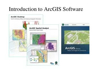
What is ArcGIS Spatial Analyst? • Integrated raster and vector spatial analysis tools • Extension product that adds functionality to all ArcGIS applications
Key Features • More than 300 functions and operators • Analysis on all raster formats • Analysis on all vector formats • On-the-fly projections • Great developer tools
The Spatial Analyst toolbar Has dialogs for the mostcommonly-used tools Can composeMap Algebraexpressions Has its own environment (not part of geoprocessing) A
Analysis Tools • Density Mapping • Neighborhood and Block Statistics • Zonal Overlay • Surface Analysis • Hydrologic and Groundwater Analysis • Reclassification
Density Mapping • Count occurrences of a phenomena within an area and distribute it through the area. • Use points or lines as input. • Population per Km2 • Road density per Mi2
Neighborhood and Block Statistics • Calculates a statistic for a neighborhood • Majority, Maximum, Mean, Median, Minimum, Minority, Range, Sum, Standard Deviation, Variety • Used for filtering, data smoothing, and data aggregation
Zonal Overlay • A zone is all the areas/cells with the same value. • Calculate a statistic within the zones for each cell in a raster.
Mean Slope per Watershed Watersheds Zonal Overlay (cont.) Slope
Surfaces Surface Analysis • Hillshade • Slope • Viewshed • Cut/Fill • Curvature A Demo
Reclassification • Reclassify individual values or ranges of values. • Load and save reclass tables.
Hydrologic Analysis • Create watersheds and stream networks from DEMs • Flow Direction • Flow Accumulation • Watershed Delineation • Flow Length • Sink Filling • Stream Ordering
What’s New in Spatial Analyst at 9.2? • Solar radiation tools • New math functions • Weighted Sum tool • Spline with Barriers • Histogram tool colors now match layer
What’s New in Spatial Analyst after 9.2? Performance Improvements Combine 40x faster (SP1) Was 1 hr, now 1.5 minutes on 250 thousand combinations Now works on millions of combinations Fill 45x faster Was 9.5 hrs, now 12 minutes on 350mb DEM with over 2 million sinks. Improved error messages and status New Contour with Barriers tool