Download
1 / 10
410 likes | 1.76k Views
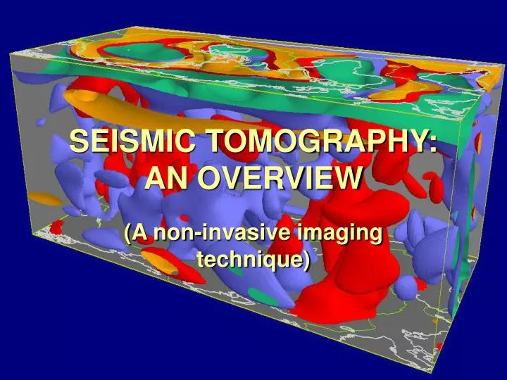
SEISMIC TOMOGRAPHY: AN OVERVIEW. (A non-invasive imaging technique). Introduction. What is seismic tomography? - technique that maps the interior of the earth in a 3-D image How is it done? - this technique uses earthquakes or explosions as transmitters and seismometers as detectors

E N D
SEISMIC TOMOGRAPHY: ANOVERVIEW (A non-invasive imaging technique)
Introduction • What is seismic tomography? - technique that maps the interior of the earth in a 3-D image • How is it done? - this technique uses earthquakes or explosions as transmitters and seismometers as detectors - other sources include p and s waves, surface waves, Moho reflections and controlled source in a borehole
Introduction (cont’d.) • many images are based on spatial distr. of p and s wave velocity which is determined by travel time data • data is gathered from numerous stations across the Earth
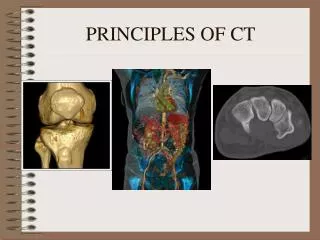
Radiological vs. seismic tomography • equations to be solved are similar • huge difference in scale of the objects to be mapped • the number of detectors used in radiology is greater than those used in seismology - insures a much more accurate 3-D reconstruction image of the object • can verify the reconstructed image in medicine using other medical tools
Real world examples • East Africa - using seismic tomography geophysicists have mapped the slow creation of new ocean floor • San Andreas fault zone
Findings • below the crust, the Earth is fairly homogeneous - magnitude of heterogeneity is greatest at the top, decreases monotonistically with depth, and increases again at the outer core-mantle boundary • with this technique we can “age” the different sections of the mantle or estimate the time it takes for magma plumes to rise to the crust and fall back to the outer core
Findings (cont’d.) • oceanic plate subduction is another velocity anomaly • easier to determine the location of the velocity anomaly and map the phenomenon • roots of volcanoes - recently, geologists have found they are generally characterized by low-velocity anomalies
Methods • widely used methods to reconstruct images in this field are direct inversion method and iterative algorithms LSQR - both give similar results • the direct inversion method and iterative back-projection method were compared as well - though greater computer efficiency of the latter
Methods (cont’d.) • ‘sequential estimation’ - more effective in exploiting the sparseness of matrix inherent in tomography technique - basically uses one datum at a time; solution and the resolution and error covariance matrix are evaluated simultaneously - computer time needed for evaluating matrix using recursive inversion is between direct and iterative inversion - though, never used in seismic tomography
Future Directions • some ways to improve seismic tomography - more seismometers that are situated closer together and are uniformly distributed • using all data recorded rather than just the arrival times • recursive inversion method