Download
1 / 55
590 likes | 991 Views
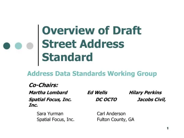
Co-Chairs: Martha Lombard Ed Wells Hilary Perkins Spatial Focus, Inc. DC OCTO Jacobs Civil, Inc. Overview of Draft Street Address Standard. Address Data Standards Working Group. Sara Yurman Carl Anderson Spatial Focus, Inc. Fulton County, GA. Sponsoring Organizations.

E N D
Co-Chairs: Martha Lombard Ed Wells Hilary Perkins Spatial Focus, Inc. DC OCTO Jacobs Civil, Inc. Overview of Draft Street Address Standard Address Data Standards Working Group Sara Yurman Carl Anderson Spatial Focus, Inc. Fulton County, GA
Sponsoring Organizations • URISA – Submitting organization • NENA – Supporting organization • U.S. CensusBureau – Support, on-going maintenance
Urban & Regional Information Systems Association • URISA is a non-profit educational and professional association • Mission: “To promote the effective and ethical use of spatial information and information technologies for the understanding and management of urban and regional systems.” • 7,000 national and chapter members in the US and Canada • Members from government, private, and academic sectors • Slightly more than half are state and local government employees
National Emergency Number Association • NENA is a professional association of 7,000 members and 46 chapters dedicated to providing effective and accessible 9-1-1 service for North America • NENA fosters the technological advancement, availability, and implementation of a universal emergency telephone number • NENA promotes research, planning, training, and education • NENA's objectives include the protection of human life, the preservation of property, and the maintenance of general community security
Other Organizations Represented • Local, regional, and state government • 911/Emergency management associations • Federal agencies • GIS software vendors and consultants • Universities • Other standards organizations
FGDC Proposal • In April 2005, the Federal Geographic Data Committee (FGDC) accepted a proposal from URISA to create a street address data standard • The standard is being prepared under the auspices of the FGDC Subcommittee on Cultural and Demographic Data • If the standard is adopted, Census Bureau will be maintenance authority
Work Plan • Convene core committees • Work primarily by collaborative website • Teleconferences monthly • Meet two times: • August: Street Smart Conference • Austin, TX • October: URISA Annual Conference • Kansas City, MO
Core Committee Structure • Policy and Coordination • Content and Classification • Data Quality • Exchange
Participant Roles • Participants (Core Committees): writers/editors/provocateurs for draft sections and responding to comments • Reviewers: review and work with the committee to create the drafts • Observers: review drafts and provide comments or recommendations on behalf of themselves and/or their organization
Schedule • Present first draft at Street Smart and Address Savvy Conference (Austin, August 15, 2005) - Complete • Post to URISA website for review & comment - Complete • Synthesize comments - Complete • Present revised draft at the URISA annual conference in Kansas City (October, 2005) - Complete • Second review period – Underway, ends December 31, 2005 • Synthesize comments • Submit revised standard to FGDC for full public review, comment adjudication, and approval as a draft standard (early 2006)
Introduction to the Draft Standard • Provides background information. • Defines address. • Describes the goals and objectives. • Lays out the standards development process. • Identifies the maintenance authority.
Street Address Definition • A street address specifies a location by reference to a thoroughfare, or a landmark; or it specifies a point of postal delivery • Four basic classes of street address: • Thoroughfare addresses • Landmark addresses • Postal addresses • General addresses (can be any of these three)
Why A Street Address Standard? • Street addresses are the location identifiers most widely-used by state and local government and the public. • Street addresses are critical information for administrative, emergency response, research, marketing, mapping, GIS, routing and navigation, and many other purposes. • Street addresses have evolved over many decades, under the control of thousands of local jurisdictions, in many different record and database formats, and to serve many purposes. • The variety of different address formats and types pose a number of complex geoprocessing and modeling issues. • As a consequence, government agencies struggle with these issues as they seek to integrate large, mission-critical files into master address repositories.
Goals • Create a street address content and classification standard that provides the foundation for data exchange and data quality standards • Define tests of street address data quality • Provide a statement of best practices for street address data content and classification • Offer a migration path from legacy formats to standards- compliant ones • Different users may require different levels of standardization • Build on previous FGDC address standard efforts
Objectives • Objective: Create a data standard for street addresses • Content • Classification • Quality • Exchange One Standard – Four Parts
Comment SummaryIntroduction • 21 comments • Most related to the overall scope and goals of the standard: • Clarify objectives / explain the benefits • Lean toward rigidity in conformance • Tell custodians of data what’s expected of them • Clarify geographic extent of the standard • Include an acronym list and a statement of best practices
Part 1: Content • Simple Elements • Address Number • Street Name • Building, Floor, & Unit • Intersection • Landmark Name • Larger-Area • Postal Address • Complex Elements • Address Attributes
Address Number Elements • Prefix: B317 Main Street • Number: 123 Main Street • Suffix: 123 1/2 Main Street
Street Name Elements • Pre-modifier: Old North B Street • Pre-directional: North Main Street • Pre-type: Avenue A • Name: Main Street • Post-type: Main Street • Post-directional: Main Street North • Post-modifier: B Street Extended
Building, Floor, Unit • Building Type • Building ID • Floor Type • Floor ID • Unit Type • Unit ID Building 12, Mezzanine Level, Suite 200
Separator and Landmark Elements • Separator Element • Fifth Street and Main Street (intersection) • 100 – 199 Main Street (range) • Landmark Name • Statue of Liberty • Galleria Mall • Winona Park Elementary School
Larger-Area Elements • Community (Urbanization) Place Name • Municipality Place Name • USPS Place Name • County • State • ZIP Code • ZIP+4 • Nation
Postal Address Elements • Postal Box Type, Postal Box ID • Postal Group Type, Postal Group ID • USPS General Delivery Point • PO Box 6943 • RR 1, Box 27 • CMR 4, Box 2 (overseas military) • General Delivery
Complex Elements • Complete Address Number • Complete Street Name • Building, Floor, Unit • Complete Occupancy Identifier • Address Range • Complete Feature Address • Place Name • Place State Zip
Address Attributes • Address ID • Descriptive Attributes • Address Class • Address Feature Type • Lifecycle Status • Address Status (official, alias) • Address Range Type • Location Description
Address Attributes (continued) • Location Attributes • Address X Coordinate • Address Y Coordinate • US National Grid Coordinate • Address Z Value • Latitude • Longitude • Address Lineage Attributes • Starting Date for Address Status • Ending Date for Address Status • Address Direct Source • Address Authority • FIPS Identifiers for Addressing Authority
Address Attributes (continued) • Address Quality Elements • Parity • Address Scheme Origin • Address Scheme Axes • Street Sequence • Street Name Group
Comment SummaryPart One: Content • 97 comments • Additional content elements • Lat-long, z-value, parity, land use • Abbreviations • Extensive discussion, trade-off on quality • More information on implementation • Will create an Implementation Guide • Clarifications and Definitions • Glossary • Spanish Syntax • Consistent use of Spanish elements
Part 2: Classification • Classes Defined by Syntax • Classes defined by their data elements and the order in which they are arranged • Four Classes • Thoroughfare Address • Landmark Address • Postal Address • General Address
Thoroughfare Classes A thoroughfare in this context is a linear feature used to travel from or to a specific location. A thoroughfare is typically but not always a road — it may be, for example, a walkway, a railroad, or a river. • Site:1230A North Main Street Extended • Landmark-Site:City Hall, 410 Main Street • Intersection:Seventh Street and D Street • Address Range:110-126 Main Street • Block Range (TIGER format): • 100-130, 101-135 Main Street
Landmark Classes A landmark is a named point or area that is prominent enough in the local landscape as to be publicly known. • Single Site:Howard University • Multi-site:Truth Hall, Howard University • Community:123 Urbanization Los Olmos
Postal Classes Postal addresses specify points of postal delivery which have no definite relation to the location of the recipient, such as post office boxes, rural route boxes, etc. • USPS Postal Delivery Box:PO Box 6943 • USPS Postal Delivery Route:RR 1, Box 100 • USPS General Delivery Address:General Delivery, Elko NV
General Class • Holds addresses of any class: Complete Feature Address, Place, State, ZIP, ZIP+4 • For general mailing and contact lists • Supports specialized profiles such as USPS Publication 28 standard • A starting point for parsing and classification
Debated Issues • Abbreviate, or spell out completely? • Use the name as given by the local authority • Spell everything out in the base record • Use views and interfaces to abbreviate • What is the place name? • Community, Municipality, USPS, County • Record all; recommend rules for picking one • Are TIGER-style block ranges an address class? • How to handle leading zeros in Address Number?
Comment SummaryPart Two: Classification • 21 comments • Clarification and Definition • Glossary • More information on implementation • Will create an Implementation Guide
Part 3: Quality • Goal: Help implement quality control for addresses, not redefine principles of spatial quality • Existing Standards and Documents Describing Spatial Data Quality • Content Standard for Digital Geospatial Metadata • Topic 11: OpenGIS Metadata (ISO/TC 211 DIS 19115) • Supporting ISO Geographic Information standards • 19113: Quality principles • 19114: Quality evaluation procedures • Spatial Data Transfer Standard (SDTS)
Elements of Quality • Elements appearing in both Content Standard for Digital Geospatial Metadata (CSDGM) and OGC Topic 11 (ISO 19115) • Dataset Identity • What is this stuff? • Attribute (Thematic) Accuracy • What do we know about it, and with what degree of certainty? • Logical Consistency • If (A = B), do A and B both exist? • If the Official Status of an address is Active, is there a number assigned? • Completeness • Are all the addressable objects within the schema or jurisdiction addressed? If not, do we know why?
Elements of Quality (continued) • Elements appearing in both Content Standard for Digital Geospatial Metadata (CSDGM) and OGC Topic 11 (ISO 19115) • Positional Accuracy • Do we know where it is? • Does where we think we know it is align with anything else? • Lineage • How did it happen? Who did this? • Temporal Accuracy • Independent OGC/ISO Element, Dependent CSDGM Element • How long has it been like that? • Are we sure?
What's Different about Addresses? • Uncertainty and Addresses • Address source • Date and conditions of assignment • Current status: lifecycle and official • Agreement with local address schema • Ground conditions:posting, street signs, etc. • Coordinate location • Local schema and domains of values
Testing Address Quality • Tests grouped by Content and Classification: • Simple Elements • Complex Elements • Attributes • Address Classes • Tests described by: • Measure Name • Measure Description • Report • Evaluation Procedure • Pseudocode Example (Pseudo SQL)
Why SQL? • Platform-neutral, portable logic • Standard spatial predicates described in the OpenGIS Simple Features Specification for SQL (SFSQL) • Has enough logic to describe one implementation of the Evaluation Procedure • Generalized, but close enough for spatial database users to adapt quickly
Comment SummaryPart Three: Quality • 5 comments • This section was provided in outline form only for the first review period. As such the comments focused on what should be included when the section was complete.
Part 4: Exchange Two basic forms: • Monolithic or Complete • Transactional or Incremental The address data exchange standard supports both types using slightly different structures. Required Elements: • Address Data • Metadata
Local Dataset XML Export Exchange Engine Data and Metadata XML Import Exchange Engine Data and Metadata Destination Dataset Exchange (continued)
Reasons for XML Business reasons for using XML as the exchange data language • FGDC standards require its use • XML protects content producers and content consumers from changing data • Field order is unimportant • Missing fields don't prevent exchanges • Extra fields don't prevent exchanges • XML is extensible
Preparing to Exchange Data • Undo localizations of data (normalize the data) • Reparse data into one of the four Address Classes • Express data in the XML format of the Standard • Prepare metadata describing the data being exchanged
Preparing Data (sample) 125 | E 11th | St | Austin | TX | 78701 reparse local data into normal form 125 | East | 11th | Street | Austin | TX | 78701 express data in XML <ThoroughfareAddress> <CompleteAddressNumber AddressNumber=”125” /> <CompleteStreetName StreetPreDirectional=”East” StreetName=”11th” StreetPostType=”Street” /> <PostalZip>78701</PostalZip> <PostalPlaceName>Austin</PostalPlaceName> <PostalState>TX</PostalState> <AuthorityId>4845305000</AuthorityId>” </ThoroughfareAddress>