Download
1 / 24
240 likes | 498 Views
Robert Atlas NOAA/Atlantic Oceanographic and Meteorological Laboratory February 5, 2008. Issue. Hurricanes represent one of the Nation’s greatest environmental threats Increasing vulnerability along the Nation’s coast

E N D
Robert Atlas NOAA/Atlantic Oceanographic and Meteorological Laboratory February 5, 2008
Issue • Hurricanes represent one of the Nation’s greatest environmental threats • Increasing vulnerability along the Nation’s coast • NOAA reduced track errors by about 50% over the last 20 years, butlittle progress was made to reduce the intensity forecast error. • Given recent events, • Katrina and Wilma causing catastrophic damage in 2005 • Back-to-back Category 5 storms in the Caribbean Sea - Dean and Felix in 2007 • Rapid intensifiers just prior to landfall - Charlie (2004) and Humberto (2007) • HIRWG and national reports calling for major investments in hurricane research The time is now for NOAA to lead an aggressive effort with commensurate investments to improve its hurricane forecasting capability.
NOAA’s Response • Established Hurricane Forecast Improvement Project (HFIP) • Develop a balanced and prioritized 10-year project plan building on recent reports and recommendations • Define roles and responsibilities for each stage of plan • Rate of progress linked to funding • Specify stretch goals and metrics • Develop metric for rapid intensity change and linkage to other existing metrics
HFIP Leadership (HEOB) • The membership of the HFIP Executive Oversight Board (HEOB) includes: • NWS AA, Dr. John L. Hayes (Co-Chair) • OAR AA, Dr. Richard Spinrad (Co-Chair) • NESDIS AA, Ms. Mary Kicza • NOS AA, Mr. John H. Dunnigan • NMFS Senior Designee, Ms. Bonnie Ponwith • PPI AA, Dr. Paul Doremus (Acting) • NMAO, Director or Designee (TBD) • Director, NHC/NWS, Dr. Edward Rappaport (Acting) • Director, AOML/OAR, Dr. Robert Atlas • Director, NCEP/NWS, Dr. Louis Uccellini • Director, Office of the Federal Coordinator for Meteorology, Mr. Sam Williamson
HFIP Team • Dr. Frank Marks and Dr. Ahsha Tribble were selected as the Project Lead and Deputy Project Lead, respectively. Fred Toepfer is the Project Manager. They formed a project team including: • Program Manager, Environmental Modeling Program: Mr. Fred Toepfer • Program Designee, Local Forecasts and Warnings: Mr. Scott Kiser • Program Manager, Science and Technology Infusion or designee: Dr. Chris Fairall • NESDIS Representative: Dr. Mark DeMaria • Hurricane Program Director, Aircraft Operations Center: Dr. Jim McFadden • Program Manager, NMAO Aircraft Services: RADM Phil Kenul • HWRF Program Manager and EMC Hurricane Lead: Dr. Naomi Surgi • OFCM/JAG/TCR representative: Mr. Mark Welshinger • ELDP Candidate (NWS): Mr. Mark McInerney • Executive Secretariat: NWS/Dr. Daniel Meléndez • OAR/Mr. Roger Pierce
Significance of Rapid Intensity Change • Rapid intensity (RI) change (≥30 kt in 24 hours) has a significant impact on preparedness and evacuation actions for emergency managers • Greatest forecast challenge for hurricane forecasters • Not handled well by current operational models • High priority in HIRWG report and past NOAA research solicitations • 83% of major hurricanes have at least 1 RI event • Major hurricanes are responsible for 80% of all hurricane damage • Linked to changes in storm structure and storm surge • Research and operational efforts necessary to improve forecasts of rapid intensity change will also improve intensity and track forecasts.
HFIP Performance Metrics • Reduce average track error at Days 1 - 5 • Reduce average intensity error at Days 1 - 5 • Increase probability of detection (POD) for rapid intensity change for Days 1 through 5 • Decrease false alarm ratio (FAR) for rapid intensity change for Days 1 through 5 • Quantify and reduce the uncertainty in the forecast guidance
Primary HFIP Metric Goals HFIP “stretch” goals for model guidance for rapid intensification NOAA Geophysical Fluid Dynamics Laboratory (GFDL)
Scope of HFIP Plan NSB HIRWG OFCM Modeling and Data Assimilation Observing Strategies and Observations T2O Critical mass Impacts on Engineered Structures HFIP Ecosystem Impacts Storm Surge Rainfall and Inland Flooding Socio-Economic Impacts Predictability/ Uncertainty Operational Needs Forecasting Hurricane Modification Climate Interactions Preparedness and Response
HFIP Portfolio* • IMPROVEHurricane Forecast System/Global Forecast System TO REDUCE ERROR IN INTENSITY AND TRACK FORECASTS • OPTIMIZE observing systems TO ENHANCE research and operations CAPABILITIES AND IMPACTS • EXPAND AND IMPROVEforecaster tools and applications TO ADD VALUE TO MODEL GUIDANCE * Addresses most HIRWG Recommendations
HFIP Portfolio (I) Improve Hurricane Forecast System (HFS)/ Global Forecast System (GFS) to improve intensity and track forecasts ACTIVITIES NEEDED: Develop, test, and implement: Near (~5yrs) and long term (~10-15yrs) high resolution HFS Next-generation high-resolution GFS to improve track forecasts HFS, GFS and multi-model ensembles to quantify and bound uncertainty Next-generation storm surge modeling system Invest in research on physical processes, ensemble modeling, and post-processing for developing probabilistic forecast guidance Increase high performance computing (HPC) capability Increase efficiency of transition from research to operations
HFIP Portfolio (II) • Optimize Observing Systems for Research and Operations (modeling and direct use by forecasters) A capability is needed to evaluate the utility of different observing platforms and instrumentsand advise NOAA on its observing investments for improvements in tropical cyclone analysis, forecasting, and operational modeling. Capability is directly relevant to QuikSCAT evaluation and to DWL
HFIP Portfolio (II) cont. ACTIVITIES NEEDED: • Establish evaluation capability to: • Support NOAA in its investment decisions on observing systems and platforms • Define future research & development observing strategies to improve hurricane prediction • Prioritize observing systems investments targeted to improve forecasts of intensity change • Demonstrate the utility of observations to improve HFS guidance • Targeted field experiments focused on key physical processes • Optimize transition of observing system advances for direct use by forecasters • Improve access to and utility of new observations for the forecasters • Streamline process to transition new observations and platforms into operations ---- Ensure life-cycle plan provides sufficient operations and maintenance support
HFIP Portfolio (III) Examples: Observing tools: Stepped-Frequency Microwave Radiometer (SFMR), airborne Doppler radar, QuikSCAT Applications such as: Wind speed probabilities, Rapid Intensity Index (RII), DOD/NOAA Automated Tropical Cyclone Forecast (ATCF) system Forecast product enhancements: Consensus ensembles, model confidence III. Expand and improve forecaster tools and applications to add value to NWP output ATCF
HFIP Portfolio (III) cont. ACTIVITIES NEEDED: Fund internal and external applied research to develop new operational tools Enhance Joint Hurricane Testbed (JHT) to transition projects into operations Improve model guidance, observing capabilities and related data assimilation schemes
Output The overarching goal of this project is improved forecasts and reduced uncertainty of tropical cyclones forecasts to enhance mitigation and preparedness by decision makers at all levels of government and by individuals. Outcomes: • Improved hurricane forecast guidance • Accelerated and streamlined transition of research to operations and applications • Established evaluation capability for observing systems to advise NOAA on its investments to improve access, impact, and utility of observations for operations and research • Developed strategy to increase high performance computing capacity and capability for hurricane forecasting (provide business case for investment) • Expanded and developed tropical expertise for enhanced interaction with the operational modeling and research communities
Next Steps • Internal Reviews • Internal Briefings (for FY09, FY10-14 budgets) • CFO Council – Feb 2008 • CIO Council – Feb 2008 • NEP – Feb 2008 • Engage the external community: • AGU Meeting • AMS Annual Meeting • Hurricane/Tropical Conferences (AMS, OCFM, N.H.C.) • Considering a Request for Information (RFI) • Congressional Staff Briefings
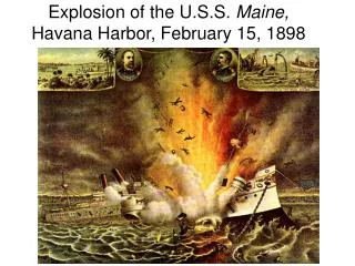
DiscussionHurricane Charley: 9-14 Aug. 2004 • Charley strengthened from a Category 2 to a Category 4 in only 5 hours, less than 3 hours prior to landfall. • Official forecasts called for Charley to strengthen from a Cat 2 to Cat 3 by landfall • In the U.S., Charley was responsible for: • ~$14 billion in damages • 10 direct and 25 indirect deaths
DiscussionHurricane Dean (2007) Dean RI event: 12 UTC 17 August - 03 UTC 18 August • Peak wind: • 85 kt to 125 kt • change of 40 kt in 15 h • Wind field area increase & doubling of integrated kinetic energy (IKE) 21 UTC 16 August 09 UTC 18 August
DiscussionFelixRapid Intensity Change Felix became Cat 1 at 0300 UTC 2 Sep and Cat 5 by 0000 UTC 3 Sep Felix intensified from Cat 1 to Cat 5 in < 21 hours Cat 5 Cat 4 Cat 3 Cat 2 Cat 1 WP-3D 0902I WP-3D 0902H WP-3D 0903I WP-3D 0901H AFRC C-130 *Data from NHC (http://www.nhc.noaa.gov/archive/2007/FELIX.shtml?)
DiscussionRapid Intensification Implications • Hurricane Felix intensified from Cat 1 to Cat 5 in < 21 hours! • A “Felix-like” forecast error in the vicinity of a heavily populated area would have significant and possibly catastrophic consequences (e.g., Katrina – storm surge) • To improve forecast and reduce risks our nation should accelerate • advances in the science and technology of our future forecast system, • rate of adoption of the above results forecast operations • improve communication to concerned decision makers in vulnerable areas • Experts agree that the following areas require major improvements • Scientific understanding rapid hurricane intensity change • Numerical modeling capabilities (faster computers and better models) • Observations of rapid intensity change as well as those with research value • The scientific community as a whole recommended in numerous reports the need for a range of approaches as opposed to a any particular one
POD Official +30 kts DiscussionPOD vs Lead Time
FAR Official +30 kts DiscussionFAR vs Lead Time