Download
1 / 10
110 likes | 393 Views
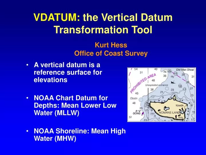
VDATUM: the Vertical Datum Transformation Tool. Kurt Hess Office of Coast Survey. A vertical datum is a reference surface for elevations NOAA Chart Datum for Depths: Mean Lower Low Water (MLLW) NOAA Shoreline: Mean High Water (MHW) . RTK/PPK-GPS Hydrographic Surveys.

E N D
VDATUM: the Vertical Datum Transformation Tool Kurt Hess Office of Coast Survey • A vertical datum is a reference surface for elevations • NOAA Chart Datum for Depths: Mean Lower Low Water (MLLW) • NOAA Shoreline: Mean High Water (MHW)
RTK/PPK-GPS Hydrographic Surveys Depths are measured “on the fly” relative to ellipsoidal datum (e.g., WGS84). Depths need to be converted to chart datum (MLLW). • Eliminates need for: • -tide gauges during survey • settlement & squat • corrections for survey vessel • time-consuming post-survey • processing
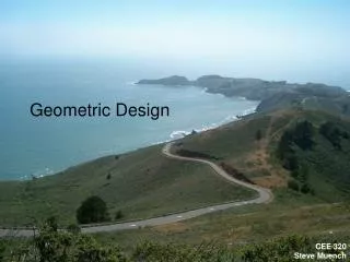
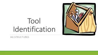
‘MSL’ Mapped Shoreline Elevations MHW MLLW (MLW) NAVD 88, NGVD 29 Depths NAD 27 NAD 83 Need to Integrate Land and Water Datasets with Different Elevation Reference Systems NOAA USGS (Tidal Datums) (Intertidal) (Orthometric Datums) MLLW MHW Charted Charted Shoreline Shoreline
How to convert between these various datums? Vdatum Conversion Software Tidal DatumsMHHWMHWMSLMLWMLLW Orthometric Datums NAVD 88 NGVD 29 Ellipsoidal Datums WGS 84 ITRFxxxx NAD 83
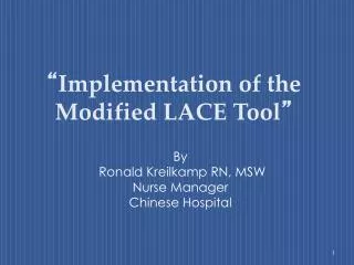
DELAWARE BAY PPK-GPS SURVEY, June 2001 Tide Zones VDatum gives a more realistic series of depths values VDatum vs Zoning : VDATUM conversion fields ‘Jump’ due to crossing tide zones
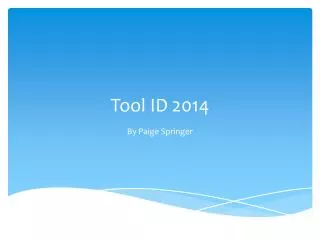
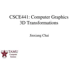
Digital Elevation Models to StudySea Level Rise in North Carolina NC Land Elevation Inundated areas due to a 30 cm sea level rise NOAA Bathymetry Integrated DEM
LIDAR data transformed from ellipsiodal to the MHW datum using VDatum. NOAA T-Sheet MHW shoreline (1977) 0 m contour is MHW shoreline (1996) Consistently–defined Shoreline • first true consistently- • defined MHW shoreline • can utilize topographic • LIDAR data from many • sources • can also measure MLLW • from bathymetric LIDAR • true interface between • bathymetry & topography
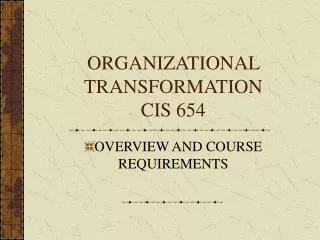
VDATUM TODAY Areas where VDatum tool is complete and available to the public
In Summary, VDatum Supports: • Faster, cheaper, more accurate hydrographic survey data • Merging NOAA bathymetric data for GIS and other uses • Integrated bathymetric-topographic DEMs for: • Storm surge and flooding • Port planning and Homeland Security • Sea Level Rise studies • LIDAR coastal elevation data for: • Consistently defined shoreline for NOAA, USGS • NOS charting products • maritime boundaries
Issues • We must educate users about the importance of understanding and using the various vertical datums and reference systems • Establishing VDatum for entire US will require (1) setting priorities for geographic areas and (2) long-term hydro survey planning • Tide and surveyed benchmark data are often lacking or are outdated. Also true for bathymetric data, which are needed for tide modeling • There is a need for many more elevation measurements (e.g., LIDAR) in the inter-tidal zone