Download
1 / 19

E N D
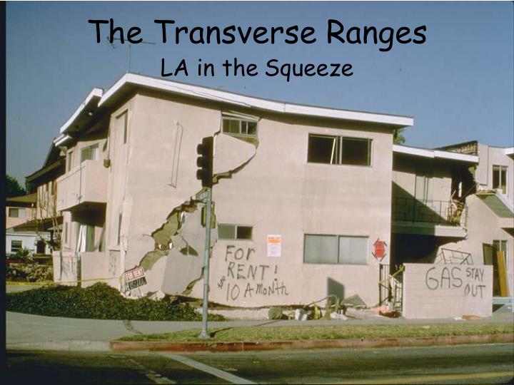
The Transverse Ranges LA in theSqueeze
The coastline from Ventura to Point Conception beyond Santa Barbara is unusual in that it faces south, not west, toward the mountainous Northern Channel Islands, a submerged mountain range that projects westward from the Santa Monica Mountains north of Los Angeles.
The Santa Ynez Range and the Topa Topa Mountains rise north of Santa Barbara and Ventura, and farther east are the San Gabriel and San Bernardino Mountains, raised up because the Big Bend of the San Andreas Fault causes continental crust of the North American Plate to collide with crust of the Pacific Plate. These are collectively known as the Transverse Ranges, so called because they are transverse to the normal north-south trend of ranges along the Pacific margin of North America.
The Transverse Ranges are one of the Earth’s most rapidly uplifting areas. The steep, rugged mountains along the Big Bend are some of the evidence of rapid uplift. The stepped marine terraces near Ventura and Palos Verdes provide further proof of rapid uplift: the terraces there are rising by as much as 5 to 10 mm per year.
Sudden dramatic uplift takes place during some earthquakes. During the 1994 Northridge earthquake, the Santa Susana Mountains rose 70 cm, and during the 1971 San Fernando Earthquake, the same mountains rose about 2 meters. Damage resulting from 1971 San Fernando Earthquake Damage resulting from 1994 Northridge Earthquake
The mountain ranges are raised to the highest elevations in southern California, and between them the crust is dropped down to depths of many miles – although this fact is hidden by great thicknesses of sediment beneath the valleys. From west to east, these thick basins of sediment include the Santa Barbara Channel, the Ventura Basin, the San Fernando Valley, the Los Angeles Basin, and the San Gabriel and San Bernardino valleys.
The great thicknesses of sediment resulted in vast accumulations of oil and gas in the Ventura and Los Angeles basins and in the Santa Barbara Channel, adding to the wealth of southern California.
The borders between basins and mountains are typically active faults – either reverse faults or strike-slip related to the San Andreas Fault System.
The 1994 Northridge, 1987 Whittier Narrows (ML 5.9) , and 1971 San Fernando earthquakes were all centered on reverse faults buried beneath the Los Angeles Basin. The 1983 Coalinga Earthquake (ML 6.5) was also centered on a blind fault, one of several bordering the western edge of the San Joaquin Valley. Wall Damage to Building in Downtown Coalinga Damage to State Theater Building, Coalinga
Second Floor Wall Failure on Coalinga House The Coalinga Earthquake of May 2, 1983 had a magnitude of 6.7, caused $31 million in damage, but no deaths. The most severe damage occurred to the old (usually pre-1930) one- and two-story buildings of unreinforced brick masonry wall construction, with floors and roofs of wood. Total Collapse of Front of Residence, Coalinga
Partial Collapse of Parking Garage, Whittier, CA, 1987 Earthquake The October 1, 1987 Whittier Earthquake (ML 5.9) killed 3 people and caused $350 million in damage Collapse of Wall of Store in 1987 Whittier, CA Earthquake
The January 17, 1994 Northridge Earthquake (ML 6.7)was one of the worst natural disasters in the history of the United States. Partial collapse of Bullocks Department Store Collapsed roof near Northridge Mall
Partially collapsed parking structure, Cal State Univ. - Northridge Northridge statistics include 56 dead, 25,000 dwellings uninhabitable, and $10 billion in damage. I-5 and SR-14 Freeway collapse
Collapse of apartment building over garage in Reseda Damage to Kaiser Clinic in Granada Hills
On February 9, 1971, at 6:01 A.M. local time, a magnitude 6.5 earthquake occurred in the San Fernando Valley, 20 miles north of Los Angeles. The San Fernando earthquake was felt over an area of 80,000 square miles. The statistics include 58 dead and $497.8 million in damage. Damage at I-5 and I-210 Freeway Interchange Damaged home in Crestview Park
Aerial view of damaged Olive View Hospital Aerial view of damage to San Fernando VA Hospital
In metropolitan Los Angeles, numerous other active faults lie beneath the surface. These include left-lateral faults such as the Santa Monica Fault, Hollywood Fault, Raymond Fault, and San Jose Fault. Reverse and thrust faults are likewise numerous and include the Sierra Madre-Cucamonga Fault, Elysian Park Blind Thrust Fault, Las Cienegas Blind Thurst Fault, and Compton-Los Alamitos Thrust.
It’s clear that metropolitan Los Angeles, including the Los Angeles Basin, San Gabriel Valley, and San Fernando Valley, is laced with active faults. The majority of these faults appear to be slipping very slowly, which suggests that the recurrence interval for earthquakes on these faults is measured in thousands of years, in comparison with hundreds of years for the San Andreas Fault System. The reason these faults are so important is that earthquakes on them would affect millions of people in Los Angeles. There is evidence from the Sierra Madre Fault that larger earthquakes than those of the Coalinga, Whittier, San Fernando and Northridge earthquakes – as large as M 7.6 – are possible. Such an event would be catastrophic for southern California.
The situation in the Ventura Basin is a little different. Several faults that include the Oak Ridge, San Cayetano and Santa Susana faults – and quite possibly the Red Mountain Fault as well – have slip rates that are quite a bit higher than those to the south. This suggests a shorter recurrence interval for earthquakes along these faults; a thousand years or less.