Download
1 / 19
620 likes | 1.43k Views
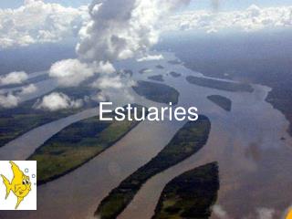
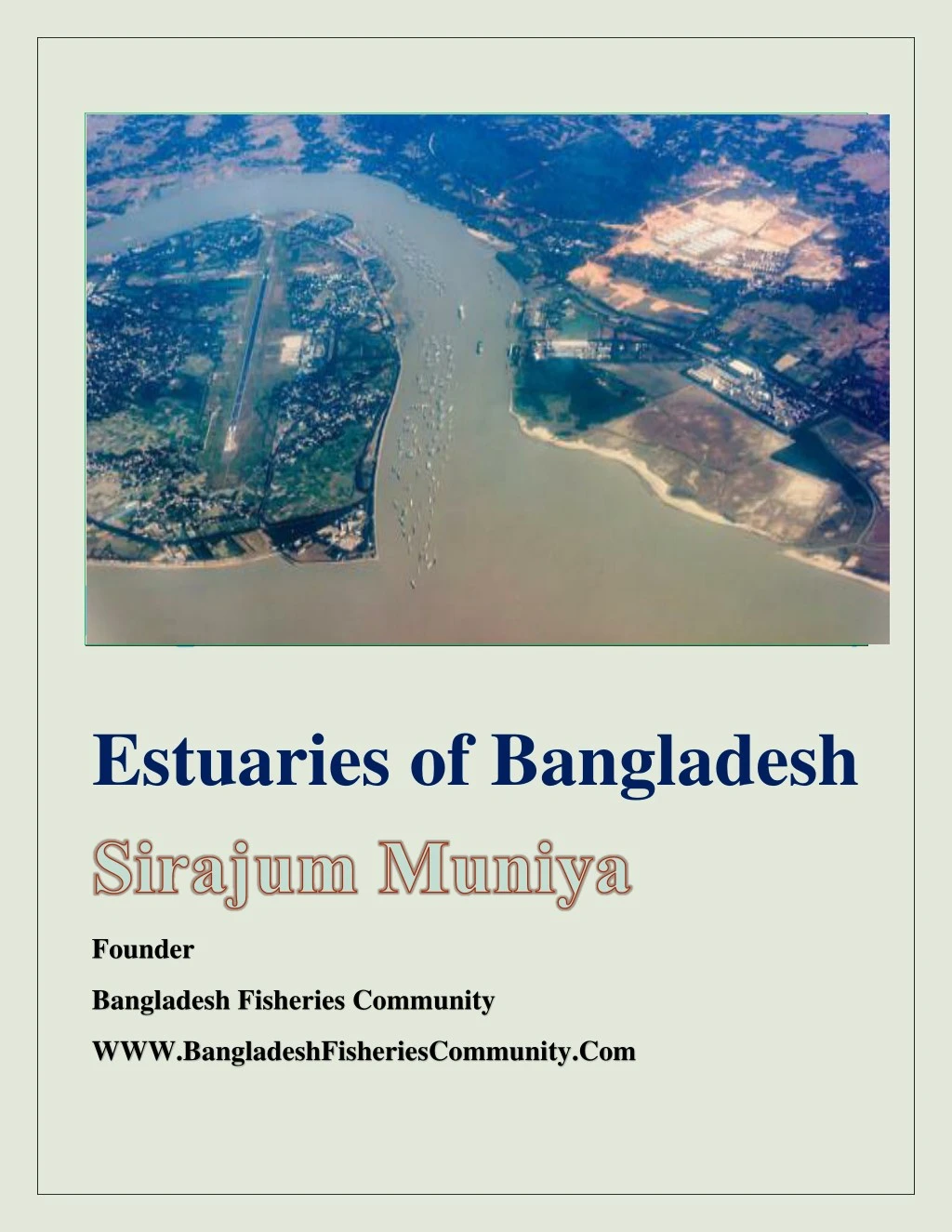
Bangladesh is a low lying, riverine country located in South Asia with a largely marshy jungle coastline of 580 km on the northern littoral of the Bay of Bengal.<br>

E N D
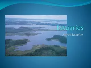
Estuaries of Bangladesh Founder Bangladesh Fisheries Community WWW.BangladeshFisheriesCommunity.Com
Estuaries of Bangladesh Estuaries of Bangladesh No. of Topics Name of The Topics Page Number 2 1. Definition of Estuary 2. Common features of estuaries 2 3 (4 -15) 4-5 6 7 8 8-9 10-11 11 11-12 13 14 14-15 15 15 16 3. Name of estuaries of Bangladesh 4. Major Estuaries of Bangladesh 4.1 The Meghna River Estuary 4.2 The Karnafuli River Estuary 4.3 The Sundarbans Estuary 4.4 The Haringhata River Estuary 4.5 The Hariavhanga River Estuary 4.4 The Muhuri River Estuary 4.5 The Sangu River Estuary 4.6 The Naf River Estuary 4.7 The Matamuhuri River Estuary 4.8 The Icchamati River Estuary 4.9 The Feni River Estuary 4.10 The Kirtonkhola River Estuary 4.11 The Bakkhali River Estuary Conclusion 5. 6. References 17 www.bangladeshfisheriescommunity.com Our PageOur Group
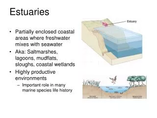
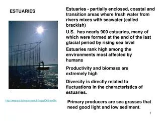
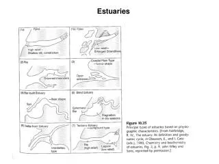
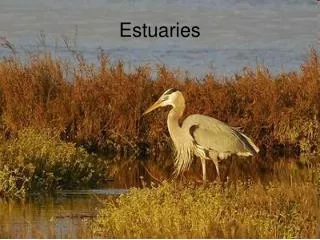
Estuaries of Bangladesh Estuaries of Bangladesh An Estuary is a partially enclosed body of water formed where freshwater from rivers and streams mixes with salty sea water. An estuary is a channel that has the sea at one end and a river at the other; in an estuary, seawater is appreciably diluted. In estuaries, the fresh river water is blocked from flowing freely into the open ocean by either surrounding mainland, peninsulas, barrier islands, or fringing salt marshes. This mixing of fresh and salt water creates a unique environment that brims with life of all kinds. It is a transition zone between the land and sea. Common Features of estuaries Estuaries are unique ecosystems unlike any other on Earth. The rivers forming estuaries are the most productive on Earth. They create more organic material than most other types of environments. This organic matter creates a nutrient-rich ecosystem that animals rely on for food. Estuaries provide a safe place to live, a breeding ground, and a safe rest stop for migrating animals, along with the food needed to survive. The features of an estuary are determined by a region's geology, and influenced by physical, chemical, and climatic conditions. For example, movements in the Earth’s crust elevate or lower the coastline. Estuaries are typically classified by their existing geology or their geologic origins. The five major types of estuaries classified by their geology are Coastal plain Bur built Deltas Tectonic Fjord Estuaries are often fleeting features of the landscape. In fact, most estuaries are less than 10,000 years old (Levinton, 1995). Coastal plain estuaries, or drowned river valleys, are formed when rising sea levels flood existing river valleys. Bar-built estuaries are characterized by barrier beaches or islands. The silver lining for Bangladesh and the delta system remains the one billion tons of river sediment that may be effectively dispersed onto the landscape to alleviate elevation deficits. www.bangladeshfisheriescommunity.com Our PageOur Group
Estuaries of Bangladesh Bangladesh is a low lying, riverine country located in South Asia with a largely marshy jungle coastline of 580 km on the northern littoral of the Bay of Bengal. It is formed by a delta plain at the confluence of the Ganges (Padma), Brahmaputra (Jamuna) and Meghna rivers and their tributaries. For these reasons, there are many estuaries in Bangladesh. Maximum estuaries are river estuaries. The defining feature of an estuary is the mixing of fresh and salt water, not its geographic name. Major estuaries occur in the Bay of Bengal. Many estuaries are locations of some of the major seaports. Changes in salinity and turbidity depend on annual rainfall. The color of most estuarine waters is tea brown or brown due to heavy outflows during the monsoon. The tidal mixing and riverine discharge governs the distribution of the hydrological parameters. The pH of these waters is reported to be slightly alkaline (>7.66) and dissolved oxygen (<6.0 mg/l) shows an inverse relationship to temperature. Studies of plankton have indicated two periods of maximum abundance, i.e. February, March and August- September. The abundance of fish and shrimp larvae varies in number and composition with season. Many marine and freshwater species are available in various types of coastal brackish water, which depend on monsoonal activities and local environmental conditions. There are about 20 estuaries throughout the coastal zone of Bangladesh as well as some complex estuarine ecosystems in natural and planted mangrove forest dominated areas, but relatively little is known. Some of these are as follows The Meghna River Estuary The Karnafuli River Estuary The Sundarban River Estuary The Haringhata River Estuary The Hariavhanga River Estuary The Muhuri River Estuary The Pasour River Estuary The Sangu River Estuary The Naf River Estuary The Matamuhuri River Estuary The Icchamati River Estuary The Vagirathi River Estuary The Feni River Estuary The Tetulia River Estuary The Kirtonkhola River Estuary The Bakkhali River Estuary www.bangladeshfisheriescommunity.com Our PageOur Group
Major Estuaries of Bangladesh The Meghna River Estuary Meghna river estuary is the largest estuarine ecosystem of Bangladesh and support diverse fisheries communities compared to others. Meghna Estuary is the easternmost sector of the Ganges delta. oThe geographical location is between latitude 20°30′ and 22° N and longitude 91°45′ and 92°15′ E. The Meghna river estuary features a sunny and tropical weather along with monsoon climate. oThe area has been greatly influenced by the seasonal monsoon winds like other parts of the country. Mean annual rainfall in the study area is 3207 mm, and mean annual temperature is 26.24 °C. oFindings showed that Meghna river estuary is the habitat of 53 fish species and Oxyurichthysmicrolepis , HemiariussonaArius thalassinus . oThe estuary is formed inside Bangladesh by the joining of the Surma and Kushiyara rivers originating from the hilly regions of eastern India. Down to Chandpur, this area is hydrographically referred to as the Upper Meghna. After the Padma joins, it is referred to as the Lower Meghna which falls to the Bay of Bengal. Major tributaries in the Meghna river region included the Dhaleshwari river, Gumti river, and Feni river. The Meghna empties into the Bay of Bengal via four principal mouths, named Tetulia, Shahbazpur, Hatiya, and Bamni. www.bangladeshfisheriescommunity.com Our PageOur Group
Meghna river estuary is the largest estuarine ecosystem of Bangladesh which is still unknown, unmanaged and unmonitored. The main reason behind this is the complexity and high variability at different temporal and spatial scales with lack of reference on previous conditions of ecosystem. Impacts of Meghna Estuary in Fisheries The main economically important resources related to river and sea, are fisheries, aquaculture, mangrove forest, land and water. Cage culture of tilapia in Meghna river is presently a dominant water use pattern in this area. Meghna estuary possesses an extensive system of aquatic ecosystem which supports multitudes of species of plants, fish and other organisms. Of all these living organisms, fish are the most important element and is the major source of dietary protein for the national sector. This sector also generates employment opportunity which forms the lifeline for rural economy. Meghna estuary plays an important role to the fisheries sector of Bangladesh. A number of commercially important fish species in addition to the crustaceans and mollusks live and spawn to the Meghna estuary Meghna River Estuary Different important fish species use this estuary as nursery ground during their early stage of life cycle due to better protection and abundant foods. The main migratory and commercially important fish, Hilsa (Tenualosailisha), adults as well as the juveniles (jatka) are widely distributed to the coastal waters, estuaries and riverine waters of Meghna, Padma, Jamuna and other deltaic rivers of Bangladesh. www.bangladeshfisheriescommunity.com Our PageOur Group
The confluence of Padma-Meghna is a very significant water body, the major nursery grounds of hilsa (Tenualosa ilisha) and many other commercially important riverine fishes of Bangladesh. The Karnafuli River Estuary The largest and most important river in Chittagong and the Chittagong Hill Tracts, originating in the Lushai hills in Mizoram State of India. oIt travels through 180 km of mountainous wilderness making a narrow loop at Rangamati and then follows a zigzag course before it forms two other prominent loops, the Dhuliachhari and the Kaptai. oThe Rangamati and the Dhuliachhari loops are now under the reservoir of the Kaptai earth-filled dam. the river drains into the Bay of Bengal cutting across several hill ranges, viz the Barkal, Gobamura, Chilardak, Sitapahar and Patiya of the Chittagong Hill Tracts and Chittagong. oThe main tributaries of the Karnafuli are the Kasalong, Chengi, Halda and Dhurung on the right and the Subalong, Kaptai, Rinkeong and Thega on the left. Impacts on Fisheries All most all the tributaries of the Karnafuli river are very important for artisanal and commercial fisheries. A large number of young and adult fishes both from fresh water and marine water are widely distributed to these river systems. Halda river is one of the most important natural breeding grounds especially for the carps and some other fishes of our country. Karnafuli river is also an important navigational route and Chittagong port is situated just 16.89 km above from the Bay of Bengal. It is navigable throughout the year by sea-going vessels up to Chittagong Port and by large Boats, shallow draughts and all sorts of freighters and launches up to Kaptai river in the Hill Tracts. www.bangladeshfisheriescommunity.com Our PageOur Group
The Karnafuli River Estuary The Sundarbans Estuary The largest single block of tidal halophytic mangrove forest in the world, located in the southern part of Bangladesh. It lies on the Ganges-Brahmaputra delta at the point where it merges with the Bay of Bengal. The forest lies a little south to the Tropic of Cancer between the latitudes 21º30´N and 22º30´N, and longitudes 89º00´E and 89º55´E. With its array of trees and wildlife the forest is a showpiece of natural history. It is also a Centre of economic activities, such as extraction of timber, fishing and collection of honey. Fisheries Resource in Meghna River Estuary The forest consists of about 200 islands, separated by about 400 interconnected tidal rivers, creeks and canals. The Sundarbans was originally measured (about 200 years ago) to be of about 16,700 sq km. Now it has dwindled to about 1/3 of the original size. Because of the partition of India, Bangladesh received about 2/3 of the forest; the rest is on the Indian side. It is now estimated to be about 4,110 sq km, of which about 1,700 sq. km is occupied by waterbodies www.bangladeshfisheriescommunity.com Our PageOur Group
Of about 50 species of reptiles the largest member in the Sundarbans is the Estuarine Crocodile (Crocodylus porosus), some of which may attain a length of about seven metres. Although once they were abundant in this mangrove habitat, their total number is now estimated to be around 250. The Haringhata River Estuary Haringhata is one of the most spectacular visiting places in Pathorghata area. Here, a beautiful forest is situated in the lap of the sea. Besides the forest and the sea, one can also observe the congregation of several deer at this spot. It is a remarkably pleasant sight of blue waters of the sea, green trees of the forest and beautiful deer roaming around in the area. Haringhata is located in Barguna Pathorghata estuaries located in the Bay of Bengal and bisakhali harinaghata reserved forest. Bisakhali laldiya from the estuaries of the Ganges ruhita up to 15 km long at the green surround Pathorghata armor. www.bangladeshfisheriescommunity.com Our PageOur Group
Haringhata Estuarine River The Hariavhanga River Estuary Hariavhanga River is a tidal estuarine river in and around the Sundarbans in North 24 Parganas district in the Indian state of West Bengal, bordering on Satkhira District of Bangladesh. The Icchamati breaks into several distributaries below Hingalganj the chief of which are the Raimangal, Bidya, Jhilla, Kalindi and Jamuna. It follows the international boundary between India and Bangladesh. The New Moore Island is located at the mouth of the Hariavhanga River. Zonation of Hariavhanga river estuary The Muhuri River Estuary The Muhuri river is of the transboundary rivers of Bangladesh. The river takes its rise on the Lushai hills of Tripura in India and enters Bangladesh through Parshuram upazila of Feni district after flowing over the hilly regions of India. As such the river is wild in nature and often causes flash floods. At some places, it demarcates the boundary between India and Bangladesh and falls into the Bay of Bengal after dividing the Feni and the Chittagong district. www.bangladeshfisheriescommunity.com Our PageOur Group
The Muhuri Estuarine River The Muhuri is not wide enough and it is only 150 to 200 metres wide. But the width increases towards the sea. The depth of the river is also very little and people can cross it on foot during the lean period. Close to the sea, the rivers under tidal influence. The Muhuri River Project There is a closure dam on the river about 4 km upstream from the estuary for irrigation purpose and a 20-vent regulator has also been constructed. During high tide, the dam along with the regulator controls the influx of saline water. This river is also a line of contention between the two neighboring countries, India and Bangladesh. The border of the two nation (India Bangladesh) according to Indira - Mujib treaty is defined as the mid of the river. There is a huge and advanced dam in one side of it (this part belongs to India, Belonia- Bankar area). Thus, in the rainy seasons the flood water cannot cause much disaster in this portion, whereas most of the times it causes a menacein the lower areas. In course of time the river engulfed a huge area of Bangladesh provience, increasing the boundary of Indian part. This is the main reason of border dispute. www.bangladeshfisheriescommunity.com Our PageOur Group
The Sangu River Estuary The Sangu River is a river in Myanmar and Bangladesh .Its source is in the North Arakan Hills of Myanmar, located at 21°13´N 92°37´E. The Arakan Hills form the boundary between Arakan and the Chittagong Hill Tracts. It follows a northerly circuitous course in the hill tracts and then enters Bangladesh near Remarki, Thanchi Upazila, Bandarban District, from the east. It flows north through Thanchi, Rowangchhari and Bandarban Sadar Upazilas of Bandarban District. It then flows west through Satkania and Bisakhali Upazilas in Chittagong District and flows into the Bay of Bengal near Chittagong, at 22°6´N 91°51´E, or about 16.09 kilometres south of the mouth of the Karnafuli River. The length of the river is 270 kilometres (170 mi); 173 kilometres (107 mi) are located within Bangladesh. The Sangu Estuarine River Impact on Fisheries •The major tributaries of the river are the Chand Khali Nadi and Dolukhal. The Chand Khali Nadi flows through the Patiya Plains, and the Dolukhal River drains into the Satkania Plains. Another tributary is the Kumira Khali, which drains into the Kutubdia Channel. •There are seven Bangladesh Water Management Board hydrometric stations on this river, which have been recording data since 1965. •The Sangu drains off the waters of Patiya, Satkania, and Banshkhali Upazila. It has a connection with the Karnafuli River through the Chand Khali River. •The Sangu is a shallow river, but it becomes violent during rains and develops rapid currents. It is navigable up to 48.27 kilometres from the estuary. The Sangu gas field is located about 50 kilometres southwest of Chittagong and reaches a depth of 10 meters at its mouth.. www.bangladeshfisheriescommunity.com Our PageOur Group
The Naf River Estuary Naf River is a river marking the border of Bangladesh and Myanmar. It is an elongated estuary in the extreme southeast of Cox's Bazar district dividing the district from Arakan, Myanmar. It rises in the Arakan hills on the southeastern borders of the district and flows into the Bay of Bengal. Its width varies from 1.61 km to 3.22 km. The river is influenced by tide. Akyab in Myanmar is on the eastern bank and Teknaf upazila of Cox's Bazar district is on the western bank of the river. The Naf River's average depth is 128 feet (39 m) and maximum depth is 400 feet (120 m). The Naf River Estuary The Matamuhuri River Estuary Matamuhuri River a river that originates at 21°14'N and 92'36'E, only 1° to the north and 1° to the east of the source of the SANGU river in the ranges of hills that divide Arakan from Chittagong. Matamuhuri is the Bangla version of the Magh name Mamuri. www.bangladeshfisheriescommunity.com Our PageOur Group
Like the Sangu, this river also flows northwest in the Hill Tracts and enters Cox's Bazar district from the east. Flowing west it falls into the Bay of Bengal at 21°45'N and 91°57'E forming a broad Delta at its mouth extending from Bhola Khal to Khuta Khali. The delta is of the same character as the Sundarban, consisting of groups of islets intersected by a network of tidal creeks and covered by mangrove vegetation. The entire area has been brought under cultivation by erecting embankments. The principal upazila adjoining this river is Chakaria. The length of the river is about 287 km. Matamuhuri Estuarine River Location of Matamuhuri River Estuary The Icchamati River Estuary Icchamati River Estuary is a trans-boundary river which flows through India and Bangladesh and also forms the boundary between the two countries. www.bangladeshfisheriescommunity.com Our PageOur Group
Icchamati River is now in three parts: (1) The longer part flows from the Mathabhanga River, a distributary of the Padma (2) Once the main river west of Dhaka and (3) Icchamati of Dinajpur. Rennel’s map of 1764–66, shows the last two rivers as one. According to a number of hydrologists, the three Icchamati rivers, in the past, were a single channel. Location of Icchamati River Estuary The Feni River Estuary The Feni River originates in South Tripura district and flows through Sab room town and then enters Bangladesh. This estuarine river is navigable by small boats as far as Ramgarh, about 80 kilometres. www.bangladeshfisheriescommunity.com Our PageOur Group
The Feni River estuary has moderate species diversity. Species diversity is higher in the estuarine mouth compared to that of its upstream direction. Feni River is a river in the Indian state of Tripura and southeastern Bangladesh. It is a trans-boundary river with an ongoing dispute about water rights. Location of Feni River Estuary The Kirtonkhola River Estuary Kirtonkhola the river is about 16 kilometers long by 600 meters wide and 15 meters deep. The catchment area is 307.00 km square. The estuarine river flows throughout the year as a whole. It is influenced by the tide. Barisal City Corporation and the main section of town next to a river Kirtonkhola, social and cultural life of the city and its economic well-being is an important role is. Barisal, East as popular as many canals of Venice, known locally as khals known rivers in the city, passing through the city. Business in the last 400-500 years has sailed here. This ancient river is known as River in Barisal. www.bangladeshfisheriescommunity.com Our PageOur Group
Kirtonkhola Estuarine River The Bakkhali River Estuary Bakkhali River the only important river in cox's bazar district. It rises from the ranges that divide Chittagong from Arakan and flows north, then turning to the west flows past ramu and Cox's Bazar towns and falls into the Maheshkhali channel. Bakkhali river in Cox’s Bazar is getting narrower day by day as the land grabbers are out to encroach on both sides of the river by erecting illegal structures. Many of the grabbers have either built structures or hung signboards. Bakkhali Estuary Map www.bangladeshfisheriescommunity.com Our PageOur Group
Conclusion The coastal area of Bangladesh includes a number of bays into which different types of rivers empty, creating an estuarine ecosystem adjacent to the shore. The main estuarine systems are Brahmaputra-Megna (Gangetic delta), Karnaphuly, Matamuhuri, Bakkhali and Naf rivers, which are comprised of mangroves, salt marshes, seagrass, seaweeds, fisheries, coastal birds, animals, coral reefs, deltas, salt beds, minerals and sand dunes. The estuarine environment, which serves as feeding, breeding and nursery grounds for a variety of animals, varies according to the volume of discharge of the river and tidal range. It is highly productive in terms of nutrient input from different sources that promotes other living resources in the estuaries. Drought conditions exist during the winter months, i.e. November to February, and effective rainfall is confined to the monsoon period, i.e. May to June. Estuaries provide a calm refuge from the open sea for millions of plants and animals, which supports enormous abundance and diversity of species e.g. fish, shellfish, lobsters, marine worms, seagrasses, algae and phytoplankton etc. Estuaries are considered as safe havens for many different organisms. Many species of fish use the estuary to breed and leave their young to grow and mature before moving off to the open sea. A number of commercial fishes are use estuaries at some stage in their life cycle e.g. snapper, flounder, mullet, rock fish, sole, kahawai, trevally, parore, red cod Koral, Lakhoua, gurnard etc. www.bangladeshfisheriescommunity.com Our PageOur Group
References 1. Abu Hena M. Kamal and Mohd Ashraful A. Khan (2009), Coastal and estuarine resources of Bangladesh: management and conservation issues, University of Chittagong: Institute of Marine Sciences and Fisheries. 2. B. H. Ketchum, “Estuaries and Enclosed Seas”, Elsevier, Amsterdam, 1983. 3. A. M. A. Salam and Y. S. A. Khan, “Algal flora of the Karnafully estuary”, Phykos, 1978 4. Hossain, Md Mosarof , Coastal & Marine Ecosystem, Faculty of Fisheries, Sylhet Agricultural University. 5.Wikipedia www.bangladeshfisheriescommunity.com Our PageOur Group