Download
1 / 21
220 likes | 577 Views
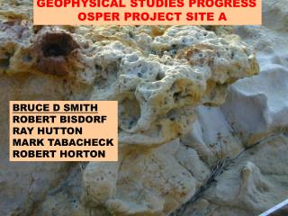
Title slide site A. Electrical Geophysical Surveys of Oil Field Saline Water Contamination, Osage Skiatook Petroleum Environmental Research Site. Bruce D. Smith (USGS) Haoping Haung (Geophex Ltd) James K. Otton (USGS) Robert A. Zielinski (USGS) Yousif K. Kharaka (USGS) and

E N D
Title slide site A Electrical Geophysical Surveys of Oil Field Saline Water Contamination, Osage Skiatook Petroleum Environmental Research Site Bruce D. Smith (USGS) Haoping Haung (Geophex Ltd) James K. Otton (USGS) Robert A. Zielinski (USGS) Yousif K. Kharaka (USGS) and Marvin M. Abbott (USGS)
Skiatook Lake “B” site Location Map
Ground Geophysical Surveys ►2001 EM31 terrain conductivity and DC Resistivity depth sounding ►2003 Borehole conductivity and Gamma logging ► 2004 Borehole conductivity and GEM2A terrain conductivity ► 2005 GEM2A terrain conductivity including from boat and some borehole conductivity
B Site Geology 50 0 100 ft 0 10 20 30 m BE01 x N BA01 x ? x x BE03 BE02 BA03 G x ? G BE18 x x BE19 x BE04 L x x BE05 G B’ BE06 x BE15 x BE10 x x BE14 BE08 G x x BA02 BE09 BE07 BE11 x x x x S BE12 B x G BE13 G x S G BE16 Good slug test x x Shoreline December 2001 BE17 Slug test failed L Shoreline March 2001 Legend Road cut exposures Alluvium Exposed lake bottom Road Oil-impacted soils Colluvium Colluvium on Water G- gravel and boulders Sandstone Artificial fill hillslopes Shale Survey station S- Sand Graded cut area, Thick colluvial apron deposits Sandstone Stripped of soil cover next to road Drainage trace L- lake bottom silt, mud, (based on float) Soil profile intact Pit and organic matter Sandstone Tanks (outcrop along creek) Salt scar Salt scar Salt scar Pit Skiatook Lake
B Site Cross Section Colluvium Weathered shale Unweathered shale WEATHERED BEDROCK CONDUCTIVITY 1000 100 10
EM31 conductivity map B site High apparent electrical conductivities shown in warmer colors
2005 Conductivity Survey GEM2 2005 conductivity survey including survey from boat. Leveling between boat and land is approximate at this point.
LOCATION MAP OSPER SITE A STRATIGRAPHIC DRILL HOLE DETAIL DRILLING SITE SKIATOOK LAKE
Shallow Apparent Conductivity Conductivity 2001 survey Conductivity 2003 GEM2 survey
GEM2 Conductivity Depth Image (EW) 650 400 150 20 0 Conductivity (mS/m) 0 200 400 600 0 0 1 5 2 Depth (Ft) mS/m Depth (m) 3 10 4 15 (a) EM inversion (b) Conductivity Logging (c) DC sounding (d) Conductivity Logging In AA03 In AA02 Near AA02
Line locations Red is 29 Black is 27 200% 90% 30% 20% 0% -20% -40% Percentage change 29 to 27 GEM2 surveys
GEM2 Composite Conductivity High Frequency Data in Bay from dry conditions includes part of 2005 data
GEM2 Conductivity High Frequency Data in Bay from boat
Conclusions conclusions ► Ground conductivity effective in measurement of subsurface brine concentration and shallow temporal variations ► Subsurface conductivities tied to both ground water and soluble salts (above water table) ► Electrical conductivity can be related to the spatial distribution of chloride concentrations
► Ft Peck brines above Bear Paw Shale in and above water table ► Soluble salts above water table Coal Bed Methane development ► Salinity in ground water – several Texas studies (Paine) Implications For Other Studies