Download
1 / 23
230 likes | 583 Views
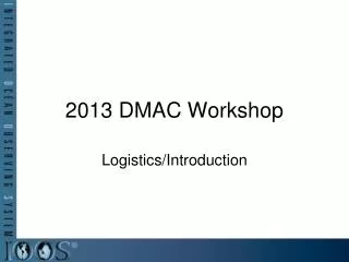
AOOS DMAC Data Management Workshop 27 January 2005. Online Browse. Compiled by Peter Olsson and Igor Katrayev. First, a definition of “Online Browse”. Online browse- The ability, using a web browser, to explore data sets available for a given website ( www.AOOS.org ) and:

E N D
AOOS DMAC Data Management Workshop 27 January 2005 Online Browse Compiled by Peter Olsson and Igor Katrayev
First, a definition of “Online Browse” Online browse- The ability, using a web browser, to explore data sets available for a given website (www.AOOS.org) and: • Discover and peruse metadata, • Understand what data is available for a given location, • Visualize and/or download portions of data sets (or examples of the data sets) in a consistent geospatial context.
Some Candidates for Online Browse • Live Access Server • OpenMap • MapServer • Applied Science Associates CoastMap
Live Access Server (LAS) • Description: LAS is a highly configurable Web server designed to provide flexible access to geo-referenced scientific data • It can present distributed data sets as a unified virtual data base through the use of DODS networking.
LAS user capabilities • LAS enables the Web user to: • visualize data with on-the-fly graphics • request custom subsets of variables in a choice of file formats • access background reference material about the data (metadata) • compare (difference) variables from distributed locations
LAS: PROS • Closest in design from bottom up to serve a community of scientists. • Designed around the idea of using distributed data sets from “sister” LAS servers. (good for IOOS) • Relatively large user base. (availabile expertise) • LAS is written in perl and should run on any Ferret-supported Unix / linux platform • Open Source (free) and supported by through a users email list, and email list archives
LAS PROS/CONS depending on point of view… • Rather tightly bound to FERRET, an interactive computer visualization and analysis environment for visualizing gridded data sets • Can also be used with Matlab, IDL, GrADs with some tinkering. • All-in-all a lot already combined in one package (Ferret/OpenDAP/LAS)
LAS CONS • Only works well with a small combination of client OSs and browsers (Example: lots of sites would not work with Win XP and Netscape 7.0, even fewer with RH linux+mozilla) • Hard to get data into (R. Cermak). Data needs to be COARDS NetCDF compliant. • Limited documentation makes creation of a separate backend (other than Ferret) problematic.
OpenMap Self Description: BBN Technologies' OpenMap Open Systems Mapping Technology package is an Open SourceJavaBeans-based programmer's toolkit for building applications and applets needing geographic information. • OpenMap provides the means to allow users to see and manipulate geospatial information. • Developer is BBN Technologies, but source is open (developer sells support)
OpenMap PROS • Since it is Java-based, it should be supported on a variety of platforms • Toolkit approach allows for a flexible and rapid development capability (both pro and con) • Provides basic OpenMap Viewer application is basic MapViewer application which can be tweaked as appropriate (or start from scratch) • BBN is member of OGC (implies OGC compliance???)
OpenMap CONS • Relatively speaking, would require lots of development from the ground up. • Not designed to access gridded data as data files. • Relatively new product, rapid development cycle (pro and con). • Does not currently work with some /OS/browser combinations (e.g. RH linux/Mozilla) • Demo site(s) were slow and balky (buggy?) • Documentation seems sketchy
MAPSERVER • Self Description: OpenSource development environment for constructing spatially enabled Internet-web applications. • MapServer supports several Open Geospatial Consortium (OGC) web specifications • Beyond browsing GIS data, MapServer is designed to create "geographic image maps", that is, maps that can direct users to content.
MAPSERVER PROS • MapServer includes MapScript that allows popular scripting languages such as PHP, Perl, Python, and Java to access the MapServer C API. • Scripts can access most common databases • Free and open source • MapServer is known to compile on most versions of UNIX/Linux, Microsoft Windows, binaries available. • Works with most browser/OS combinations
MAPSERVER CONS • Primary aim is GIS applications (not too much of a con) • Not a big implementor base outside of Brazil and Minnesota • Documentation seems sketchy • provided by contributors to the MapServer Documentation Project • Others (Igor ???)
Applied Science Associates COASTMAP • Self Description: Globally re-locatable integrated ocean monitoring and modeling system • COASTMAP provides an integrated linkage among real time and historical observations, modeling, and data distribution for shelf, coastal sea, and estuarine waters anywhere in the world. (sounds like what we want to do!) • Developers: ASA and University of Rhode Island
COASTMAP PROS • Out-of-the-box solution for all your OOS needs, providing direct links to: • oceanographic and meteorological sensors, • large-scale models, • localized models, • Allows synthesis of data sets from distributed locations • Allows for visualization of data sources on client side. • Demo on web seems to work well, but requires a bit of spin-up. • Appears to be a relatively mature product.
COASTMAP CONS • Commercial product, closed source (?) and probably significant $$$ • Requires client-side software, though example on web is browser-available. • No mention of hardware requirements. • Product aimed at sophisticated users • First responders, oil spill, homeland security
EASy (Environmental Analysis System) • Self Description: An advanced Geographic Information System (GIS) that has been specifically designed for environmental research. The software processes data in 4-Ds, i.e., Latitude, Longitude, Depth and Time, a capability necessary for complex marine and environmental applications. • Available in desktop and netviewer applications with many open source “service” extensions. • EASy has been developed by System Science Applications Inc. of Redondo Beach, and the Kiefer Laboratory at the University of Southern California. • EASy is used in the Alaska Marine Information System (AMIS).
EASy GIS Summary • Full-featured, 4-dimensional GIS tool • Requires mostly GIS skills • Stateful connections make it more responsive • Can be easily enhanced using COM technology • Requires MS JVM on client side which is not always available
MapServer Summary • MapServer is a simple 2-dimensional map graphic service • Stateless connection makes it very scalable • It’s not a full featured GIS product • Requires more likely web developer skills rather than GIS • Runs on different platforms • Supports a number of graphic formats
Online Browse Summary • LAS and CoastMap provide the most well-developed “out-of-the-box” solutions for AOOS implementation (though perhaps not the most flexible approach) • Client browser compatibility (Javascript handling) is an issue with all products examined. • All products (with possible exception of CoastMap) are rapidly evolving- new capabilities are constantly being added. • Open source seems desirable, from cost and development standpoint and for server-hardware flexibility. • All things considered (from this reviewer’s standpoint) LAS seems farthest down the road for our intended purpose.